
| { Main | Search | Countries | Information | Member Page } | |
David Mower's confluences |
| Mower, David | ||
| This Visitor does not have any Plans. | View confluence map | |
| 88 visits (83 unique) in 5 countries: | 88 active, 0 pending, 0 submitting | |
| 74 successful (72 unique): | 74 primary, 0 secondary | |
| 14 incomplete (14 unique): | 14 primary, 0 secondary | |
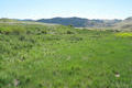
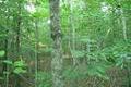
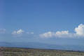
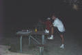
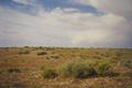
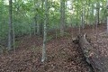 | 36°N 79°W 5.7 miles (9.2 km) W of Durham (Durham), Orange, NC, USA [23-Oct-15] |
 | 44°N 112°W 12.4 miles (20.0 km) WNW of Parker, Fremont, ID, USA [22-Aug-13] |
 | 38°N 24°E 1.9 km (1.2 miles) S of Rafína, Attikí, Greece [08-Aug-11] |
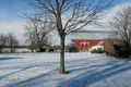
 | 41°N 82°W 0.8 miles (1.3 km) NNW of Burbank (Wayne), Medina, OH, USA [07-Oct-09] |
 | 47°N 112°W 5.4 miles (8.7 km) SSW of Craig, Lewis and Clark, MT, USA [31-Jul-08] |
 | 42°N 85°W 4.1 miles (6.6 km) N of Coldwater, Branch, MI, USA [19-Jan-08] |
 | 39°N 115°W 6.7 miles (10.8 km) NNE of Preston, White Pine, NV, USA [21-Apr-07] |
 | 38°N 118°W 6.7 miles (10.8 km) WSW of Coaldale, Esmeralda, NV, USA [21-Apr-07] |
 | 39°N 118°W 10.0 miles (16.1 km) NW of Gabbs, Nye, NV, USA [19-Apr-07] |
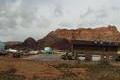
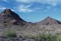
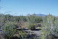
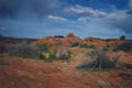
 | 34°N 114°W 4.7 miles (7.5 km) N of Bouse, La Paz, AZ, USA [30-Dec-06] |
 | 40°N 105°W 4.4 miles (7.0 km) SE of Erie (Weld), Broomfield, CO, USA [01-Apr-06] |
 | 43°N 112°W 19.1 miles (30.7 km) NE of Inkom (Bannock), Caribou, ID, USA [15-Jul-05] |
 | 43°N 113°W 8.9 miles (14.3 km) WNW of Aberdeen, Bingham, ID, USA [13-Jul-05] |
 | 42°N 105°W 4.5 miles (7.2 km) SSW of Wheatland, Platte, WY, USA [23-Jun-05] |
 | 42°N 96°W 2.2 miles (3.5 km) SW of Turin, Monona, IA, USA [21-Jun-05] |
 | 41°N 96°W 6.2 miles (10.0 km) WSW of Plattsmouth, Cass, NE, USA [incomplete] [17-Jun-05] |
 | 34°N 85°W 2.4 miles (3.9 km) E of Rockmart, Polk, GA, USA [07-Aug-04] |
 | 34°N 86°W 0.9 miles (1.4 km) SW of Gadsden, Etowah, AL, USA [07-Aug-04] |
 | 34°N 84°W 3.1 miles (5.0 km) NNW of Lawrenceville, Gwinnett, GA, USA [02-Aug-04] |
 | 44°N 114°W 20.1 miles (32.4 km) WNW of Mackay, Custer, ID, USA [15-Jul-04] |
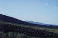
 | 38°N 112°W 8.1 miles (13.0 km) S of Antimony, Garfield, UT, USA [14-May-04] |
 | 41°N 109°W 19.0 miles (30.6 km) W of Hiawatha, Moffatt, CO, USA [14-Aug-03] |
 | 45°N 110°W 0.7 miles (1.1 km) SW of Silver Gate (MT), Park, WY, USA [incomplete] [10-Jul-03] |
 | 44°N 107°W 6.8 miles (11.0 km) SSW of Hazelton, Johnson, WY, USA [incomplete] [09-Jul-03] |
 | 44°N 108°W 2.5 miles (4.0 km) WSW of Worland, Washakie, WY, USA [09-Jul-03] |
 | 44°N 109°W 12.6 miles (20.2 km) SSW of Meeteetse, Park, WY, USA [incomplete] [09-Jul-03] |
 | 43°N 111°W 2.4 miles (3.8 km) SSE of Etna, Lincoln, WY, USA [05-Jul-03] |
 | 42°N 113°W 15.1 miles (24.3 km) WNW of Snowville (UT), Oneida, ID, USA [04-Jul-03] |
 | 37°N 113°W 1.5 miles (2.4 km) NW of Colorado City, Mohave, AZ, USA [05-Apr-03] |
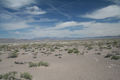
 | 33°N 113°W 26.3 miles (42.4 km) SW of Arlington, Maricopa, AZ, USA [19-Jan-03] |
 | 38°N 109°W 6.6 miles (10.6 km) NW of Egnar, San Miguel, CO, USA [11-Dec-02] |
 | 36°N 106°W 0.8 miles (1.2 km) N of La Puebla, Santa Fe, NM, USA [11-Dec-02] |
 | 37°N 115°W 26.4 miles (42.5 km) SSE of Alamo, Lincoln, NV, USA [15-Nov-02] |
 | 37°N 122°W 2.3 miles (3.7 km) NE of Santa Cruz, Santa Cruz, CA, USA [20-Oct-02] |
 | 39°N 123°W 5.1 miles (8.2 km) SW of Lakeport, Lake, CA, USA [18-Oct-02] |
 | 38°N 123°W 10.4 miles (16.7 km) SW of Inverness, Marin, CA, USA [18-Oct-02] |
 | 42°N 112°W 2.8 miles (4.5 km) SSW of Weston, Franklin, ID, USA [14-Oct-02] |
 | 36°N 115°W 2.3 miles (3.7 km) S of Henderson, Clark, NV, USA [07-Oct-02] |
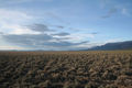
 | 39°N 108°W 3.9 miles (6.3 km) SW of Grand Mesa, Delta, CO, USA [22-Aug-02] |
 | 12°S 77°W near Lurigancho, Lima, Peru [07-Jul-02] |
 | 10°N 84°W 6.6 km (4.1 miles) NE of San Vicente, San José, Costa Rica [06-Jul-02] |
 | 39°N 76°W 4.6 miles (7.4 km) SE of Centreville, Queen Anne's, MD, USA [13-May-02] |
 | 39°N 77°W 1.3 miles (2.0 km) NW of Langley Park (Prince George's), Montgomery, MD, USA [12-May-02] |
 | 42°N 112°W 2.8 miles (4.5 km) SSW of Weston, Franklin, ID, USA [incomplete] [04-Apr-02] |
 | 41°N 112°W 4.0 miles (6.5 km) SW of Kaysville, Davis, UT, USA [incomplete] [04-Apr-02] |
 | 33°N 112°W 5.0 miles (8.1 km) SE of Maricopa, Pinal, AZ, USA [16-Nov-01] |
 | 40°N 114°W 2.6 miles (4.2 km) SSW of Ibapah, Tooele, UT, USA [13-Nov-01] |
 | 41°N 114°W 18.2 miles (29.3 km) N of Wendover (Tooele), Box Elder, UT, USA [07-Nov-01] |
 | 40°N 109°W 12.0 miles (19.3 km) WSW of Rangely, Rio Blanco, CO, USA [01-Nov-01] |
 | 40°N 113°W 20.4 miles (32.8 km) SW of Dugway, Tooele, UT, USA [24-Oct-01] |
 | 37°N 115°W 26.4 miles (42.5 km) SSE of Alamo, Lincoln, NV, USA [incomplete] [11-Oct-01] |
 | 38°N 114°W 1.7 miles (2.7 km) W of Hamlin Valley, Iron, UT, USA [11-Oct-01] |
 | 41°N 113°W 15.1 miles (24.3 km) NNW of Low (Tooele), Box Elder, UT, USA [06-Oct-01] |
 | 40°N 110°W 13.8 miles (22.2 km) SSE of Myton, Duchesne, UT, USA [20-Sep-01] |
 | 41°N 102°W 5.9 miles (9.4 km) SE of Big Springs (Deuel), Perkins, NE, USA [15-Sep-01] |
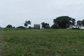
 | 42°N 93°W 5.2 miles (8.4 km) SW of Marshalltown, Marshall, IA, USA [14-Sep-01] |
 | 42°N 95°W 1.6 miles (2.6 km) WSW of Halbur, Carroll, IA, USA [14-Sep-01] |
 | 41°N 86°W 3.0 miles (4.9 km) SE of Akron, Fulton, IN, USA [incomplete] [13-Sep-01] |
 | 41°N 85°W 3.6 miles (5.8 km) N of Hoagland, Allen, IN, USA [13-Sep-01] |
 | 41°N 84°W 2.8 miles (4.5 km) SE of Ottawa, Putnam, OH, USA [13-Sep-01] |
 | 41°N 83°W 3.7 miles (5.9 km) S of Bloomville, Seneca, OH, USA [13-Sep-01] |
 | 42°N 80°W 4.0 miles (6.5 km) N of Waterford, Erie, PA, USA [incomplete] [12-Sep-01] |
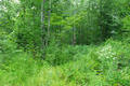
 | 43°N 76°W 1.2 miles (1.9 km) W of Manlius, Onondaga, NY, USA [09-Sep-01] |
 | 43°N 77°W 4.1 miles (6.6 km) NE of Phelps, Ontario, NY, USA [09-Sep-01] |
 | 43°N 78°W 1.7 miles (2.7 km) NW of Le Roy, Genesee, NY, USA [09-Sep-01] |
 | 43°N 80°W 2.7 km (1.7 miles) S of Willow Grove, ON, Canada [08-Sep-01] |
 | 37°N 114°W 8.8 miles (14.2 km) NNW of Littlefield, Mohave, AZ, USA [30-Aug-01] |
 | 43°N 71°W 2.9 miles (4.7 km) NW of Exeter, Rockingham, NH, USA [incomplete] [17-Aug-01] |
 | 41°N 94°W 3.3 miles (5.3 km) SE of Thayer (Union), Clarke, IA, USA [14-Aug-01] |
 | 42°N 111°W 4.3 miles (6.9 km) S of Taylor, Lincoln, WY, USA [28-Jul-01] |
 | 37°N 111°W 26.3 miles (42.3 km) ENE of Page, Coconino, AZ, USA [incomplete] [18-Jul-01] |
 | 40°N 111°W 23.1 miles (37.2 km) NNW of Helper (Carbon), Wasatch, UT, USA [14-Jul-01] |
 | 37°N 113°W 1.5 miles (2.4 km) NW of Colorado City, Mohave, AZ, USA [05-Jul-01] |
 | 37°N 110°W 10.6 miles (17.1 km) SW of Halchita, San Juan, UT, USA [incomplete] [21-Jun-01] |
 | 40°N 112°W 2.9 miles (4.8 km) NW of Elberta, Utah, UT, USA [04-Jun-01] |
 | 39°N 114°W 5.0 miles (8.1 km) NNE of Garrison, Millard, UT, USA [29-May-01] |
 | 39°N 111°W 7.3 miles (11.7 km) SSE of Molen, Emery, UT, USA [18-May-01] |
 | 39°N 112°W 6.4 miles (10.3 km) NW of Aurora, Sevier, UT, USA [17-May-01] |
 | 39°N 113°W 16.3 miles (26.2 km) WSW of Clear Lake, Millard, UT, USA [09-May-01] |
 | 32°N 92°W 5.0 miles (8.1 km) E of Holum, Caldwell, LA, USA [29-Apr-01] |
 | 33°N 92°W 6.0 miles (9.7 km) NNW of Beekman, Morehouse, LA, USA [29-Apr-01] |
 | 31°N 92°W 2.6 miles (4.2 km) NNW of Plaucheville, Avoyelles, LA, USA [29-Apr-01] |
 | 37°N 112°W 23.6 miles (38.0 km) NW of Marble Canyon, Coconino, AZ, USA [26-Apr-01] |
 | 39°N 110°W 8.7 miles (14.0 km) E of Green River (Emery), Grand, UT, USA [21-Apr-01] |
 | 38°N 111°W 23.0 miles (37.0 km) S of Caineville (Wayne), Garfield, UT, USA [incomplete] [11-Apr-01] |
 | 38°N 112°W 8.1 miles (13.0 km) S of Antimony, Garfield, UT, USA [29-Mar-01] |
 | 38°N 113°W 14.1 miles (22.8 km) NNW of Summit, Iron, UT, USA [26-Mar-01] |
 | 38°N 114°W 1.7 miles (2.7 km) W of Hamlin Valley, Iron, UT, USA [incomplete] [26-Mar-01] |