
| { Main | Search | Countries | Information | Member Page } | |
Curt Christiansen's confluences |
| Christiansen, Curt | ||
| This Visitor does not have any Plans. | View confluence map | |
| 33 visits (33 unique) | 33 active, 0 pending, 0 submitting | |
| 33 successful (33 unique): | 31 primary, 2 secondary | |
| 0 incomplete (0 unique): | 0 primary, 0 secondary | |
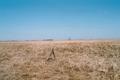
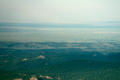
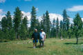
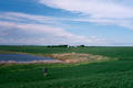
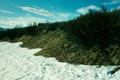
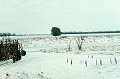
 | 64°N 142°W 5.4 miles (8.7 km) SSW of Chicken, Southeast Fairbanks, AK, USA [29-May-04] |
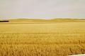
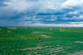
 | 60°N 151°W 21.0 miles (33.8 km) SE of Clam Gulch, Kenai Peninsula, AK, USA [13-Mar-04] |
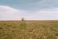
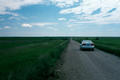
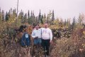
 | 66°N 150°W 25.6 miles (41.2 km) W of Stevens Village, Yukon-Koyukuk, AK, USA [16-Aug-03] |
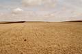
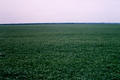
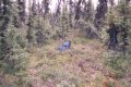
 | 62°N 148°W 20.6 miles (33.2 km) NE of Chickaloon, Matanuska-Susitna, AK, USA [12-Jul-03] |
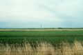
 | 46°N 98°W 6.0 miles (9.7 km) E of Ludden (Dickey), Sargent, ND, USA [03-May-02] |
 | 46°N 102°W 8.7 miles (14.0 km) ENE of Lemmon (SD), Adams, ND, USA [01-May-02] |
 | 45°N 99°W 6.5 miles (10.5 km) ESE of Faulkton, Faulk, SD, USA [30-Apr-02] |
 | 47°N 105°W 12.7 miles (20.5 km) NNE of Fallon (Prairie), Dawson, MT, USA [28-Apr-02] |
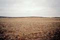 | 46°N 106°W 18.8 miles (30.3 km) NW of Volborg, Custer, MT, USA [27-Apr-02] |
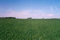 | 45°N 100°W 2.3 miles (3.7 km) WSW of Gettysburg, Potter, SD, USA [19-Jun-01] |
 | 44°N 103°W 1.0 miles (1.7 km) WNW of Caputa, Pennington, SD, USA [18-Jun-01] |
 | 44°N 104°W 8.4 miles (13.5 km) W of Deerfield, Pennington, SD, USA [18-Jun-01] |
 | 45°N 103°W 5.3 miles (8.6 km) W of Mud Butte (Meade), Butte, SD, USA [18-Jun-01] |
 | 46°N 103°W 7.8 miles (12.5 km) SSW of Reeder (Adams), Bowman, ND, USA [18-Jun-01] |
 | 46°N 104°W 20.7 miles (33.3 km) SSW of Marmath (Slope), Bowman, ND, USA [17-Jun-01] |
 | 47°N 104°W 5.7 miles (9.1 km) N of Beach, Golden Valley, ND, USA [17-Jun-01] |
 | 47°N 103°W 9.3 miles (15.0 km) N of South Heart (Stark), Dunn, ND, USA [17-Jun-01] |
 | 48°N 103°W 5.7 miles (9.2 km) NNW of Keene, McKenzie, ND, USA [17-Jun-01] |
 | 48°N 102°W 2.5 miles (4.1 km) SW of Plaza, Mountrail, ND, USA [17-Jun-01] |
 | 48°N 101°W 5.1 miles (8.2 km) SW of Velva (McHenry), Ward, ND, USA [15-Jun-01] |
 | 63°N 146°W 46.8 miles (75.4 km) S of Donnelly (Southeast Fairbanks), Valdez-Cordova, AK, USA [secondary] [09-Jun-01] |
 | 46°N 95°W 2.5 miles (4.0 km) ESE of Clotho, Todd, MN, USA [01-Apr-01] |
 | 46°N 96°W 1.3 miles (2.2 km) WNW of Elbow Lake, Grant, MN, USA [01-Apr-01] |
 | 46°N 94°W 4.1 miles (6.6 km) SE of Lastrup, Morrison, MN, USA [01-Apr-01] |
 | 47°N 97°W 2.7 miles (4.4 km) NNW of Prosper, Cass, ND, USA [22-Dec-00] |
 | 48°N 97°W 4.9 miles (7.9 km) N of East Grand Forks, Polk, MN, USA [22-Dec-00] |
 | 64°N 145°W 22.4 miles (36.0 km) E of Delta Junction, Southeast Fairbanks, AK, USA [secondary] [09-Sep-00] |
 | 62°N 147°W 47.4 miles (76.4 km) W of Glennallen (Valdez-Cordova), Matanuska-Susitna, AK, USA [22-Jul-00] |
 | 48°N 104°W 0.4 miles (0.7 km) W of Buford, Williams, ND, USA [07-May-00] |
 | 40°N 86°W 3.2 miles (5.1 km) S of Noblesville, Hamilton, IN, USA [01-Apr-00] |
 | 46°N 100°W 2.0 miles (3.2 km) S of Hague, Emmons, ND, USA [26-Mar-00] |
 | 46°N 99°W 11.2 miles (18.0 km) WNW of Forbes, Dickey, ND, USA [23-Mar-00] |
 | 47°N 98°W 5.3 miles (8.5 km) N of Valley City, Barnes, ND, USA [22-Mar-00] |