|


Peru : Arequipa
3.0 km (1.9 miles) NNE of Mollendo, Arequipa, Peru
Approx. altitude: 304 m
(997 ft)
([?] maps: Google MapQuest OpenStreetMap ConfluenceNavigator)
Antipode: 17°N 108°E
Accuracy: 10 m (32 ft)
Quality: good
Click on any of the images for the full-sized picture.
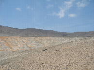
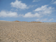
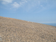
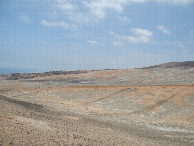
| 17°S 72°W (visit #2) |
![Visit #1: [07-Oct-04]](/pe/all/s17w072/preview.jpg "Visit #1: [07-Oct-04]")
 (visited by Alexander Koptilkin)
02-Ноября-2025 – Этот и ещё три визита были совершены во время моего большого велопутешествия по Южной Америке. Я вёл ежедневный дневник и ниже буду публиковать выдержки из него, касающиеся дней конкретных посещений. День 74. 51-й км трассы 1SD – Около пункта оплаты "Пунта де Бомбон". 108 км. «Сегодняшний длинный день начался после не очень спокойной ночи. Ветер колыхал палатку до раннего утра, я съезжал все время к входу: все же место было не идеально горизонтальное. Поэтому не раз просыпался ночью. Оказывается, у берега то тут, то там одинокие огоньки. А мне казалось, что он необитаем... А ещё я узнал, что уже до сюда доплывают пингвины. Продолжаю движение по замечательной 1SD дальше. Рельеф всё такой же интересный, пейзажи тоже. Где-то тут я прохожу высшую точку подъёма, начатого ещё вчера – 400 с лишним метров. Неплохо! Дальше дорога плавно снижается и уже показалась бухта порта Матарани с большими и малыми кораблями. На кольце перед Матарани завтракаю/обедаю в кафешке для дальнобойщиков. Ну, судя по времени, скорее обедаю. Смотрю в Google Maps наличие рядом супермаркетов Mass (к сожалению, не везде есть) и вспоминаю, что около Мойендо мной помечена точка пересечения целой параллели 17 южной широты и меридиана 72 западной долготы. Если кто-то ещё не знает, уже 20 лет как участвую в проекте The Degree Confluence Project. Вот сайт: https://www.confluence.org. Олдскульный, с 1998 года без изменений! Надо точку посетить! Ну, и в Матарани, в магазин! По отличной, широкой трассе с разделительной полосой я быстро долетаю до Мойендо. Точнее, до объезда: трасса обходит город. Пока еду по этому участку, параллельно наблюдаю первый в Перу железнодорожный состав. Маневровый тепловоз тянет десяток вагонов с бочками в порт. А вот и место, где мне нужно съехать с трассы. Включаю старичка Garmin и начинаю охоту. Пересечение очень простое. Проезжаю немного в гору до конца условно жилого сектора, оставляю велик за недостроем, от глаз, и чешу 150 м по холмам, где с лёгкостью нахожу заветное место. Последний раз тут были лет 20 назад, судя по сайту. Ловлю нули, делаю необходимые фото и назад. Легко! Дальше дорога спускается на уровень моря, к пляжу, и так я еду до конца сегодняшнего дня, 50 км! Вот такое побережье Тихого океана в Перу я ждал! Сначала тянутся коттеджные посёлки с белоснежными виллами. Очень жаль, что поехал в объезд города Меха. И подниматься пришлось, и путь длиннее, и пропустил спокойное педалирование по, надеюсь, красивому месту. Со стороны выглядело как на картинке. Много площадей, занятых под продажу участков. Заметил, что такое явление на побережье Перу распространено. Дальше дорога проходит через заповедник Лагунас де Меха. Это протяжённый заболоченный участок между пустыней и океаном с озерами и птицами. Под дорогой периодические проходы для животных! Дальше заповедник плавно переходит в сельхозугодья, где выращивают всё на свете. Проезжаю крупный посёлок Пунта де Бомбон и дорога начинает плавно приближаться к океану. Жду, пока закончатся сначала плантации, затем просто огороженные территории и птицефермы. Наконец, после пункта оплаты проезда по трассе начинается дикий пляж. И дорога начинает ползти вверх, на холм. До подъёма съезжаю на пляж, закрытый скалами от дороги, и встаю прямо за ними. Дорогу немного слышно, но меня не видно. Скорее более слышно бушующий океан, он метрах в 100–150. После ужина взял стул, термос с кофе и пошёл к океану провожать солнце. Напугал всех крабов, разбежались по норам. Длинный день подошёл к концу. Хороший он был сегодня.» Данные посещения:
2 de noviembre de 2025 – Esta y otras tres visitas se realizaron durante mi extenso viaje en bicicleta por Sudamérica. Llevé un diario, y a continuación publicaré extractos de días específicos. Día 74. Kilómetro 51 de la 1SD – Cerca del peaje de Punta de Bombón. 108 km. "Hoy comenzó un largo día tras una noche bastante intranquila. El viento sacudió la tienda hasta la madrugada, y yo seguía deslizándome hacia la entrada: al fin y al cabo, el terreno no era perfectamente llano. Por eso me desperté varias veces durante la noche. Resulta que hay luces solitarias aquí y allá a lo largo de la costa. Pero yo pensaba que estaba deshabitada... También descubrí que los pingüinos ya nadan hasta aquí." Continúo por la maravillosa 1SD. La carretera es tan interesante como los paisajes. Por aquí, llego al punto más alto de la subida que comencé ayer: más de 400 metros. ¡Nada mal! La carretera desciende gradualmente y aparece a la vista la bahía del puerto de Matarani, con sus barcos grandes y pequeños. En la rotonda antes de Matarani, desayuno/almuerzo en una cafetería de camioneros. Bueno, a juzgar por la hora, más bien es un almuerzo. Consulto Google Maps para ver si hay supermercados Mass cerca. (Desafortunadamente, no están disponibles en todas partes) y recuerden que cerca de Mollendo marqué la intersección el paralelo 17 sur y el meridiano 72 oeste. Para quienes no lo sepan, he participado en el "Degree Confluence Project" durante 20 años. Aquí está el sitio web: https://www.confluence.org. ¡De la vieja escuela, sin cambios desde 1998! ¡Necesito visitar ese lugar! Bueno, ¡rumbo a Matarani, a la tienda! Llego rápidamente a Mollendo por la excelente y ancha carretera con mediana. O mejor dicho, la circunvalación: la carretera rodea el pueblo. Mientras conduzco por este tramo, diviso el primer tren de Perú. Una locomotora de maniobras arrastra una docena de vagones cargados de barriles hacia el puerto. Y aquí es donde necesito salir de la carretera. Enciendo mi viejo Garmin y empiezo a buscar. El cruce es muy sencillo. Subo una corta cuesta hasta el final de la zona residencial, aparco la bici detrás de un edificio sin terminar, fuera de la vista, y camino 150 metros por las colinas, donde encuentro fácilmente el lugar deseado. Según la página web, la última vez que alguien estuvo aquí fue hace unos 20 años. Capturo los ceros, tomo las fotos necesarias y regreso. ¡Así de fácil! Luego, el camino desciende hasta el nivel del mar, a la playa, y así sigo pedaleando el resto del día, ¡50 km! ¡Esta es la costa del Pacífico peruano que tanto anhelaba! Al principio, hay comunidades de casas de campo con villas blancas como la nieve. Es una pena que haya tomado el desvío alrededor del pueblo de Meja. Tuve que subir, el camino era más largo y me perdí un paseo tranquilo por lo que espero que haya sido un lugar hermoso. Desde afuera, parecía un cuadro. Muchos terrenos en venta. Noté que este fenómeno es común a lo largo de la costa peruana. Luego, el camino atraviesa la Reserva Natural Lagunas de Meja. Esta es una zona larga y pantanosa entre el desierto y el océano, con lagos y aves. ¡Hay pasos de animales periódicos debajo de la carretera! Más adelante, la reserva se transforma gradualmente en tierras de cultivo donde se siembra de todo. Paso el gran pueblo de Punta de Bombón, y el camino comienza a acercarse al océano. Espero hasta que terminan las plantaciones, luego las áreas cercadas y las granjas avícolas. Finalmente, después del peaje, comienza una playa salvaje. Y el camino comienza a ascender la colina. Antes de la subida, me detengo en una playa, protegida del camino por acantilados, y me quedo justo detrás de ellos. El camino se oye débilmente, pero soy invisible. Más audible es el océano embravecido, a 100–150 metros de distancia. Después de cenar, tomé una silla, un termo de café y me dirigí al mar para ver la puesta de sol. Asusté a todos los cangrejos, que se dispersaron de vuelta a sus madrigueras. Un largo día ha llegado a su fin. Fue un buen día." Detalles de la visita:
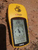
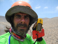
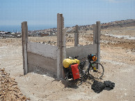
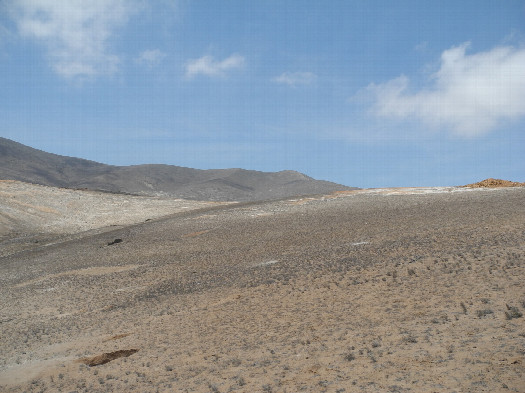
2-Nov-2025 – This and three other visits were made during my extensive bike trip across South America. I kept a daily diary, and below I will publish excerpts from it for specific days of my visit. Day 74. Kilometer 51 of the 1SD – Near the Punta de Bombón toll booth. 108 km. "Today's long day began after a rather restless night. The wind blew the tent until the early morning, and I kept sliding down to the entrance: after all, the place wasn't perfectly level. That's why I woke up more than once during the night. It turns out there are lonely lights here and there along the shore. And I thought it was uninhabited... And I also learned that penguins are already swimming this far. I continue on the wonderful 1SD. The road is still as interesting as ever, and so are the landscapes. Somewhere around here I reach the highest point of the climb I started yesterday – over 400 meters. Not bad! The road then descends gradually, and the bay of Matarani port, with its large and small ships, comes into view. At the roundabout before Matarani, I have breakfast/lunch at a cafe for truckers. Well, judging by the time, it's more like lunch. I check Google Maps for nearby Mass supermarkets (unfortunately, they're not available everywhere) and remember that near Mollendo I marked the intersection of the entire parallel of 17 south latitude and the meridian of 72 west longitude. In case anyone doesn't know, I've been participating in The Degree Confluence Project for 20 years now. Here's the website: https://www.confluence.org. Old school, unchanged since 1998! I need to visit that point! Well, off to Matarani, to the store! I quickly reach Mollendo along the excellent, wide highway with a median strip. Or rather, the bypass: the highway bypasses the town. As I drive along this stretch, I spy the first train in Peru. A shunting locomotive pulls a dozen cars loaded with barrels to the port. And here's the spot where I need to exit the highway. I turn on my old Garmin and begin hunting. The confluence is very simple. I ride a short distance uphill to the end of the supposedly residential area, park my bike behind an unfinished building, out of sight, and walk 150 meters through the hills, where I easily find the coveted spot. The last time anyone was here was about 20 years ago, according to the website. I catch the zeros, take the necessary photos, and head back. Easy! Then the road descends to sea level, to the beach, and so I ride for the rest of today, 50 km! This is the Pacific coastline in Peru I was waiting for! At first, there are cottage communities with snow-white villas. It's a shame I took the detour around the town of Meja. I had to climb, the road was longer, and I missed out on a leisurely pedal through what I hope was a beautiful place. From the outside, it looked like a picture. Lots of land for sale. I noticed this phenomenon is common along the coast of Peru. The road then passes through the Lagunas de Meja Nature Reserve. This is a long, swampy area between the desert and the ocean, with lakes and birds. There are occasional animal crossings under the road! Further on, the reserve gradually transitions into farmland where they grow everything under the sun. I pass the large village of Punta de Bombón, and the road begins to gradually approach the ocean. I wait until first the plantations end, then the fenced areas and poultry farms. Finally, after the toll booth, a wild beach begins. And the road starts to ascend the hill. Before the climb, I pull onto a beach, screened from the road by cliffs, and stand just beyond them. You can barely hear the road, but you can't see me. More audible is the raging ocean, 100–150 meters away. After dinner, I grabbed a chair, a thermos of coffee, and headed to the ocean to see the sun go down. I scared all the crabs, who ran off to their holes. A long day has come to an end. It was a good one today." Visit details:
|
| All pictures |
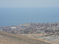
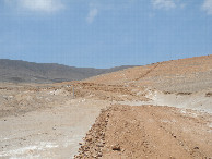
| #1: General view #2: View to the north #3: View to the east #4: View to the south #5: View to the west #6: GPS reading #7: "Hunter" #8: Mollendo #9: Road to the confluence #10: Hidden Bicycle ALL: All pictures on one page |