
| { Main | Search | Countries | Information | Member Page } | |
Shawn Fleming's confluences |
| Fleming, Shawn | ||
| This Visitor does not have any Plans. | View confluence map | |
| 235 visits (224 unique) in 5 countries: | 225 active, 0 pending, 10 submitting | |
| 223 successful (215 unique): | 223 primary, 0 secondary | |
| 12 incomplete (12 unique): | 11 primary, 1 secondary | |
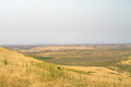
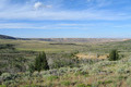
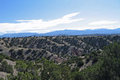
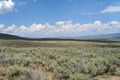 | 42°N 111°W 4.3 miles (6.9 km) S of Taylor, Lincoln, WY, USA [17-Jul-18] |
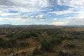
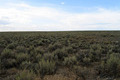
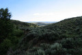
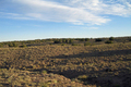
 | 42°N 110°W 3.2 miles (5.2 km) ENE of Fontenelle (Lincoln), Sweetwater, WY, USA [17-Jul-18] |
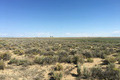
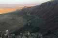
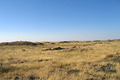
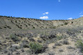
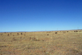
 | 42°N 108°W 22.6 miles (36.3 km) N of Wamsutter, Sweetwater, WY, USA [16-Jul-18] |
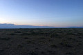
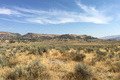
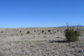
 | 42°N 107°W 15.5 miles (25.0 km) N of Fort Steele, Carbon, WY, USA [16-Jul-18] |
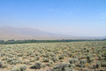
 | 42°N 118°W 14.5 miles (23.3 km) W of McDermitt, Malheur, OR, USA [24-Aug-17] |
 | 42°N 117°W 36.9 miles (59.5 km) E of McDermitt (NV), Owyhee, ID, USA [23-Aug-17] |
 | 43°N 115°W 5.7 miles (9.2 km) NNW of Bliss, Gooding, ID, USA [22-Aug-17] |
 | 42°N 114°W 17.8 miles (28.6 km) SSW of Oakley, Cassia, ID, USA [22-Aug-17] |
 | 43°N 114°W 8.5 miles (13.7 km) ESE of Richfield, Lincoln, ID, USA [21-Aug-17] |
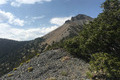
 | 44°N 114°W 20.1 miles (32.4 km) WNW of Mackay, Custer, ID, USA [21-Aug-17] |
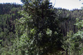
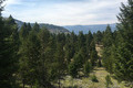 | 45°N 114°W 13.3 miles (21.4 km) SW of Salmon, Lemhi, ID, USA [20-Aug-17] |
 | 44°N 113°W 14.9 miles (24.0 km) N of Howe, Butte, ID, USA [19-Aug-17] |
 | 43°N 112°W 19.1 miles (30.7 km) NE of Inkom (Bannock), Caribou, ID, USA [18-Aug-17] |
 | 43°N 113°W 8.9 miles (14.3 km) WNW of Aberdeen, Bingham, ID, USA [18-Aug-17] |
 | 42°N 113°W 15.1 miles (24.3 km) WNW of Snowville (UT), Oneida, ID, USA [18-Aug-17] |
 | 31°N 102°W 8.5 miles (13.6 km) NW of Iraan (Pecos), Crockett, TX, USA [31-Oct-16] |
 | 41°N 112°W 4.0 miles (6.5 km) SW of Kaysville, Davis, UT, USA [01-Oct-16] |
 | 36°N 108°W 15.3 miles (24.6 km) NNW of Seven Lakes, McKinley, NM, USA [30-Aug-16] |
 | 35°N 108°W 13.2 miles (21.2 km) SW of Grants, Cibola, NM, USA [29-Aug-16] |
 | 35°N 109°W 3.6 miles (5.8 km) WSW of Tekapo, McKinley, NM, USA [29-Aug-16] |
 | 34°N 109°W 12.4 miles (20.0 km) ENE of Nutrioso (AZ), Catron, NM, USA [03-Jul-16] |
 | 34°N 110°W 9.8 miles (15.8 km) SSW of Pinetop, Navajo, AZ, USA [15-Jun-16] |
 | 34°N 112°W 9.7 miles (15.6 km) NE of New River, Maricopa, AZ, USA [22-May-16] |
 | 32°N 110°W 3.0 miles (4.8 km) SE of Dragoon, Cochise, AZ, USA [19-Nov-15] |
 | 42°N 115°W 16.8 miles (27.0 km) W of Jackpot (NV), Twin Falls, ID, USA [03-Aug-15] |
 | 43°N 116°W 4.8 miles (7.8 km) E of Grand View, Elmore, ID, USA [03-Aug-15] |
 | 48°N 117°W 1.4 miles (2.2 km) S of Blanchard, Bonner, ID, USA [02-Aug-15] |
 | 48°N 119°W 2.1 miles (3.4 km) W of Elmer City (Okanogan), Douglas, WA, USA [30-Jul-15] |
 | 44°N 124°W 5.1 miles (8.2 km) ENE of Florence, Lane, OR, USA [28-Jul-15] |
 | 43°N 122°W 10.4 miles (16.7 km) SW of Diamond Lake Junction, Klamath, OR, USA [27-Jul-15] |
 | 42°N 122°W 5.0 miles (8.1 km) NW of Dorris, Siskiyou, CA, USA [27-Jul-15] |
 | 33°N 109°W 12.7 miles (20.5 km) ENE of Three Way (AZ), Grant, NM, USA [12-Apr-15] |
 | 33°N 110°W 3.3 miles (5.3 km) SW of Fort Thomas, Graham, AZ, USA [11-Apr-15] |
 | 34°N 108°W 13.3 miles (21.4 km) SW of Datil, Catron, NM, USA [03-Apr-15] |
 | 32°N 113°W 27.0 miles (43.5 km) SSW of Ajo, Pima, AZ, USA [04-Jan-15] |
 | 33°N 108°W 10.0 miles (16.1 km) N of Mimbres, Grant, NM, USA [11-Oct-14] |
 | 32°N 108°W 23.3 miles (37.5 km) SW of Deming, Luna, NM, USA [11-Oct-14] |
 | 37°N 105°W 12.4 miles (20.0 km) SW of Weston, Las Animas, CO, USA [28-Aug-14] |
 | 41°N 111°W 18.6 miles (29.9 km) S of Evanston, Uinta, WY, USA [09-Jul-14] |
 | 41°N 110°W 5.8 miles (9.4 km) WSW of McKinnon, Sweetwater, WY, USA [incomplete] [09-Jul-14] |
 | 41°N 109°W 19.0 miles (30.6 km) W of Hiawatha, Moffatt, CO, USA [08-Jul-14] |
 | 41°N 108°W 18.0 miles (29.0 km) W of Baggs (WY), Moffatt, CO, USA [08-Jul-14] |
 | 41°N 107°W 10.2 miles (16.4 km) N of Columbine, Routt, CO, USA [08-Jul-14] |
 | 41°N 106°W 4.0 miles (6.5 km) S of Jelm, Albany, WY, USA [07-Jul-14] |
 | 41°N 105°W 7.2 miles (11.5 km) SSE of Granite, Laramie, WY, USA [incomplete] [07-Jul-14] |
 | 32°N 112°W 9.2 miles (14.8 km) NW of Sells, Pima, AZ, USA [26-Jan-14] |
 | 34°N 111°W 7.3 miles (11.7 km) SSW of Young, Gila, AZ, USA [02-Jul-13] |
 | 36°N 111°W 16.4 miles (26.4 km) SE of Tuba City, Coconino, AZ, USA [02-Jul-13] |
 | 39°N 111°W 7.3 miles (11.7 km) SSE of Molen, Emery, UT, USA [01-Jul-13] |
 | 40°N 111°W 23.1 miles (37.2 km) NNW of Helper (Carbon), Wasatch, UT, USA [01-Jul-13] |
 | 40°N 110°W 13.8 miles (22.2 km) SSE of Myton, Duchesne, UT, USA [30-Jun-13] |
 | 40°N 109°W 12.0 miles (19.3 km) WSW of Rangely, Rio Blanco, CO, USA [30-Jun-13] |
 | 40°N 108°W 5.3 miles (8.5 km) WSW of Meeker, Rio Blanco, CO, USA [30-Jun-13] |
 | 40°N 107°W 10.3 miles (16.6 km) NW of Burns (Eagle), Routt, CO, USA [29-Jun-13] |
 | 40°N 106°W 6.7 miles (10.9 km) SSW of Granby, Grand, CO, USA [29-Jun-13] |
 | 39°N 108°W 3.9 miles (6.3 km) SW of Grand Mesa, Delta, CO, USA [15-Jun-12] |
 | 39°N 109°W 16.8 miles (27.1 km) SW of Loma, Mesa, CO, USA [14-Jun-12] |
 | 39°N 110°W 8.7 miles (14.0 km) E of Green River (Emery), Grand, UT, USA [14-Jun-12] |
 | 39°N 111°W 7.3 miles (11.7 km) SSE of Molen, Emery, UT, USA [incomplete] [13-Jun-12] |
 | 38°N 111°W 23.0 miles (37.0 km) S of Caineville (Wayne), Garfield, UT, USA [13-Jun-12] |
 | 38°N 110°W 36.9 miles (59.4 km) WNW of Monticello, San Juan, UT, USA [12-Jun-12] |
 | 38°N 108°W 0.3 miles (0.6 km) NNE of Sawpit, San Miguel, CO, USA [11-Jun-12] |
 | 39°N 107°W 9.0 miles (14.5 km) N of Crested Butte, Gunnison, CO, USA [10-Jun-12] |
 | 38°N 103°W 3.7 miles (6.0 km) SSW of Caddoa, Bent, CO, USA [06-Jun-12] |
 | 38°N 102°W 2.9 miles (4.7 km) S of Coolidge, Hamilton, KS, USA [06-Jun-12] |
 | 38°N 101°W 1.1 miles (1.8 km) NNW of Holcomb, Finney, KS, USA [05-Jun-12] |
 | 38°N 100°W 8.3 miles (13.4 km) SW of Jetmore, Hodgeman, KS, USA [05-Jun-12] |
 | 38°N 99°W 3.3 miles (5.3 km) NW of Macksville, Stafford, KS, USA [05-Jun-12] |
 | 38°N 98°W 3.8 miles (6.1 km) SW of South Hutchinson, Reno, KS, USA [05-Jun-12] |
 | 39°N 98°W 1.6 miles (2.5 km) WSW of Beverly, Lincoln, KS, USA [05-Jun-12] |
 | 39°N 99°W 8.2 miles (13.3 km) N of Gorham, Russell, KS, USA [05-Jun-12] |
 | 39°N 100°W 6.7 miles (10.8 km) WSW of Wakeeney, Trego, KS, USA [05-Jun-12] |
 | 39°N 101°W 7.2 miles (11.6 km) S of Monument, Logan, KS, USA [04-Jun-12] |
 | 39°N 102°W 9.4 miles (15.1 km) N of Weskan, Wallace, KS, USA [04-Jun-12] |
 | 39°N 103°W 12.0 miles (19.3 km) NE of Aroya, Cheyenne, CO, USA [04-Jun-12] |
 | 34°N 107°W 6.6 miles (10.6 km) W of Laborcita, Socorro, NM, USA [16-Oct-11] |
 | 39°N 104°W 10.7 miles (17.2 km) SSE of Simla, Elbert, CO, USA [12-Oct-11] |
 | 38°N 104°W 9.0 miles (14.5 km) S of Fowler, Otero, CO, USA [12-Oct-11] |
 | 37°N 104°W 3.9 miles (6.4 km) SE of Trinchera, Las Animas, CO, USA [11-Oct-11] |
 | 37°N 106°W 5.5 miles (8.8 km) S of Antonito, Conejos, CO, USA [11-Oct-11] |
 | 36°N 106°W 0.8 miles (1.2 km) N of La Puebla, Santa Fe, NM, USA [11-Oct-11] |
 | 35°N 107°W 17.8 miles (28.6 km) E of Mesita (Cibola), Bernalillo, NM, USA [10-Oct-11] |
 | 35°N 105°W 14.6 miles (23.6 km) SSE of La Loma, Guadalupe, NM, USA [10-Oct-11] |
 | 34°N 106°W 9.9 miles (15.9 km) S of Claunch, Socorro, NM, USA [10-Oct-11] |
 | 33°N 106°W 3.7 miles (6.0 km) NW of La Luz, Otero, NM, USA [09-Oct-11] |
 | 33°N 107°W 12.3 miles (19.8 km) S of Engle, Sierra, NM, USA [09-Oct-11] |
 | 51°N 0° 3.0 km (1.9 miles) NW of Fletching, East Sussex, England, United Kingdom [31-Jul-11] |
 | 51°N 1°W 1.9 km (1.2 miles) S of Froxfield, Hampshire, England, United Kingdom [31-Jul-11] |
 | 51°N 0° 3.0 km (1.9 miles) NW of Fletching, East Sussex, England, United Kingdom [31-Jul-11] |
 | 51°N 1°W 1.9 km (1.2 miles) S of Froxfield, Hampshire, England, United Kingdom [31-Jul-11] |