
| { Main | Search | Countries | Information | Member Page } | |
United States : Oregon; showing visits by Ross Finlayson |
| There are no Plans for this Region. |
|
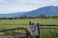
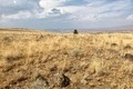
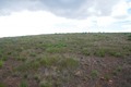
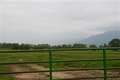
45°N 118°W 4.4 miles (7.0 km) SE of North Powder, Union, OR, USA [incomplete] [15-Jun-26] |
|
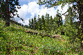
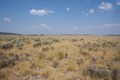
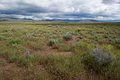
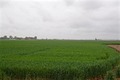
45°N 117°W 6.9 miles (11.2 km) WNW of Oxbow, Baker, OR, USA [15-Jun-26] |
|
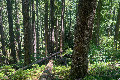
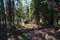
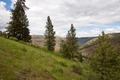
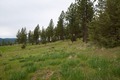
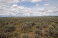
45°N 122°W 19.8 miles (31.8 km) NNE of Detroit (Marion), Clackamas, OR, USA [27-Aug-24] |
|
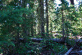
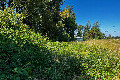
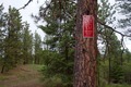
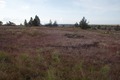
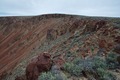
44°N 122°W 30.0 miles (48.4 km) SW of Sisters (Deschutes), Lane, OR, USA [27-Aug-24] |
|
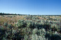
43°N 121°W 9.0 miles (14.5 km) SSE of Silver Lake, Lake, OR, USA [27-Aug-24] |

|
43°N 122°W 10.4 miles (16.7 km) SW of Diamond Lake Junction, Klamath, OR, USA [02-Sep-22] |
|
44°N 123°W 3.4 miles (5.4 km) SSE of Springfield, Lane, OR, USA [27-Aug-22] |
|
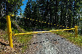
43°N 123°W 8.1 miles (13.0 km) ENE of Days Creek, Douglas, OR, USA [incomplete] [10-Jul-22] |
|
42°N 121°W 11.8 miles (19.0 km) E of Langell Valley, Klamath, OR, USA [10-Jul-22] |
|
42°N 120°W 12.5 miles (20.1 km) NE of Fort Bidwell (CA), Lake, OR, USA [18-Oct-18] |
|
43°N 120°W 18.3 miles (29.5 km) SSW of Wagontire (Harney), Lake, OR, USA [16-Oct-18] |

|
45°N 124°W 1.0 miles (1.6 km) W of Neotsu, Lincoln, OR, USA [09-Sep-18] |
|
44°N 124°W 5.1 miles (8.2 km) ENE of Florence, Lane, OR, USA [incomplete] [09-Sep-18] |
|
44°N 117°W 2.6 miles (4.2 km) SW of Ontario, Malheur, OR, USA [29-Aug-17] |
|
44°N 118°W 14.5 miles (23.3 km) W of Westfall, Malheur, OR, USA [29-Aug-17] |
|
44°N 120°W 9.9 miles (16.0 km) SSW of Paulina, Crook, OR, USA [29-Aug-17] |
|
45°N 119°W 3.2 miles (5.1 km) ENE of Dale (Grant), Umatilla, OR, USA [29-May-16] |
|
44°N 119°W 3.9 miles (6.3 km) SW of Silvies, Grant, OR, USA [incomplete] [27-May-16] |
|
43°N 119°W 16.9 miles (27.2 km) W of Diamond, Harney, OR, USA [27-May-16] |
|
42°N 119°W 18.8 miles (30.3 km) W of Denio (NV), Harney, OR, USA [27-May-16] |
|
45°N 120°W 8.4 miles (13.5 km) SW of Lonerock (Gillian), Wheeler, OR, USA [02-Jul-15] |
|
45°N 121°W 12.1 miles (19.5 km) W of Shaniko, Wasco, OR, USA [28-Jun-15] |
|
45°N 118°W 4.4 miles (7.0 km) SE of North Powder, Union, OR, USA [incomplete] [28-Jun-15] |
|
44°N 117°W 2.6 miles (4.2 km) SW of Ontario, Malheur, OR, USA [incomplete] [28-Jun-15] |
|
43°N 118°W 17.2 miles (27.7 km) NNW of Burns Junction, Malheur, OR, USA [22-Jun-15] |
|
42°N 118°W 14.5 miles (23.3 km) W of McDermitt, Malheur, OR, USA [22-Jun-15] |
|
42°N 120°W 12.5 miles (20.1 km) NE of Fort Bidwell (CA), Lake, OR, USA [07-Sep-12] |
|
43°N 121°W 9.0 miles (14.5 km) SSE of Silver Lake, Lake, OR, USA [07-Sep-12] |
|
44°N 121°W 16.2 miles (26.1 km) ESE of Bend, Deschutes, OR, USA [07-Sep-12] |
|
42°N 121°W 11.8 miles (19.0 km) E of Langell Valley, Klamath, OR, USA [30-May-11] |
|
43°N 120°W 18.3 miles (29.5 km) SSW of Wagontire (Harney), Lake, OR, USA [30-May-11] |

|
44°N 123°W 3.4 miles (5.4 km) SSE of Springfield, Lane, OR, USA [01-Sep-09] |
|
46°N 123°W 6.4 miles (10.3 km) SW of Prescott, Columbia, OR, USA [31-Aug-09] |
|
45°N 123°W 1.3 miles (2.1 km) NW of Hayesville, Marion, OR, USA [28-Aug-09] |
|
44°N 123°W 3.4 miles (5.4 km) SSE of Springfield, Lane, OR, USA [incomplete] [28-Aug-09] |
|
42°N 124°W 8.5 miles (13.7 km) NE of Smith River (CA), Curry, OR, USA [27-Aug-09] |
|
43°N 122°W 10.4 miles (16.7 km) SW of Diamond Lake Junction, Klamath, OR, USA [30-Oct-06] |
|
44°N 124°W 5.1 miles (8.2 km) ENE of Florence, Lane, OR, USA [26-Oct-06] |
|
43°N 124°W 7.4 miles (11.9 km) E of Broadbent, Coos, OR, USA [25-Oct-06] |