|
Germany : Sachsen-Anhalt
near Moritz-Schora, Sachsen-Anhalt, Germany
Approx. altitude: 74 m
(242 ft)
([?] maps: Google MapQuest OpenStreetMap ConfluenceNavigator)
Antipode: 52°S 168°W
Accuracy: 2 m (6 ft)
Quality: good
Click on any of the images for the full-sized picture.
| 52°N 12°E (visit #12) |
 (visited by Karl Bryk and Michael Bryk) 06-Aug-2020 -- This the twelfth of 14 CP visits made during a road trip through the Czech republic and Germany. The previous is N52 E11. The next is N51 E12.
|
| All pictures |
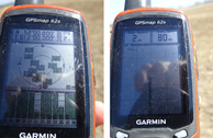
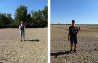
| #1: Overview #2: North #3: East #4: South #5: West #6: GPS #7: Visitors #8: Near the CP 1 #9: Near the CP 2 ALL: All pictures on one page |


![Visit #15: [27-Jul-25] Visit #15: [27-Jul-25]](/de/all/n52e012v15/preview.jpg)
![Visit #14: [26-Jul-22] Visit #14: [26-Jul-22]](/de/all/n52e012v14/preview.jpg)
![Visit #11: [06-Apr-14] Visit #11: [06-Apr-14]](/de/all/n52e012v11/preview.jpg)
![Visit #10: [25-Jul-13] Visit #10: [25-Jul-13]](/de/all/n52e012v10/preview.jpg)
![Visit #9: [15-Jun-13] Visit #9: [15-Jun-13]](/de/all/n52e012v9/preview.jpg)
![Visit #13: [13-Sep-12] Visit #13: [13-Sep-12]](/de/all/n52e012v13/preview.jpg)
![Visit #8: [28-Oct-11] Visit #8: [28-Oct-11]](/de/all/n52e012v8/preview.jpg)
![Visit #7: [13-Mar-10] Visit #7: [13-Mar-10]](/de/all/n52e012v7/preview.jpg)
![Visit #6: [19-Apr-09] Visit #6: [19-Apr-09]](/de/all/n52e012v6/preview.jpg)
![Visit #5: [25-May-06] Visit #5: [25-May-06]](/de/all/n52e012v5/preview.jpg)
![Visit #4: [21-Aug-02] Visit #4: [21-Aug-02]](/de/all/n52e012v4/preview.jpg)
![Visit #3: [14-Aug-01] Visit #3: [14-Aug-01]](/de/all/n52e012v3/preview.jpg)
![Visit #2: [16-Apr-01] Visit #2: [16-Apr-01]](/de/all/n52e012v2/preview.jpg)
![Visit #1: [07-Apr-01] Visit #1: [07-Apr-01]](/de/all/n52e012/preview.jpg)