|

United States : California
5.4 miles (8.7 km) WSW of Big Bend, Shasta, CA, USA
Approx. altitude: 878 m
(2880 ft)
([?] maps: Google MapQuest OpenStreetMap topo aerial ConfluenceNavigator)
Antipode: 41°S 58°E
Accuracy: 1.7 km (1.1 mi)
Quality: good
Click on any of the images for the full-sized picture.


| 41°N 122°W (visit #5) | (incomplete) |
![Visit #6: [02-Sep-13]](/us/ca/n41w122v6/preview.jpg "Visit #6: [02-Sep-13]")
![Visit #3: [04-Sep-01]](/us/ca/n41w122v3/preview.jpg "Visit #3: [04-Sep-01]")
![Visit #2: [08-Feb-01]](/us/ca/n41w122v2/preview.jpg "Visit #2: [08-Feb-01]")
![Visit #4: [28-Jan-01]](/us/ca/n41w122v4/preview.jpg "Visit #4: [28-Jan-01]")
![Visit #1: [05-Apr-01]](/us/ca/n41w122/preview.jpg "Visit #1: [05-Apr-01]")
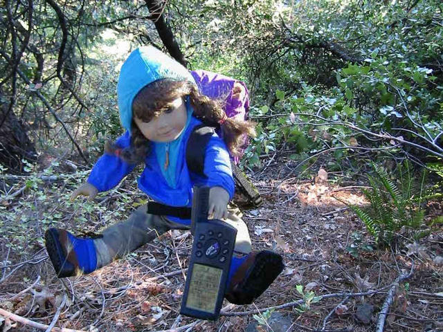
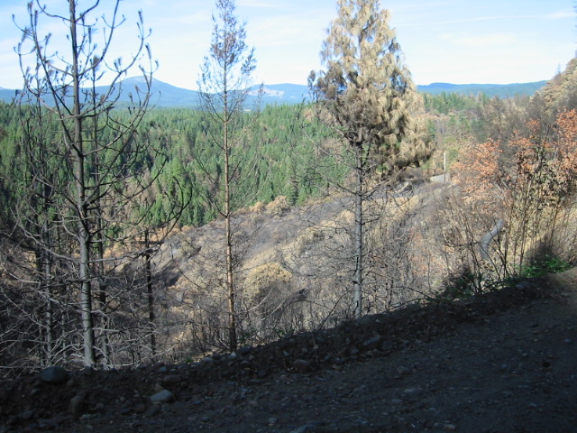
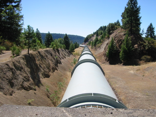
 (visited by Michael Gasman, Rebecca Gasman and Molly McIntire) 25-Aug-2001 -- After my two previous attempts to reach this confluence I thought I had made all the needed arrangements. A visit on 28 Jan gave me a general feel for the rough terrain. The group that visited the area on 5 April reported being able to drive SUVs to the site on the route on which my car got stuck in snow on 8 February. I gave the other group the summer to revisit the site and decided it was now about time this confluence was successfully visited. On August 25th I borrowed a Range Rover from Jane Flynn to drive to the site and took my eager 8-year-old daughter with her American Girl doll Molly dressed in hiking boots and backpack (picture). The Trip: There are two routes to this site, both off of HWY 299 about 35 and 45 miles NE of Redding. The South route is via Fenders Ferry Road, which heads West between the towns of Round Mountain and Montgomery Creek. After 3 miles pavement ends, and the rough road loops down then, at the 122 line, up to the Pitt River. Soon after crossing the river Bagley Mountain Jeep Road meanders north for miles. I passed the spots where I got stuck previously and ventured further north. We encountered a locked gate at (40.9739, -122.0189 WGS84) before reaching Bagley Flat, leaving us 2 miles from the confluence point - probably a 3 mile hike. (This gate was open for the attempted visit on 5 April.) This south route requires a long 12+-mile drive on dirt logging roads, a high ground clearance vehicle is required. We tried to find another way beyond the gate then turned around and returned to HWY 299. We followed the route I explored in January. The North route takes Big Bend Road that is north of Montgomery Creek after HWY 299 climbs a long grade. Pitt 5 Road is a left after 15 miles of paved winding road heading north toward the town of Big Bend. We traveled west to the Pitt River on about 4 miles of twisting pavement. We saw obvious signs of a recent fire (picture) midway to the river. A dirt road travels up the ridge. A different, driveable road on the left took us to and over the miles long penstock for the Pit 5 power plant (aerial) (picture). After following the pipe north we encountered another locked gate, preventing access to the trails marked 4WD on the topo maps. The confluence was 1 mile from this point overlooking the deep Iron Canyon (panorama). Rebecca, Molly and I took some pictures. By the time we returned to Redding we had traveled 150 miles. |
| All pictures |
| #1: Panorama of area - with labels #2: View of aqueduct as the road crosses over it #3: Topographic map with gate south of Confluence labled #4: Forest fire burn along Pitt 5 Road ALL: All pictures on one page |