|

United States : California
5.4 miles (8.7 km) WSW of Big Bend, Shasta, CA, USA
Approx. altitude: 878 m
(2880 ft)
([?] maps: Google MapQuest OpenStreetMap topo aerial ConfluenceNavigator)
Antipode: 41°S 58°E
Accuracy: 3.1 km (1.9 mi)
Quality: good
Click on any of the images for the full-sized picture.


| 41°N 122°W (visit #4) | (incomplete) |
![Visit #6: [02-Sep-13]](/us/ca/n41w122v6/preview.jpg "Visit #6: [02-Sep-13]")
![Visit #3: [04-Sep-01]](/us/ca/n41w122v3/preview.jpg "Visit #3: [04-Sep-01]")
![Visit #5: [25-Aug-01]](/us/ca/n41w122v5/preview.jpg "Visit #5: [25-Aug-01]")
![Visit #2: [08-Feb-01]](/us/ca/n41w122v2/preview.jpg "Visit #2: [08-Feb-01]")
![Visit #1: [05-Apr-01]](/us/ca/n41w122/preview.jpg "Visit #1: [05-Apr-01]")

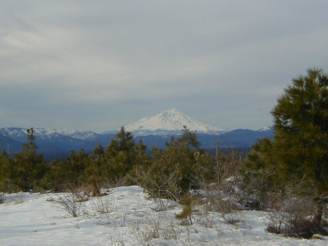
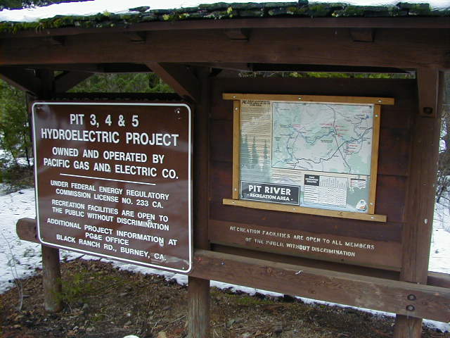
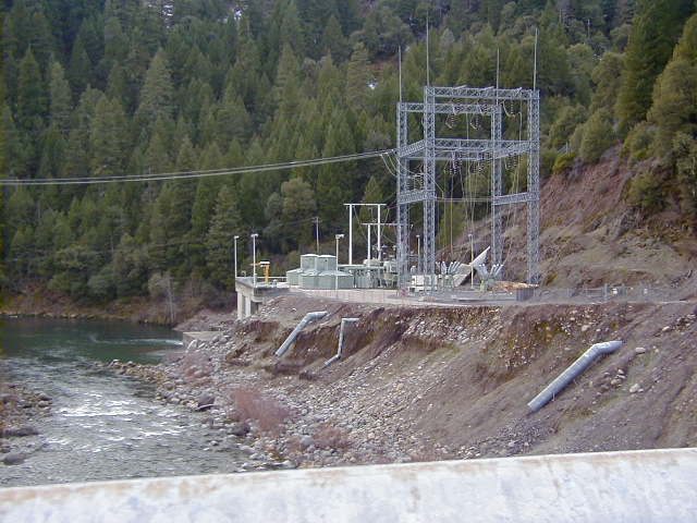
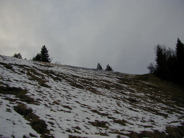
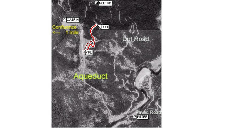
(visited by Michael Gasman) 28-Jan-2001 -- After easily reaching 40-122 by car and 40-124 after a 2-mile hike I wanted to explore this site fairly close to my home of Redding. It was obviously remote but there were trails/roads indicated on the topo maps and it was near hydroelectric development along the Pitt River. On January 28 in the afternoon I drove up to have a look. I traveled out HWY 299 past Montgomery Creek to Big Bend Road. There is a beautiful view of Mt Shasta (picture). I traveled further north to Pitt 5 Road. A sign (picture) at this intersection gave information on the hydroelectric system. Traveling west on this paved road I reached the James B Black Powerhouse (picture), Pitt 5 plant. It is one of many PG & E hydroelectric generator systems along the Pitt River, situated below the bridge that crosses the river. I drove from 1400 ft to 2400 ft elevation up the dirt road winding NW, climbing the ridge, and reached a road that I thought lead to the area. The road was rough and washed out, so I walked a short distance to the bottom of a large snow-covered terraced grade. Looking up this slope, I saw what looked like a 1-foot gas pipe (big picture). Poking around, I started climbing this grade. The slope was designed to collect water flow coming down the cut hillside in asphalt gutters about every 80 feet. When I climbed near the top of the hill I was amazed that the pipe was at least 20 ft in diameter. This pipe feeds the penstocks for the powerhouse below. I hadn't noticed this large pipe on the Terra Server aerial photographs of the confluence, that was because I was 2 miles away. I could not see the actual confluence area and realized I wouldn't be making it near the confluence on this trip and. The aerial photo using an ExpertGPS overlay of the route I walked from where I parked the car. It was getting dark as I returned to the car. |
| All pictures |
| #1: View of aquaduct at top of grade - 2 miles from Confluence #2: Sign at intersection of Big Bend and Pitt 5 Roads #3: James B Black Powerhouse - at bottom of aquaduct #4: ExpertGPS overlay of my wanderings on aerial view of aquaduct #5: Mt. Shasta from Big Bend Road ALL: All pictures on one page |