|

United States : California
5.4 miles (8.7 km) WSW of Big Bend, Shasta, CA, USA
Approx. altitude: 878 m
(2880 ft)
([?] maps: Google MapQuest OpenStreetMap topo aerial ConfluenceNavigator)
Antipode: 41°S 58°E
Accuracy: 91 m (298 ft)
Quality: good
Click on any of the images for the full-sized picture.


| 41°N 122°W (visit #3) |
![Visit #6: [02-Sep-13]](/us/ca/n41w122v6/preview.jpg "Visit #6: [02-Sep-13]")
![Visit #5: [25-Aug-01]](/us/ca/n41w122v5/preview.jpg "Visit #5: [25-Aug-01]")
![Visit #2: [08-Feb-01]](/us/ca/n41w122v2/preview.jpg "Visit #2: [08-Feb-01]")
![Visit #4: [28-Jan-01]](/us/ca/n41w122v4/preview.jpg "Visit #4: [28-Jan-01]")
![Visit #1: [05-Apr-01]](/us/ca/n41w122/preview.jpg "Visit #1: [05-Apr-01]")

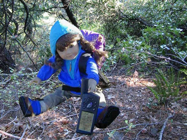
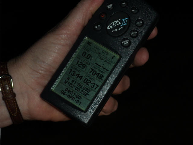
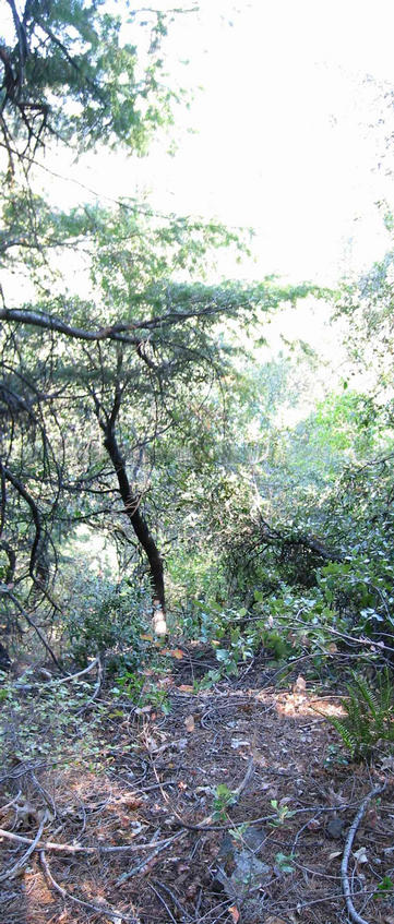
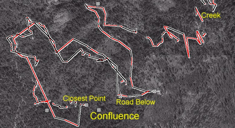
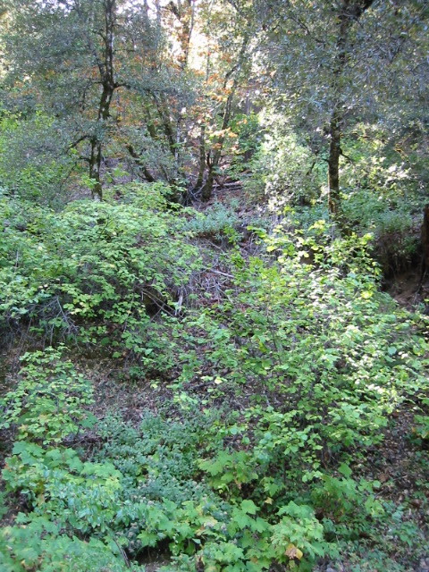
(visited by Michael Gasman and Molly McIntire) 04-Sep-2001 -- This was my fourth attempt for this difficult confluence. The intersection of 41N and 122W occurs on a steep slope between two traversing logging roads. The upper road is not on the old topo maps. Sierra Pacific Corporation, a wood products company headquartered in Anderson, California, harvests timber in this area. There are two routes to this site, both off of HWY 299 about 35 and 45 miles NE of Redding. The South route is via Fenders Ferry Road, which heads west between the towns of Round Mountain and Montgomery Creek. Both routes are detailed in my reports of earlier attempts. The first attempt was 28 January when I drove to check the roads NE of the area. The second attempt, on 8 February, involved getting stuck on the road south of the site. The third attempt, on 25 August, was with a Range Rover and I found locked logging gates 2 miles south and 1 mile east of the confluence. The gates and the land between them is managed by Sierra Pacific and borders US National Forest. A call to Sierra Pacific indicated that the gates are closed most of the time, especially during the dry forest fire season. The risk of fires being started by campfires and vehicles in this remote area is much too great. Since the gates were locked, my plan was to reach the confluence from the north gate, which is closest to the confluence and requires little dirt road driving. I packed Molly in my backpack (picture over confluence) since this was a school day and my daughter could not join me. I brought a mountain bike and regrettably decided to bike and hike the road - a tough job. The trail started at 2500 ft and traversed down to Iron Canyon Creek just downstream from where Initial Creek joins it at 1500 ft, then back up to 3200 ft UGGH! The bridge (picture) crossing the lush and flowing creek is made from the base of a Southern Pacific railroad car. I was fortunate that I had entered GPS waypoints for the switchbacks since there were roads that were not on the map. I passed scrub oak and brush in the lower elevations; then, as I climbed, evergreens become more common. Two hours after leaving the car near the aqueduct and gate I reached the area overlooking the confluence. At the top of the ridge I found the clearing which was reached by the night-driving students on 5 April. The confluence was 1/4 mile to the east (0.25 minutes of longitude - picture from 5 April). I walked down the rounded ridge along an abandoned trail where I found one of four new Natural Light beer cans along my route that day. Soon I came upon another road that is recorded as a small segment on the SE topo quad and not on the others. This road loops NW, just north of the clearing, to the road I arrived on. While walking on the road I was still 500 feet west of the confluence. I climbed down the slope below the road. The grade was covered with evergreen trees and fallen timber. I came to a much steeper slope 300 ft below the road, it was about a 60 % grade. The shift from NAD 27 (topo map) to WGS 84 pushes the location NE onto this steeper slope, more careful reading of the topo map would have better prepared me for this. I would have needed mountaineering equipment with 600 ft of rope to get to the exact confluence but the GPS read an acceptable 297 feet to the coordinates. I made a long vertical stitched image (picture) to attempt to show the steep grade relative to the bright valley. (My exposure could have been better) The tracks in the ExpertGPS overlay show the paths I took. While on the hill, I noted that the GPS tracks I recorded as I climbed the road up to the ridge came within 500 feet of the confluence above. I stopped on the return trip down the hill where the road comes close below and photographed (picture) up the hill in the direction of the confluence. There are several springs flowing down this hillside that support some smaller vegetation. The route from the aqueduct is 4 miles, an 8-mile round trip. I rode and pushed the bike over many rocky areas, a lot of 10-15% grade sections, dry grass and dust. It is a very vigorous hike and a bit dicey when biking. By the time I reached my car 4 1/2 hours after leaving it I was quite exhausted and had emptied three water bottles on this 90-degree day. If the gate were open a SUV would have little problem with this shorter, faster off-pavement route. If anyone with mountaineering experience wants to arrange for an open gate and tackle a rappel to the exact confluence, please contact me. |
| All pictures |
| #1: Looking down the steep slope toward the Confluence #2: Looking up toward the Confluence from the logging road below #3: Vista from above showing steepness related to the horizon #4: Aerial view with tracks superimposed - ExpertGPS #5: Bridge over Iron Canyon Creek below the confluence - made from railroad car #6: Molly McIntire above the Confluence ALL: All pictures on one page |