
| { Main | Search | Countries | Information | Member Page } | |
United States : Texas; showing visits by Captain Peter |
| There are no Plans for this Region. |
| Region Notes |
|
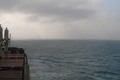
26°N 97°W 13.9 miles (22.4 km) ESE of Port Isabel, Cameron, TX, USA [11-Apr-11] |
Region Notes:
The Texas Department of Transportation has their Texas Official Travel Map available for download as a PDF file. The map includes latitude/longitude grid tic marks that have been placed at the Degree Confluences. Information on the map projections used in Texas can be found at the TNRIS website.