|

South Africa : Western Cape
10.3 km (6.4 miles) SSW of Kylemore, Western Cape, South Africa
Approx. altitude: 638 m
(2093 ft)
([?] maps: Google MapQuest OpenStreetMap ConfluenceNavigator)
Antipode: 34°N 161°W
Accuracy: 588 m (643 yd)
Quality: good
Click on any of the images for the full-sized picture.


| 34°S 19°E (visit #1) | (incomplete) |
![Visit #2: [15-Apr-03]](/za/all/s34e019v2/preview.jpg "Visit #2: [15-Apr-03]")
![Visit #3: [16-Jan-21]](/za/all/s34e019v3/preview.jpg "Visit #3: [16-Jan-21]")

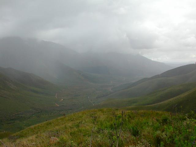
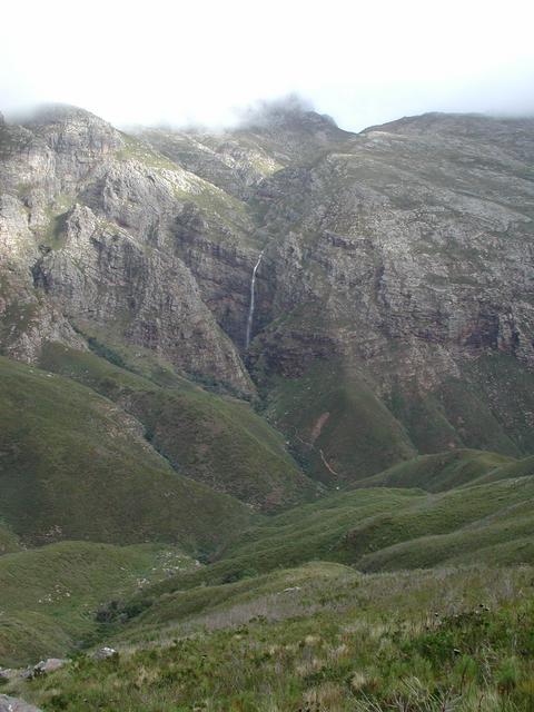
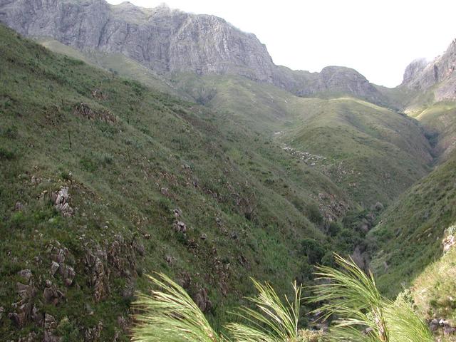
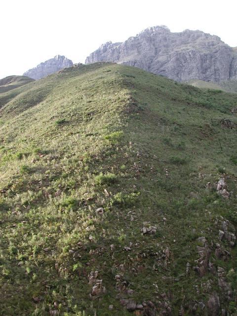
(visited by Rob Scott) 18-Jun-2002 -- This Confluence is halfway up the river valley that bisects the Jonkershoek Nature Reserve. It's a deep valley with mountains on both sides and has to be one of the most beautiful Confluences on the globe. There are a series of hanging waterfalls that plunge into the valley. We tried approaching up the valley along the north bank of the river. Although it seemed to be going in the right direction, it rapidly ascended more than 1800 feet (550 m) which seemed to leave the Confluence on the other side of the river about 700 meters away. Because the terrain was too steep and rugged to clamber down, we walked back to the car and tried the other side. Total distance walked 5 miles (8 km) and climbed a total of 2800 feet (850 m). We now tried approaching along the south bank of the river. Again it seemed to be going in the right direction and was much flatter. Again fabulous views. This time we ended up 588 meters on the other side of the point. Getting there would have entailed climbing down to the river and ascending about 1000 feet (300 m). Total distance walked about 4 miles (6.4 km) and climbed a total of 1000 feet (300 m). By this time it was getting dark and despite both being athletic, the steep grades and rough vegetation had flattened us both. |
| All pictures |
| #1: The Confluence is halfway up this slope #2: Looking down the valley #3: There are two waterfalls like this one #4: View down the valley #5: View up the valley, Confluence on slope to the left #6: Me at the closest point #7: GPS showing coordinates at closest approach to Confluence ALL: All pictures on one page |