|

France : Hauts-de-France
2.2 km (1.4 miles) SSE of Longpré-les-Corps-Saints, Somme, Hauts-de-France, France
Approx. altitude: 76 m
(249 ft)
([?] maps: Google MapQuest OpenStreetMap ConfluenceNavigator)
Antipode: 50°S 178°W
Accuracy: 47 m (154 ft)
Quality: good
Click on any of the images for the full-sized picture.


![]()

![]()

![]()
| 50°N 2°E (visit #2) | (secondary) |
![Visit #15: [14-May-24]](/fr/all/n50e002v15/preview.jpg "Visit #15: [14-May-24]")
![Visit #14: [23-Aug-19]](/fr/all/n50e002v14/preview.jpg "Visit #14: [23-Aug-19]")
![Visit #13: [23-Dec-14]](/fr/all/n50e002v13/preview.jpg "Visit #13: [23-Dec-14]")
![Visit #12: [03-May-13]](/fr/all/n50e002v12/preview.jpg "Visit #12: [03-May-13]")
![Visit #11: [29-Aug-10]](/fr/all/n50e002v11/preview.jpg "Visit #11: [29-Aug-10]")
![Visit #10: [19-Apr-10]](/fr/all/n50e002v10/preview.jpg "Visit #10: [19-Apr-10]")
![Visit #8: [17-Jul-09]](/fr/all/n50e002v8/preview.jpg "Visit #8: [17-Jul-09]")
![Visit #7: [18-Jan-09]](/fr/all/n50e002v7/preview.jpg "Visit #7: [18-Jan-09]")
![Visit #6: [01-Jan-09]](/fr/all/n50e002v6/preview.jpg "Visit #6: [01-Jan-09]")
![Visit #5: [26-Apr-08]](/fr/all/n50e002v5/preview.jpg "Visit #5: [26-Apr-08]")
![Visit #4: [16-Mar-06]](/fr/all/n50e002v4/preview.jpg "Visit #4: [16-Mar-06]")
![Visit #3: [05-May-05]](/fr/all/n50e002v3/preview.jpg "Visit #3: [05-May-05]")
![Visit #9: [10-Sep-01]](/fr/all/n50e002v9/preview.jpg "Visit #9: [10-Sep-01]")
![Visit #1: [05-Aug-01]](/fr/all/n50e002/preview.jpg "Visit #1: [05-Aug-01]")
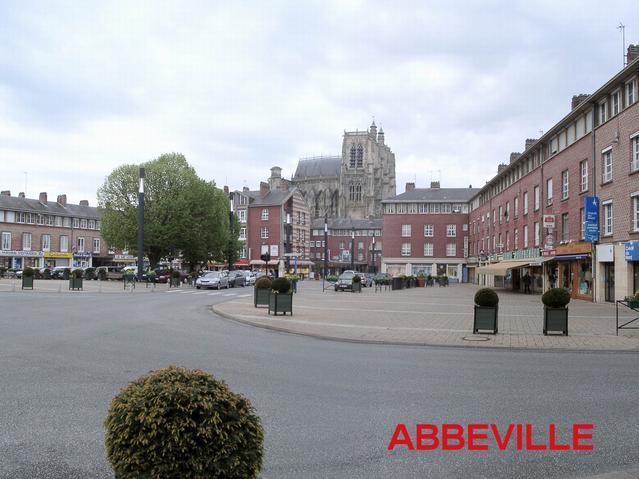
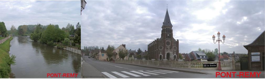
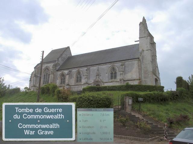
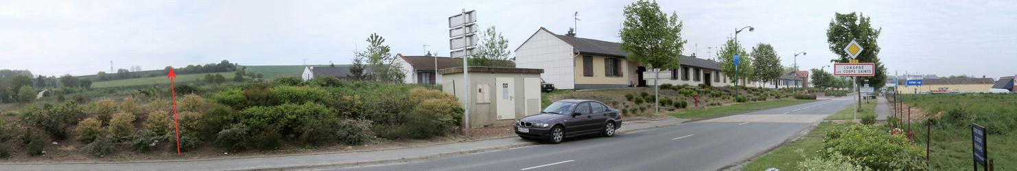
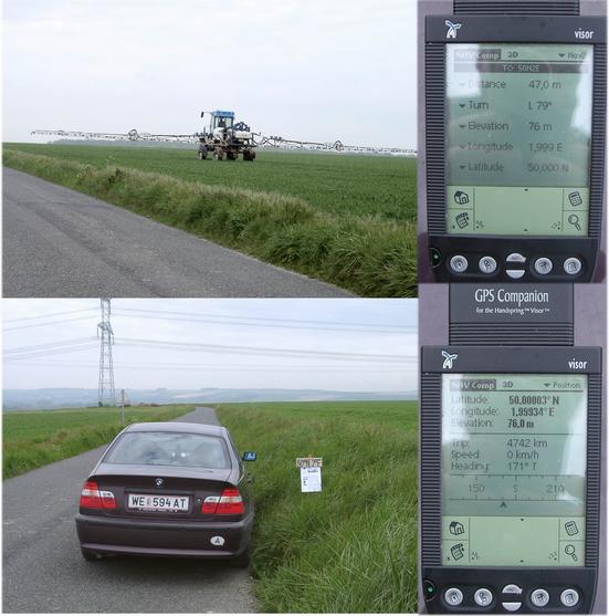
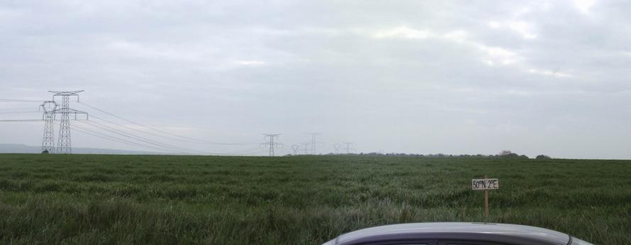
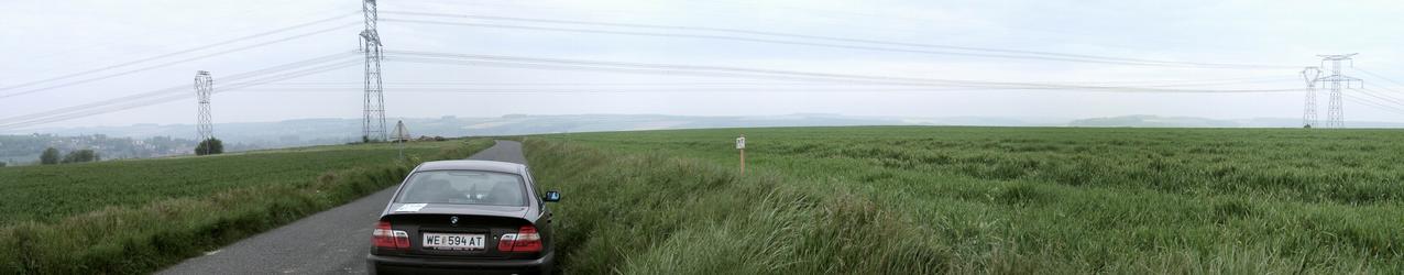
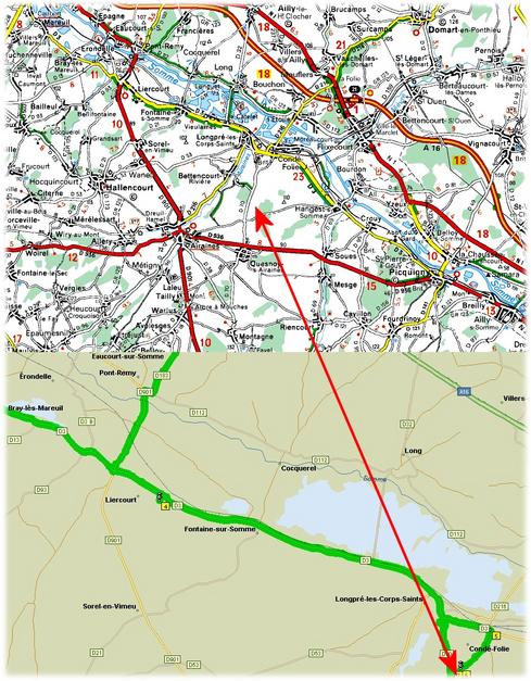
 (visited by Hans Augdoppler) 04-May-2002 -- After a short stay in Abbeville (picture) I crossed the River SOMME at Pont-Remy. Shortly afterwards I passed a half dilapidated church with war graves. At the exit of LONGPRÉ les CORPES SAINTS I could already see the area of the CP which is a plateau along the SOMME. The point is approx. 50 m on the right next to the street D70 in the direction of the LONGPRÉ les CORPES SAINTS in a wheat field. Weed killers were splashed on the neighbouring fields. The young plants had grown very thick and entering the field would have harmed them. The area is used intensively agriculturally and has no special features apart from the huge overhead power lines. This area is confessed by the tragedies of the First World War.
Lower map in pic#8 © MapPoint Europe http://www.microsoft.com; For more information see: http://linz.orf.at/gast/augdoppl/Confluence/Main.htm For an article detailing the tragic history of the Somme, see http://www.worldwar1.com/sfsomme.htm |
| All pictures |
| #1: Confluence ~50m inside the wheat field - view to SE #2: The town of Abbeville #3: River SOMME at Pont-Remy #4: Commonwealth war grave #5: Village of LONGPRÉ les CORPES SAINTS with view to CP #6: At the CP with GPS #7: View towards SOMME & LONGPRÉ les CORPES SAINTS (NORTH) #8: Maps #9: towards LONGPRÉ les CORPES SAINTS (WEST - NORTH) ALL: All pictures on one page |