|

United Kingdom : England
3.0 km (1.9 miles) NW of Fletching, East Sussex, England, United Kingdom
Approx. altitude: 25 m
(82 ft)
([?] maps: Google MapQuest OpenStreetMap ConfluenceNavigator)
Antipode: 51°S 180°
Accuracy: 5 m (16 ft)
Quality: good
Click on any of the images for the full-sized picture.


| 51°N 0° (visit #3) |
![Visit #25: [02-Sep-25]](/uk/en/n51e000v25/preview.jpg "Visit #25: [02-Sep-25]")
![Visit #24: [01-Oct-19]](/uk/en/n51e000v24/preview.jpg "Visit #24: [01-Oct-19]")
![Visit #22: [05-Jan-16]](/uk/en/n51e000v22/preview.jpg "Visit #22: [05-Jan-16]")
![Visit #21: [02-Feb-15]](/uk/en/n51e000v21/preview.jpg "Visit #21: [02-Feb-15]")
![Visit #20: [01-Mar-13]](/uk/en/n51e000v20/preview.jpg "Visit #20: [01-Mar-13]")
![Visit #19: [14-Nov-12]](/uk/en/n51e000v19/preview.jpg "Visit #19: [14-Nov-12]")
![Visit #18: [31-Jul-11]](/uk/en/n51e000v18/preview.jpg "Visit #18: [31-Jul-11]")
![Visit #17: [31-Jul-11]](/uk/en/n51e000v17/preview.jpg "Visit #17: [31-Jul-11]")
![Visit #16: [20-Aug-10]](/uk/en/n51e000v16/preview.jpg "Visit #16: [20-Aug-10]")
![Visit #14: [19-May-10]](/uk/en/n51e000v14/preview.jpg "Visit #14: [19-May-10]")
![Visit #15: [01-Apr-10]](/uk/en/n51e000v15/preview.jpg "Visit #15: [01-Apr-10]")
![Visit #13: [25-Sep-09]](/uk/en/n51e000v13/preview.jpg "Visit #13: [25-Sep-09]")
![Visit #12: [20-Apr-09]](/uk/en/n51e000v12/preview.jpg "Visit #12: [20-Apr-09]")
![Visit #11: [15-Jul-08]](/uk/en/n51e000v11/preview.jpg "Visit #11: [15-Jul-08]")
![Visit #10: [15-Jul-08]](/uk/en/n51e000v10/preview.jpg "Visit #10: [15-Jul-08]")
![Visit #8: [26-Dec-05]](/uk/en/n51e000v8/preview.jpg "Visit #8: [26-Dec-05]")
![Visit #7: [26-Jul-05]](/uk/en/n51e000v7/preview.jpg "Visit #7: [26-Jul-05]")
![Visit #6: [11-Dec-04]](/uk/en/n51e000v6/preview.jpg "Visit #6: [11-Dec-04]")
![Visit #5: [08-Apr-04]](/uk/en/n51e000v5/preview.jpg "Visit #5: [08-Apr-04]")
![Visit #4: [08-Apr-04]](/uk/en/n51e000v4/preview.jpg "Visit #4: [08-Apr-04]")
![Visit #2: [24-Apr-02]](/uk/en/n51e000v2/preview.jpg "Visit #2: [24-Apr-02]")
![Visit #1: [09-Jul-00]](/uk/en/n51e000/preview.jpg "Visit #1: [09-Jul-00]")
![Visit #9: [29-Jul-07]](/uk/en/n51e000v9/preview.jpg "Visit #9: [29-Jul-07]")
 with plate - view to WEST")
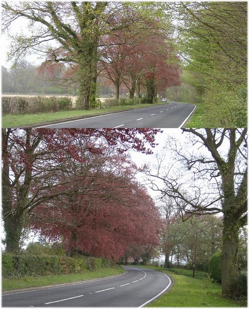
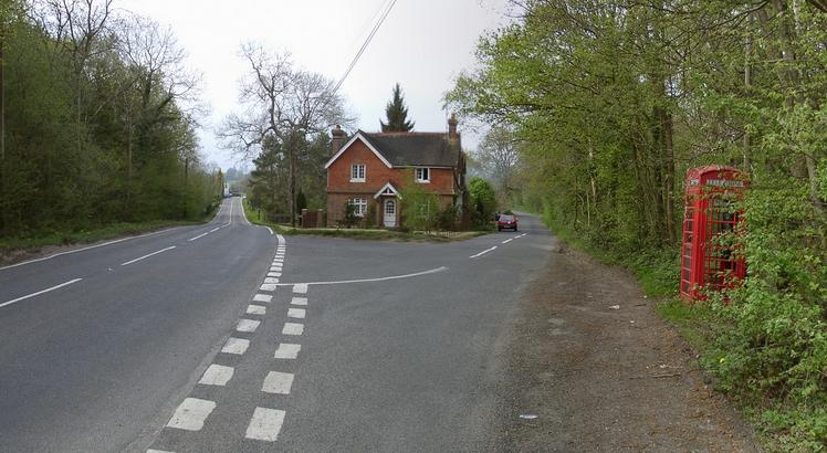
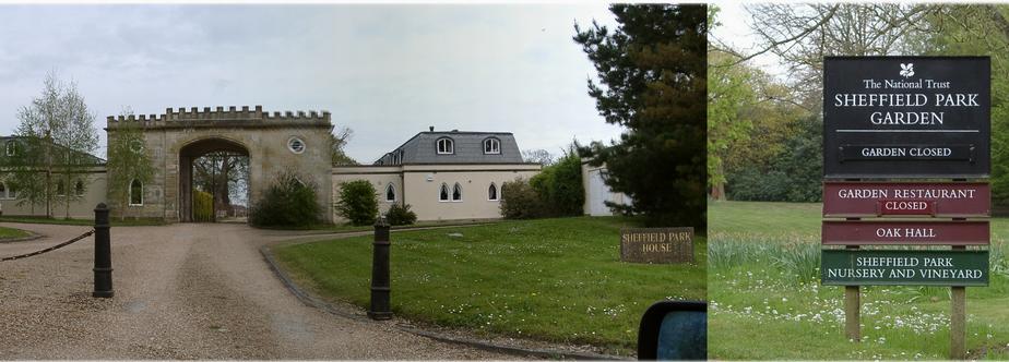
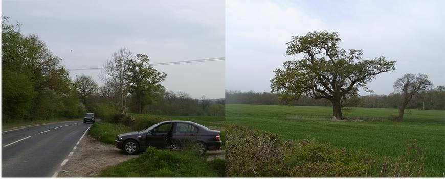
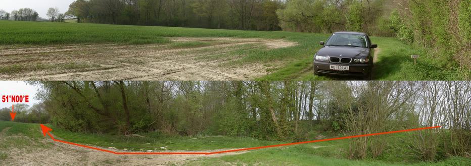
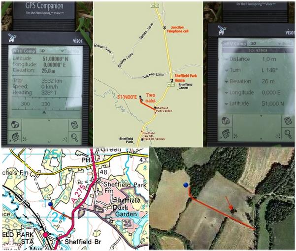
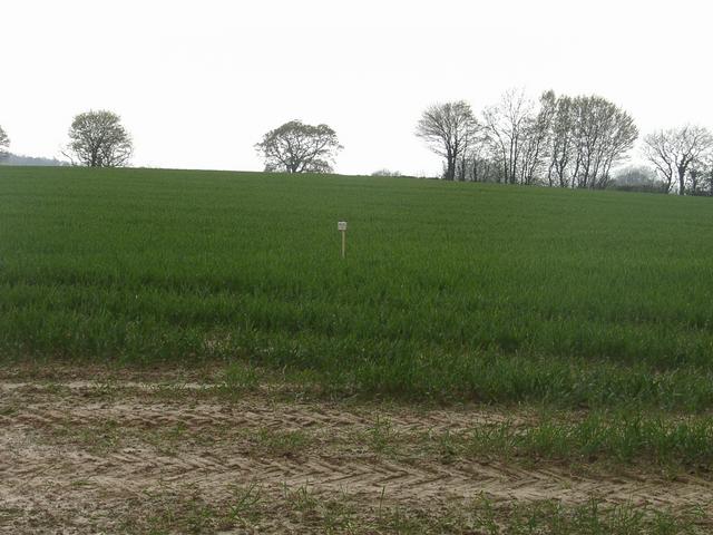
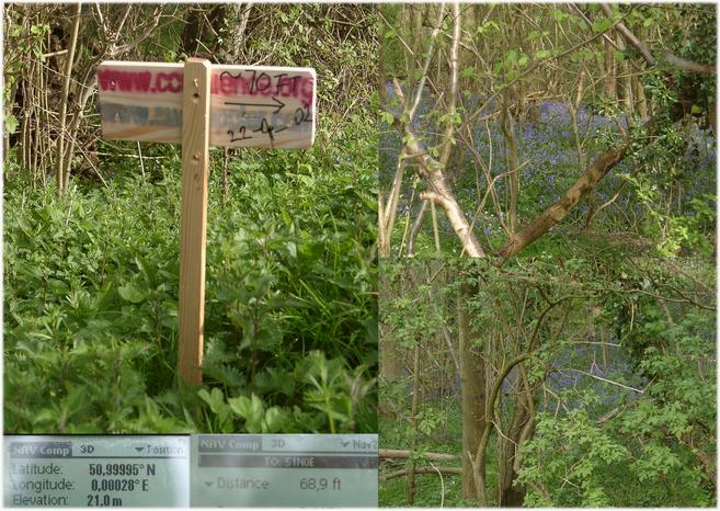
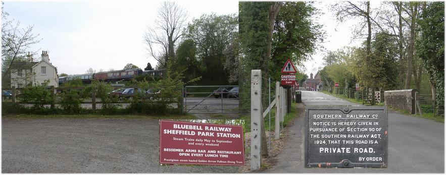
(visited by Hans Augdoppler) 22-Apr-2002 -- After crossing the channel by ferry I was late in order to avoid the evening rush around London. Therefore I decided to visit this CP and maybe also 51°N 01°W. I lost a lot of time due to some road works along the A22 to East Grinstead. As I turned into the A275 in direction Lewes I was pleased by the wonderful trees along this road as well as a typical English telephone booth at 51,0143N 0,008E. After I had passed the ‘Sheffield Park Garden’ I found a very convenient farm track at 50,9978N 0,0048E which may be identified by two oaks to the right. Thanks to a dry period an ordinary car could use the bumpy track up the CP (up to ~20 m) whereby it was necessary to cross a small brook then to turn right in direction NW, around a swampy area along the brook with small trees, flowers and nettles. Finally I parked my car ~20m (60ft) from the point located in a planted wheat field. Using large tractor tracks and blank patches it was easy to reach the exact ZERO without harming the plants. While planting the sign aside the earth track into bunches of nettles I noticed a man walking on the north western corner of the field. I waved a few times in order to get in touch with him but he disappeared in direction north. I went back to the A275 and continued to SW, passed the Bluebell railway (see picture 9). Based on the marvellous weather condition I had planned to continue to 51N01W but considering the above mentioned delay I decided to go for the final destination in Lincolnshire. Meanwhile Gordon Spence visited this CP and his narrative contains a link to MultiMap.com with indicated access route. While he and visitor#1 came from NNW I suppose my approach from the SE should be easier. Upper map in pic#7 © MapPoint Europe http://www.microsoft.com; Lower map & aerial photo in pic#7 was provided by http://www.multimap.com For more information see: http://linz.orf.at/gast/augdoppl/Confluence/Main.htm |
| All pictures |
| #1: Confluence marked (temporarily) with plate - view to WEST #2: Trees along A275 to SOUTH heading for CP #3: Junction along the A275 with telephone boot #4: Sheffield Park/Garden entrance #5: Entrance to farm track with oaks, heading NW #6: Route to CP and view to NORTH #7: Map/aerial photo with GPS reading #8: Sign pointing toward confluence #9: Bluebell railway station #10: View from confluence to SOUTH ALL: All pictures on one page |