|

Greece
1.5 km (0.9 miles) NNE of Koronoúda, Kentrikí Makedonía, Greece
Approx. altitude: 415 m
(1361 ft)
([?] maps: Google MapQuest OpenStreetMap ConfluenceNavigator)
Antipode: 41°S 157°W
Accuracy: 5 m (16 ft)
Quality: good
Click on any of the images for the full-sized picture.


| 41°N 23°E (visit #1) |
![Visit #3: [21-Mar-08]](/gr/all/n41e023v3/preview.jpg "Visit #3: [21-Mar-08]")
![Visit #2: [26-Oct-07]](/gr/all/n41e023v2/preview.jpg "Visit #2: [26-Oct-07]")

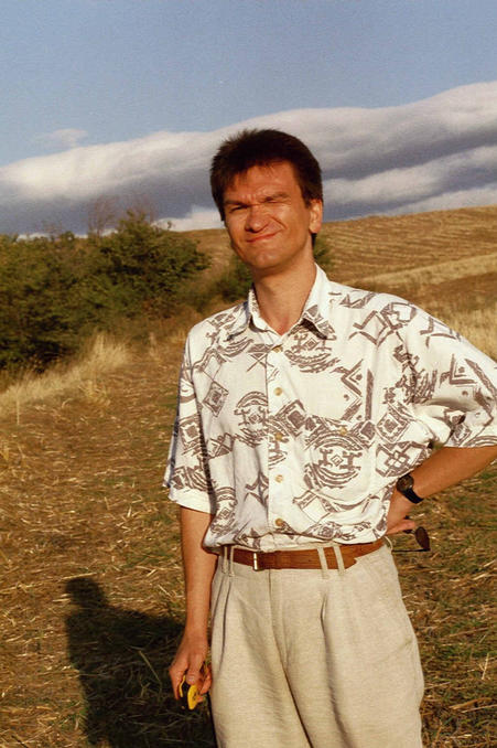
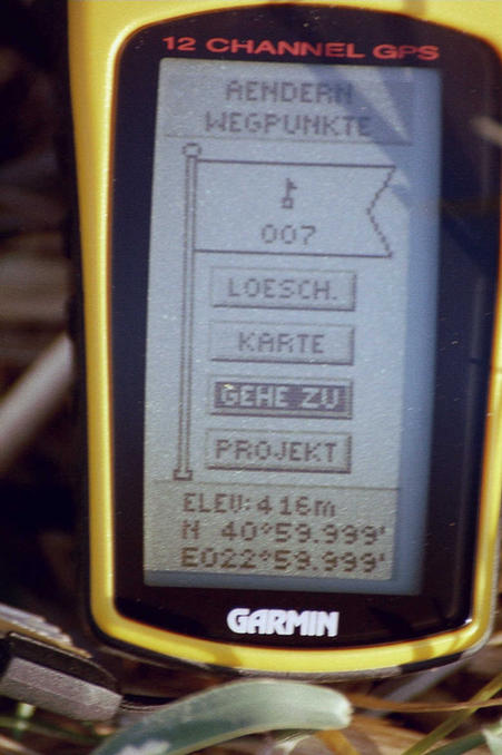
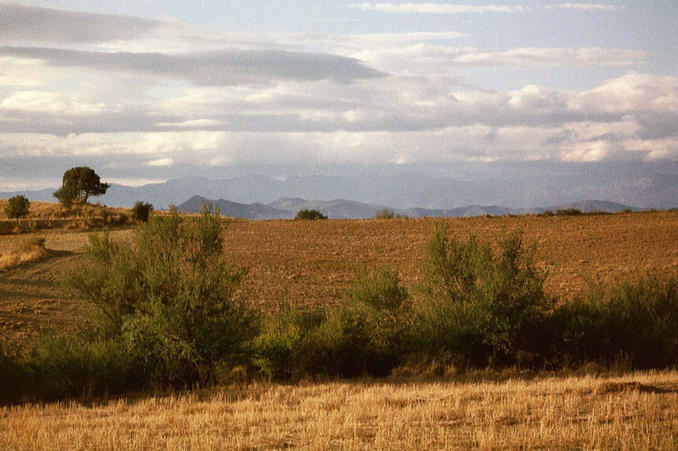
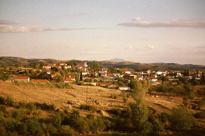
(visited by Stefan Beiergroesslein and Werner Beiergroesslein) 06-Sep-2001 -- From the town of Thessaloniki we (my father Werner and me) first drove in northeast-direction on the road no. 12 until we reached a junction to turn left to the small village of Karteres. Following a printout of the Mapquest-link for this confluence we planed to reach the village Koronouda on these smaller roads over Karteres, Lefkochori and Melanthi, each rather small villages in a rural countryside. But in Melanthi, even with the help of local people, we could not find the road directly to Koronouda, so we had to take a bowshaped detour over Stefania, which partly led away from the confluence. But finally we reached Koronouda and the GPS showed us the confluence to be just 800m NNE of the village so we walked the rest of the way through a little creek, along a country lane to a stubble field close to a big electric pylon. We reached the confluence at 18:30 local time, just an hour before sunset. Altitude 416m. It is placed in a stubble field that might have been a tobacco-field, which is a very common crop in the area, on our tour we several times saw people harvesting it and drying the leafs on racks. The pics 1-4 show the view from the confluence in N, E, S and W-direction. Pic 5 shows me standing on the confluence. Pic 6 is the GPS-display of the confluence. Due to the fact, that it is placed in a depression there is not a good view from the confluence. But from a small hill just a few steps away you get a good view to the Kerkini mountain range (dist. 40km, pic 7) which as well is the border to Bulgaria. Pic 8 finally shows Koronouda from about half way to the confluence. If there are any successors to this confluence I advise them not to approach Koronouda from the east but from the west over the town Kilkis; we took this route on our way back and it should be much easier to find. |
| All pictures |
| #1: North-view #2: East-view #3: South-view #4: West-view #5: Stefan standing on confluence #6: GPS-Display #7: Distant view North with Kerkini mountains #8: village Koronouda ca. 800m from confluence ALL: All pictures on one page |