|

Italy : Sicilia
1.9 km (1.2 miles) S of Montalbano di Elicona, Messina, Sicilia, Italy
Approx. altitude: 917 m
(3008 ft)
([?] maps: Google MapQuest OpenStreetMap ConfluenceNavigator)
Antipode: 38°S 165°W
Accuracy: 267 m (875 ft)
Quality: good
Click on any of the images for the full-sized picture.


| 38°N 15°E (visit #1) | (incomplete) |
![Visit #5: [18-Feb-20]](/it/all/n38e015v5/preview.jpg "Visit #5: [18-Feb-20]")
![Visit #4: [02-Jul-17]](/it/all/n38e015v4/preview.jpg "Visit #4: [02-Jul-17]")
![Visit #3: [12-Oct-11]](/it/all/n38e015v3/preview.jpg "Visit #3: [12-Oct-11]")
![Visit #2: [06-Oct-01]](/it/all/n38e015v2/preview.jpg "Visit #2: [06-Oct-01]")

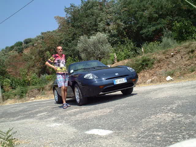
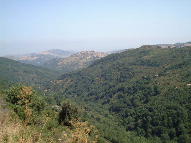
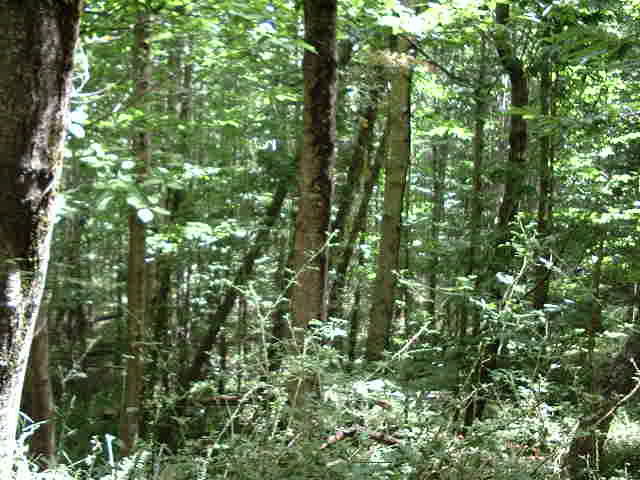
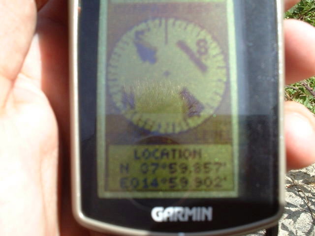
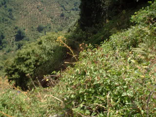
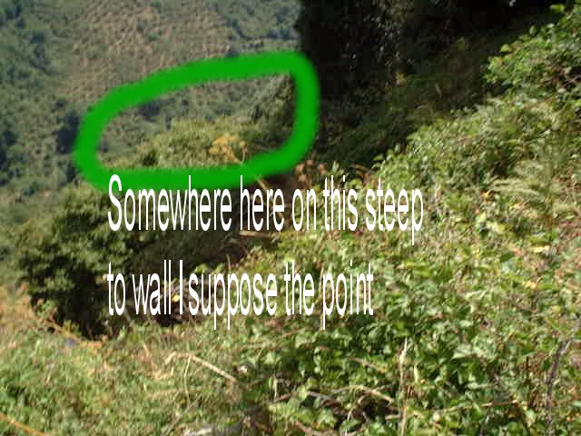
(visited by Captain Peter) 05-Aug-2001 -- At 0930EDST I left my home by car and I went via the villages of Francavilla di Sicilia / Moio Alcantara and Roccetta Valdemone to the Monte Castelazzo road crossing. Already on the map one sees from the winding roads that the territory is extremely mountainous. I stopped and parked the car on the bend closest to the point, about 950 metres SSE of the confluence point and 1300 metres above sea level. There I realized that the confluence point is totally surrounded by forests. Further I began to fear that the point is somewhere down in a steep valley or even situated on a steep wall - and therefore inaccessible without equipment or damages to clothes and even danger to get hurt. But I decided to try. Fortunately I was in the place where the forest curtain was obviously not so thick and dense, so I entered the forest. The forests are absolutely free of any human inhabitation, there is no hunting, and therefore no way to walk. I had to crawl through quite unpleasant ground. Finally I came to the bed of a small river, being almost dry. I crossed and then I found myself on a dry pasture, full of thistles. There I saw these big stones everywhere, and even a few sheep and goats, but not wild, as they had bells around their neck. This pasture was quite easy to cross, I proceeded with the GPS. I realized quite soon that the Longitude will not be a problem, because I could move quite easily on it. When leaving the forest, I was still about 500 metres away from the confluence point. Approaching the Latitude was not easy, it was terribly hot and I became very thirsty, further I had to move around these stones and sometimes the thistles hurt my legs. Finally I got the confirmation that making the point will not be possible. In position 37°59.857'N and 15°59.902'E the attempt was over. I saw what I had expected. The point is in a gap, a several hundred meters deeper than the point I was standing. So I went back and cancelled the mission about 143 thousands of a minute (267 metres) SSW of the point. I could have proceeded to exactly the Long. 15E, that was no problem, there is space, but I saw no sense in it, as I could never reach the proper Latitude and make the point correctly. Conclusion: I don't want to say that it is completely impossible to make the point. With more courage, better clothing and more enthusiasm it might be possible. Look at Picture #5: There is the problem. It is taken from the South. If you try from North, it can be probably done, but see how much forest you have to cross!!! And furthermore: I still believe the point is not on a flat place on the bottom of the gap, but it is on an extremely steep to rocky wall. |
| All pictures |
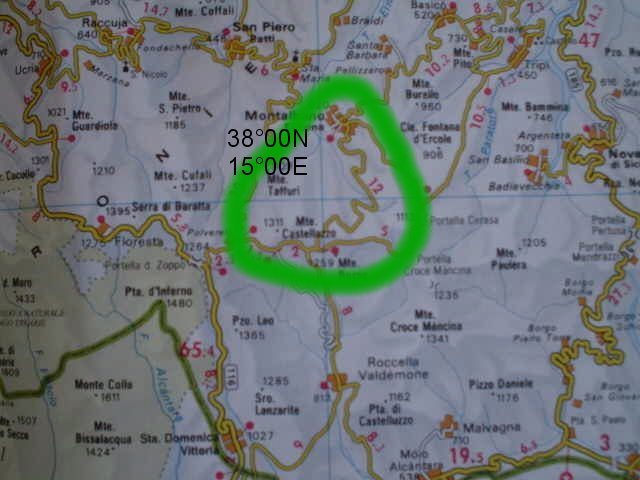
| #1: Somewhere in there... #2: I left my home by car... #3: Map of the confluence area #4: I entered the forest here #5: Totally surrounded by forests #6: GPS -- the attempt was over #7: Here's where I believe the point to be ALL: All pictures on one page |