|


Greenland : Vestgrønland/Kitaa
25.2 km (15.6 miles) NE of Saqqarliit, Vestgrønland, Greenland
Approx. altitude: 303 m
(994 ft)
([?] maps: Google MapQuest OpenStreetMap ConfluenceNavigator)
Antipode: 67°S 128°E
Accuracy: 11 m (36 ft)
Quality:
Click on any of the images for the full-sized picture.
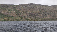
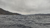
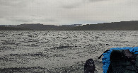
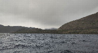
| 67°N 52°W (visit #3) |
![Visit #2: [02-Jul-13]](/gl/all/n67w052v2/preview.jpg "Visit #2: [02-Jul-13]")
![Visit #1: [11-Jul-06]](/gl/all/n67w052/preview.jpg "Visit #1: [11-Jul-06]")
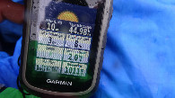
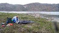
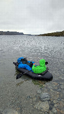
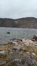
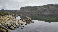
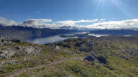
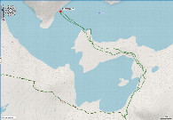
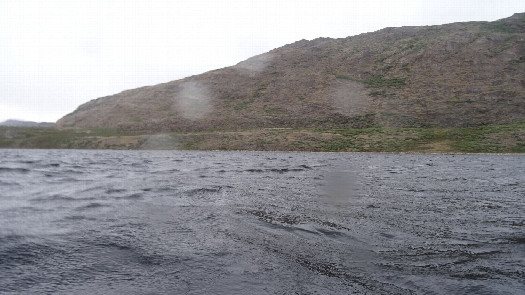 (visited by Thomas Barthel) 21-Jun-2026 -- During our holidays on Greenland, for hiking the “Arctic Circle Trail” from Kangerlussuaq to Sisimiut, I had the chance to visit three confluence points. The story follows the previous visit at CP 67° N 51° W. This is the second visit during our holidays and it took place at 67° N 52° W, located in the lake Taserssuaq. When I was reading the reports of the former incomplete visits, I overthought how to reach this one. It would be the first successful visit of this confluence point! There are some (more or less sensful) possibilities: visit it during wintertime by a skidoo. Second: swimming about 2 x 200 m with wetsuit. But therefore you need to carry the wetsuit all the time with you and you have to hike along the northern shore of the lake for around 15 km cross-country two times, which means two more days for the trip! Third: – as Rainer already wrote - taking a canoe from the neighbour lake “Amitsorssuaq”. But these Swedish aluminium canoes type “INKAS” are very large and heavy. We took the chance to use it the day before and in the morning of today (21.06.2026) and had to fight to get it in and out of the lake! No. four was my choice: using an ultralight rubber dinghy also called packraft! The lightest I found has a wight of 1.4 kg, included the paddle. In addition to this we had to take a detour of 2 x 7.7 km cross-country to minimise the distance on water. So we crossed a small river, which is flowing from the Amitsorssuaq to the Taserssuaq, walked up and down many times through a wonderful landscape, until we reached the northern end of the semi island. Arrived there I decided to start immediately, caused by the slightly low wind. Who knows how the conditions would be on the next morning? We had no weather forecast because of no mobile data connection along the trail. Still under good conditions I prepared the boat by placing my insulation mattress at the bottom and, for a better directional stability, the backpack in the front of the packraft. I started paddling around 09.50 pm. But the more I neared the aimed confluence point the more the wind speed increased. In addition to this it started raining. But after 1.7 km I was able to take the needed pictures! Unfortunately I drifted around 15 m westwards as soon as I took one picture. Under these conditions it was not possible to meet all the zeros of the coordinates. With the wind from behind on the way back, the boat was faster and better steerable. 1 h 10 min after starting I was back at the starting point and happy for finishing the first successful visit of the CP 67° N 52° W! During this time of the year the sun is two hours below horizon only. So it was still bright after this eventful fourth day of our tour. On the next morning the lake was flat as a mirror. After some kilometres of hiking we saw the whole confluence area as a nice panorama with the view back. After this visit the story continued at the CP 67° N 53° W. |
| All pictures |
| #1: location of CP 67N-52W 68 m from SE #2: view to the north #3: view to the east #4: view to the south #5: view to the west #6: GNSS reading at 67N-52W #7: preparations #8: ready for the start #9: mission completed #10: view direction CP next morning #11: area of CP 67N-52W in the lake Tasersuaq with the ACT in the foreground #12: track ALL: All pictures on one page |