|


Russia : Moskovskaya oblast'
2.1 km (1.3 miles) E of Komyagino, Moskovskaya oblast', Russia
Approx. altitude: 178 m
(583 ft)
([?] maps: Google MapQuest OpenStreetMap ConfluenceNavigator)
Antipode: 56°S 142°W
Accuracy: 10 m (32 ft)
Quality: good
Click on any of the images for the full-sized picture.
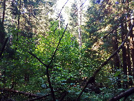
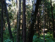
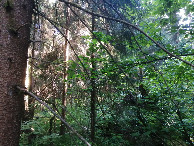
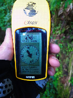
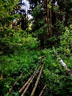
| 56°N 38°E (visit #9) | (secondary) |
![Visit #8: [06-Jan-18]](/ru/all/n56e038v8/preview.jpg "Visit #8: [06-Jan-18]")
![Visit #6: [13-Aug-13]](/ru/all/n56e038v6/preview.jpg "Visit #6: [13-Aug-13]")
![Visit #5: [18-Nov-11]](/ru/all/n56e038v5/preview.jpg "Visit #5: [18-Nov-11]")
![Visit #4: [10-May-09]](/ru/all/n56e038v4/preview.jpg "Visit #4: [10-May-09]")
![Visit #3: [17-Aug-03]](/ru/all/n56e038v3/preview.jpg "Visit #3: [17-Aug-03]")
![Visit #2: [28-Jun-03]](/ru/all/n56e038v2/preview.jpg "Visit #2: [28-Jun-03]")
![Visit #1: [07-May-03]](/ru/all/n56e038/preview.jpg "Visit #1: [07-May-03]")
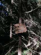
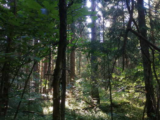 (visited by Alexander Koptilkin) 21-Июня-2026 – Волею судьбы оказался в Подмосковье, в наукограде Королёве. Будни заняты работой, а выходные совершенно свободны. А когда привёз из дома велосипед и моего жёлтого друга «Гармина», то решил изучить окрестности и посетить очень близкое ко мне пересечение. Тёплым воскресеньем, после обеда, отправился на велопрогулку сначала в Ивантеевку, а затем на север, в лесной массив, где располагаются дачи. Проскочил по пешеходному проходу шлагбаум и оказался на просеке ЛЭП, под которой расположилось СНТ «Восход-2». По пути порылся в книгах, которые кто-то выставил возле старой дачи. Нашёл себе интересное чтиво на ближайшие недели – «Сафари под Килиманджаро» Йозефа Вагнера. Затем пришло время углубляться в лесную чащу. Сначала в направлении пересечения меня вела тропка, но вскоре она затерялась и мне пришлось немного сложно с великом. Довольно труднопроходимый лес, много поваленных деревьев. И обещанная речка с плохоньки мостиком из поваленных деревьев. Оставил велосипед у ёлки, включил навигатор и стал искать спутники. Дело шло медленно, так как помимо плохой связи в лесу я не включал навигатор со времён Южной Америки, поэтому «Гармин» немного растерялся и долго думал. Наконец, все заработало, и я направился по внезапно появившейся тропинке прямиком к дереву с табличкой «53°N 38°Е Щёлковский район». Пять лет назад её, похоже, ещё не было, когда совершился последний визит. Делаю фото и не сразу нахожу свой велосипед в густом лесу. Поехал по тропинке дальше и совсем рядом с пересечением обнаруживаю лесное озеро, в котором, наконец, искупался, открыв сезон! И потом прогулка продолжилась через Фрязино и Щёлково. Уже совсем поздно возвратился в квартиру. Данные посещения:
21-Jun-2026 – By the will of fate, I found myself in the Moscow region, in the science city of Korolev. Weekdays are busy with work, and weekends are completely free. And when I brought my bike and my yellow friend Garmin from home, I decided to explore the surroundings of Korolev and visit a confluence very close to me. On a warm Sunday afternoon, I went on a bike ride first to Ivanteyevka and then north to the forested area where the dachas are located. I slipped through the pedestrian passage near the closed barrier and found myself in a clearing of the power lines, under which the Voskhod-2 dacha village was located. On the way, I rummaged through the books that someone had displayed near the old dacha. Here I found myself an interesting read for the coming weeks – “Kilimanjaro Safari” by Joseph Wagner. Then it was time to go deeper into the forest. At first, a path led me in the direction of the confluence, but soon it got lost and I had a bit of a hard time with the bike. The forest here is quite impassable, with many fallen trees. I left my bike near the spruce tree, turned on the navigator and started searching for satellites. Things were going slowly, because in addition to the poor connection in the forest, I hadn’t turned on the navigator since South America, so the Garmin was a little confused and thought for a long time. Finally, everything worked, and I headed along the suddenly appeared path straight to the tree with the sign “53°N 38°Е Shchelkovsky district.” Five years ago, the plaque apparently wasn't there yet when the last visit took place. I take a photo and have a hard time finding my bike in the dense forest. I continued along the path and very close to the confluence I discovered a forest lake, in which I finally swam, opening the season! And then my bike ride continued through Fryazino and Shchelkovo. It was already quite late when I returned to the apartment. Visit data:
|
| All pictures |
| #1: View to the west #2: View to the north #3: View to the east #4: View to the south #5: General view, plate #6: GPS reading #7: Bridge over Lyuboseyevka River #8: Tadpoles ALL: All pictures on one page |