
| { Main | Search | Countries | Information | Member Page } | |
Christopher Anton's confluences |
| Anton, Christopher | ||
| This Visitor does not have any Plans. | View confluence map | |
| 45 visits (44 unique) in 10 countries: | 45 active, 0 pending, 0 submitting | |
| 35 successful (34 unique): | 28 primary, 7 secondary | |
| 10 incomplete (10 unique): | 9 primary, 1 secondary | |
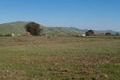
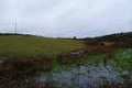
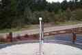
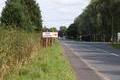
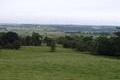
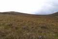
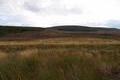
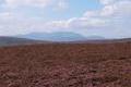
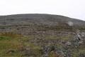
 | 59°N 3°W 4.7 km (2.9 miles) NW of Kirkwall, Orkney Islands, Scotland, United Kingdom [incomplete] [29-Aug-21] |
 | 43°N 80°W 2.7 km (1.7 miles) S of Willow Grove, ON, Canada [03-Oct-08] |
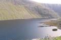
 | 58°N 7°W 4.2 km (2.6 miles) NNW of Amhuinnsuidhe, Lewis (Island), Western Isles, Scotland, United Kingdom [02-May-08] |
 | 53°N 4°W 4.8 km (3.0 miles) WNW of Blaenau-Ffestiniog, Gwynedd, Wales, United Kingdom [15-Feb-08] |
 | 38°N 122°W 2.3 miles (3.7 km) NE of Concord, Contra Costa, CA, USA [13-Mar-07] |
 | 39°N 121°W 0.4 miles (0.6 km) E of Applegate, Placer, CA, USA [incomplete] [13-Mar-07] |
 | 37°N 120°W 4.3 miles (6.9 km) NE of Madera, Madera, CA, USA [08-Mar-07] |
 | 36°N 115°W 2.3 miles (3.7 km) S of Henderson, Clark, NV, USA [07-Mar-07] |
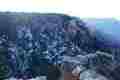 | 36°N 112°W 8.7 miles (14.0 km) ESE of Grand Canyon Village, Coconino, AZ, USA [incomplete] [06-Mar-07] |
 | 54°N 9°W 3.2 km (2.0 miles) NW of Killasser, Mayo, Ireland [incomplete] [10-Dec-06] |
 | 54°N 8°W 4.2 km (2.6 miles) WSW of Keshcarrigan, Leitrim, Ireland [secondary] [10-Dec-06] |
 | 54°N 10°W 1.4 km (0.9 miles) S of Doogort, Achill Island, Mayo, Ireland [10-Dec-06] |
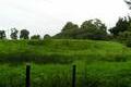
 | 51°N 1°W 1.9 km (1.2 miles) S of Froxfield, Hampshire, England, United Kingdom [11-Nov-06] |
 | 50°N 7°E 1.9 km (1.2 miles) S of Kröv-Bausendorf, Rheinland-Pfalz, Germany [16-Oct-06] |
 | 51°N 4°E 1.2 km (0.7 miles) E of Wichelen, Oost-Vlaanderen, Belgium [15-Oct-06] |
 | 51°N 7°E 1.2 km (0.7 miles) E of Köln-Flittard, Nordrhein-Westfalen, Germany [15-Oct-06] |
 | 50°N 6°E 0.5 km (0.3 miles) E of Wilwerwiltz-Enscherange, Diekirch, Luxembourg [14-Oct-06] |
 | 50°N 5°E 1.2 km (0.7 miles) W of Haut-Fays (Luxembourg), Namur, Belgium [secondary] [14-Oct-06] |
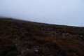
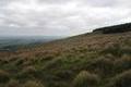
 | 57°N 6°W 2.7 km (1.7 miles) SE of Point of Sleat (Cape), Island of Skye, Highland, Scotland, United Kingdom [incomplete] [13-Jul-06] |
 | 40°N 116°E 1.4 km (0.9 miles) E of Shangweidian, Běijīng, China [incomplete] [30-Oct-05] |
 | 14°N 121°E 4.1 km (2.5 miles) SSW of Tabla, Luzon, Batangas, Philippines [incomplete] [20-Oct-05] |
 | 55°N 3°W 2.1 km (1.3 miles) W of Longtown, Cumbria, England, United Kingdom [incomplete] [11-Sep-05] |
 | 56°N 4°W 4.5 km (2.8 miles) WNW of Haggs (Falkirk), North Lanarkshire, Scotland, United Kingdom [10-Sep-05] |
 | 57°N 4°W 7.7 km (4.8 miles) SSE of Ruthven, Highland, Scotland, United Kingdom [07-Sep-05] |
 | 58°N 4°W 2.7 km (1.7 miles) NW of Backies, Highland, Scotland, United Kingdom [06-Sep-05] |
 | 57°N 3°W 5.4 km (3.4 miles) ESE of Birkhall, Aberdeenshire, Scotland, United Kingdom [06-Sep-05] |
 | 56°N 5°W 2.1 km (1.3 miles) NNE of Clachaig, Argyll and Bute, Scotland, United Kingdom [secondary] [05-Sep-05] |
 | 57°N 5°W 5.9 km (3.7 miles) NNW of Clunes, Highland, Scotland, United Kingdom [secondary] [04-Sep-05] |
 | 55°N 5°W 3.9 km (2.4 miles) NNE of Cairnryan, Dumfries and Galloway, Scotland, United Kingdom [secondary] [27-Aug-05] |
 | 53°N 0° 2.9 km (1.8 miles) SE of Frith Bank, Lincolnshire, England, United Kingdom [06-Aug-05] |
 | 52°N 2°W 1.9 km (1.2 miles) N of Alderton, Gloucestershire, England, United Kingdom [secondary] [06-Mar-05] |
 | 49°N 2°E 1.9 km (1.2 miles) N of Triel-sur-Seine, Yvelines, Île-de-France, France [secondary] [14-Feb-05] |
 | 49°N 3°E 1.2 km (0.7 miles) W of Isles-les-Meldeuses, Seine-et-Marne, Île-de-France, France [14-Feb-05] |
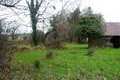
 | 52°N 3°W near Michaelchurch Escley, Herefordshire, England, United Kingdom [30-Oct-04] |
 | 53°N 8°W 0.6 km (0.4 miles) ESE of The Pike, Tipperary, Ireland [incomplete] [secondary] [11-Oct-04] |
 | 53°N 9°W 1.7 km (1.1 miles) N of Aglish, Clare, Ireland [11-Oct-04] |
 | 52°N 10°W 5.7 km (3.5 miles) ENE of Teeromoyle, Kerry, Ireland [11-Oct-04] |
 | 52°N 9°W 4.4 km (2.7 miles) NNE of Carriganimmy, Cork, Ireland [09-Oct-04] |
 | 53°N 7°W 1.6 km (1.0 miles) NW of Athy, Kildare, Ireland [09-Oct-04] |
 | 53°N 3°W near Gyfelia, Wrexham, Wales, United Kingdom [17-Sep-04] |
 | 53°N 1°W near Lowdham, Nottinghamshire, England, United Kingdom [15-Nov-03] |
 | 53°N 4°W 4.8 km (3.0 miles) WNW of Blaenau-Ffestiniog, Gwynedd, Wales, United Kingdom [08-Nov-03] |
 | 52°N 1°W 1.1 km (0.7 miles) W of Buckingham, Buckinghamshire, England, United Kingdom [01-Nov-03] |
 | 52°N 0° 1.1 km (0.7 miles) W of Barkway, Hertfordshire, England, United Kingdom [01-Nov-03] |
 | 61°N 1°W 17.9 km (11.1 miles) NNW of Muckle Flugga (Island), Shetland Islands, Scotland, United Kingdom [incomplete] [31-May-03] |