|
Germany : Rheinland-Pfalz
1.9 km (1.2 miles) S of Kröv-Bausendorf, Rheinland-Pfalz, Germany
Approx. altitude: 193 m
(633 ft)
([?] maps: Google MapQuest OpenStreetMap ConfluenceNavigator)
Antipode: 50°S 173°W
Accuracy: 5 m (16 ft)
Quality: good
Click on any of the images for the full-sized picture.
| 50°N 7°E (visit #2) |

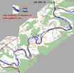
(visited by Henk Pouwels and Johan Leijtens) 16-Jul-2003 -- For my job I was called to the neighbourhood of Friedrichshafen in the south of Germany. I'm living in the Netherlands close to Amsterdam. I suggested a colleague to travel by car. He agreed for two reasons, 1st we can transport much more wine by car as by aircraft and 2nd "we can visit one of those points of you", meaning a Degree Confluence. So I planned the trip, looking for a convenient DCP close to the line Amsterdam-Friedrichshafen. In the Eifel region 50°N7°E was reported easy to find. We left the Netherlands in the morning of one of the hottest (35° Celsius) days of this summer for a 900 km trip. Indeed the DCP was easy to find. Armed with the information of visit #1 the car could be parked in the entrance of a small service road at 50 m SE of the DCP. Most likely is this the road of photograph #5 of visit #1. Walking straight North by the burning-hot road and turning left into the wood brought us to the DCP (see photograph #5). Off line examination of the recorded positions at the DCP shows an average error of 4.6 m with a standard deviation of 2.1 m over 90 fixes in 150 seconds. The ubiquitous North, East, South & West photographs (see #1, #2, #3 and #4) show the environment in full summer. Colleague Johan Leijtens is depicted in photograph #6, waiting for me to finish my DCP-business. The foliage is so dense the car parked at only 50 m somewhere behind Johan is invisible and so is the road in photograph #2. Returning to the car I noticed iron nails driven in the road marked with white numbers. The interval of the marks was 10 m. Are this geodetic reference points for altitude measurements? See photograph #7, which also shows the photographer in bright shadow. After visiting 50°N7°E we had lunch in Ürzig which is one of a number of famous wine villages in the German Mösel wine region (see photograph #8). We continued our journey with a sightseeing tour along the river Mösel, passing other well known names like Bernkastel-Kues, Piesport, Trittenheim and Klüsserath. In this region of Germany the river meanders extremely, expanding its length more then twice the distance as measured by the flying crow, see picture #9. After participating in a two day meeting we returned to the Netherlands with a nice collection of about 100 bottles of wine and other enjoyable liquids. |
| All pictures |
| #1: North looking #2: East Looking #3: South looking #4: West Looking #5: GPS display #6: Colleague who is responsible for this visit #7: German topographical markings in the road #8: Ürziger vineyards #9: The meandering sightseeing trip ALL: All pictures on one page |


![Visit #18: [10-Dec-23] Visit #18: [10-Dec-23]](/de/all/n50e007v18/preview.jpg)
![Visit #19: [13-Oct-23] Visit #19: [13-Oct-23]](/de/all/n50e007v19/preview.jpg)
![Visit #17: [15-Sep-23] Visit #17: [15-Sep-23]](/de/all/n50e007v17/preview.jpg)
![Visit #15: [22-Jul-19] Visit #15: [22-Jul-19]](/de/all/n50e007v15/preview.jpg)
![Visit #14: [25-Sep-15] Visit #14: [25-Sep-15]](/de/all/n50e007v14/preview.jpg)
![Visit #13: [03-Jan-15] Visit #13: [03-Jan-15]](/de/all/n50e007v13/preview.jpg)
![Visit #16: [01-Mar-14] Visit #16: [01-Mar-14]](/de/all/n50e007v16/preview.jpg)
![Visit #12: [06-Nov-13] Visit #12: [06-Nov-13]](/de/all/n50e007v12/preview.jpg)
![Visit #11: [29-May-13] Visit #11: [29-May-13]](/de/all/n50e007v11/preview.jpg)
![Visit #10: [15-Sep-12] Visit #10: [15-Sep-12]](/de/all/n50e007v10/preview.jpg)
![Visit #9: [23-May-10] Visit #9: [23-May-10]](/de/all/n50e007v9/preview.jpg)
![Visit #8: [18-Apr-10] Visit #8: [18-Apr-10]](/de/all/n50e007v8/preview.jpg)
![Visit #7: [28-Jan-09] Visit #7: [28-Jan-09]](/de/all/n50e007v7/preview.jpg)
![Visit #6: [16-Oct-06] Visit #6: [16-Oct-06]](/de/all/n50e007v6/preview.jpg)
![Visit #5: [05-May-05] Visit #5: [05-May-05]](/de/all/n50e007v5/preview.jpg)
![Visit #3: [20-May-02] Visit #3: [20-May-02]](/de/all/n50e007v3/preview.jpg)
![Visit #1: [21-Jan-01] Visit #1: [21-Jan-01]](/de/all/n50e007/preview.jpg)
![Visit #4: [18-Jul-04] Visit #4: [18-Jul-04]](/de/all/n50e007v4/preview.jpg)