|

Slovakia
2.2 km (1.4 miles) NNW of Vyšný Hrušov, Prešovský, Slovakia
Approx. altitude: 204 m
(669 ft)
([?] maps: Google MapQuest OpenStreetMap ConfluenceNavigator)
Antipode: 49°S 158°W
Accuracy: 8 m (26 ft)
Quality: good
Click on any of the images for the full-sized picture.
 behind the brook & trees")


")


| 49°N 22°E (visit #1) |
![Visit #5: [27-Sep-22]](/sk/all/n49e022v5/preview.jpg "Visit #5: [27-Sep-22]")
![Visit #4: [26-Jun-17]](/sk/all/n49e022v4/preview.jpg "Visit #4: [26-Jun-17]")
![Visit #3: [03-Sep-11]](/sk/all/n49e022v3/preview.jpg "Visit #3: [03-Sep-11]")
![Visit #2: [21-Nov-09]](/sk/all/n49e022v2/preview.jpg "Visit #2: [21-Nov-09]")

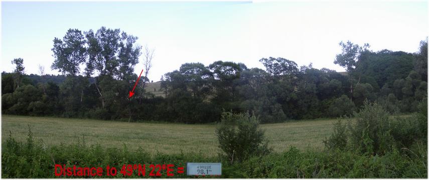
(visited by Hans Augdoppler and Klaus Baumgartner) 20-Jun-2002 -- This CP stands for jungle and horse flies.
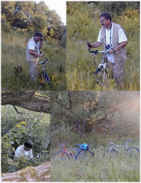
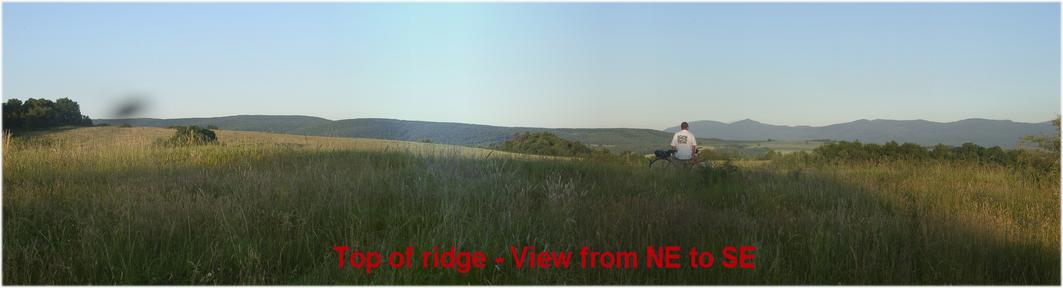
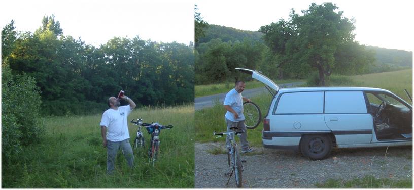
Our maps promised an easy access to this CP near the road and a creek. We left Vyšný Hrušov towards the North. We crossed the indicated creek and the GPS-indication fell below 100 m Crossing the ditch seemed possible, the grain, however, already was in an advanced maturity stage. Therefore wading through the creek from the bridge was an alternative. Unfortunately, we could see not even the water in spite of the dense vegetation, so this was -- without machete impossible. The slope opposite seemed suitable to us as an entrance and a path was shown in the map. Back in the direction of the Vyšný Hrušov and this field path was there. After we had assembled our bicycles we pedalled up the grassy track. This path led across the hill comb to the woods located behind it. We could see the road, the grain field and the creek towards the west but no way led down. The meadow seems to lie fallow and little bushes already grow into it. We decided to let the bicycles run down directly in the direction of the CP. Finally we could locate to the CP within a larger group of trees on the creek shore. Also here our presence had already got round and we were swarmed round by stable flies. We couldn't recognize any way in the direction of the road which runs less than 100 m to the west from here. We were always accompanied by the horseflies while we were forced to push our bicycles up the hill trough the high grass. Downhill, on the way back to the car, Klaus had a flat tyre and landed finally in the grass. Thank God he didn't hurt himself. After about 50 km of journey he missed his wrist-watch. This probably had been lost at his accident. It was too late to turn around, and so we decided to return in the next morning to look for the watch. Despite an intensive search we could not find it anymore. This loss lowered our excitement about the successes. Map in pic#7 © MapPoint Europe http://www.microsoft.com For more information see: http://linz.orf.at/gast/augdoppl/Confluence/Main.htm |
| All pictures |
| #1: Confluence seen from the ridge towards NW #2: Confluence from road (NE) behind the brook & trees #3: CP localization process #4: Confluence area seen from the North #5: The way back – landscape towards Vyšný Hrušov (East) #6: Klaus - at CP with watch – back at the car without watch #7: GPS reading & maps ALL: All pictures on one page |