|

Italy : Piemonte
4.5 km (2.8 miles) NE of Macugnaga, Verbano-Cusio-Ossola, Piemonte, Italy
Approx. altitude: 2541 m
(8336 ft)
([?] maps: Google MapQuest OpenStreetMap ConfluenceNavigator)
Antipode: 46°S 172°W
Accuracy: 15 m (49 ft)
Quality: good
Click on any of the images for the full-sized picture.


![]()
")
| 46°N 8°E (visit #2) |
![Visit #5: [21-Aug-22]](/it/all/n46e008v5/preview.jpg "Visit #5: [21-Aug-22]")
![Visit #4: [15-Oct-11]](/it/all/n46e008v4/preview.jpg "Visit #4: [15-Oct-11]")
![Visit #3: [13-Sep-09]](/it/all/n46e008v3/preview.jpg "Visit #3: [13-Sep-09]")
![Visit #1: [18-May-02]](/it/all/n46e008/preview.jpg "Visit #1: [18-May-02]")

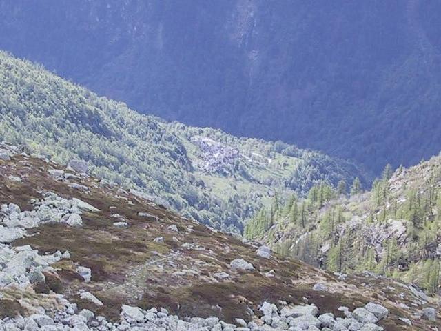
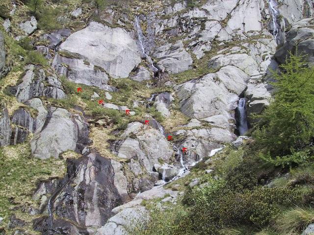
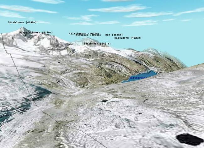
(visited by Martin Emch) 25-May-2002 -- Ever wanted to know what two tiny sheep do above 2500 m (8200 feet)? Just refer to picture 6. For anything more please keep on reading. For reaching this confluence you should be an early bird and well equipped. Friday evening I drove by motorbike the 5 hours to Mondelli village (see picture 3), where I slept a few hairpin bends below in the forest. The official road from the valley at Campioli up to Mondelli village is broken because of a landslide, so they built a very steep road straight up through the forest to bypass it. A local guy assured me that I don't have to bother about the prohibition of the road. Saturday early I woke up and put all sleeping stuff in the motorbike cases, drove up to the central parking lot of Mondelli village, and started walking at 5:40 am. The first signpost after Mondelli village announced me 4.45 hours of walking to Mondelli Pass (see picture 5), so the walk to the confluence should be some time less. Just after Mondelli village the track starts rising steep because it had to change 1400 m (4600 feet) in altitude on 4.9 km (3 miles) in distance. Upward I lost the track several times because it was not fully daylight at this time. It doesn't matter except at the height of around 1600 m (5250 feet). The track follows here a small river to the right before it changes to the other side of the small river where there are some good steps made in the rock (see picture 4). I found this way downwards, upwards I climbed over several big rocks where I sometimes only had some tufts of grass to hold myself. This could have been dangerous in case the grass was wet. On the whole trip there was no other dangerous part. From a height of 2210 m (7250 feet) on there was still snow up to the confluence, so I put my new snowshoes on and kept on walking. From now on the arrow on the GPS showed me the direction to the point where I took several pictures. I was really in doubt taking the maybe 45 minutes up to Mondelli Pass where you could have a great view into Switzerland's area of the biggest mountains (see picture 7). Because of being alone and the weather's changing I decided to go back :( The whole walk tooks me straight 6 hours (3:40 upwards and 2:20 backwards). After changing clothes at Mondelli village I started driving back home. |
| All pictures |
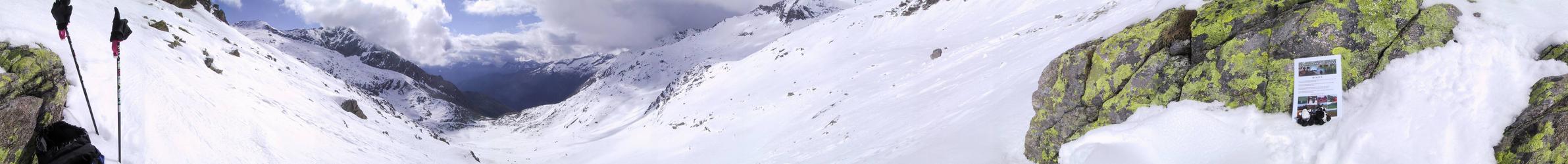
| #1: Mondelli Pass and confluence from southeast #2: My GPS12 shows 46N 8E #3: Mondelli Village where the confluence belongs to #4: Follow these arrows #5: Way to confluence is one hour less #6: Soren and Sisqo enjoying the landscape #7: View from Mondelli Pass into Switzerland (rendered from Orthophoto and DOM by Flytastic) ALL: All pictures on one page |
| Notes |
|
Altitude source: SRTM 90m digital elevation data. |