
| { Main | Search | Countries | Information | Member Page } | |
Ross Finlayson's confluences |
| Finlayson, Ross | homepage | |
| This Visitor does not have any Plans. | View confluence map | |
| 777 visits (648 unique) in 27 countries: | 777 active, 0 pending, 0 submitting | |
| 699 successful (593 unique): | 672 primary, 27 secondary | |
| 78 incomplete (77 unique): | 75 primary, 3 secondary | |
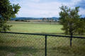
 | 43°N 86°W 3.0 miles (4.8 km) NW of Allendale, Ottawa, MI, USA [31-Jul-07] |
 | 44°N 86°W 10.0 miles (16.2 km) NW of Baldwin, Lake, MI, USA [31-Jul-07] |
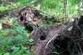
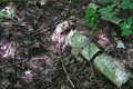
 | 46°N 84°W 4.7 miles (7.5 km) W of De Tour Village, Chippewa, MI, USA [incomplete] [30-Jul-07] |
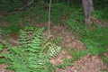
 | 46°N 85°W 8.1 miles (13.0 km) W of Moran, Mackinac, MI, USA [incomplete] [30-Jul-07] |
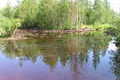
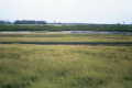
 | 46°N 86°W 0.8 miles (1.2 km) NE of Gulliver, Schoolcraft, MI, USA [30-Jul-07] |
 | 46°N 89°W 6.2 miles (9.9 km) SE of Phelps, Vilas, WI, USA [28-Jul-07] |
 | 45°N 89°W 2.1 miles (3.3 km) E of Mattoon, Shawano, WI, USA [28-Jul-07] |
 | 45°N 88°W 4.1 miles (6.5 km) NE of Lena, Oconto, WI, USA [28-Jul-07] |
 | 43°N 88°W 1.2 miles (1.9 km) SSE of West Allis, Milwaukee, WI, USA [27-Jul-07] |
 | 43°N 89°W 0.8 miles (1.3 km) SW of Lake Ripley, Jefferson, WI, USA [27-Jul-07] |
 | 42°N 89°W 4.0 miles (6.4 km) SSE of Lindenwood, Ogle, IL, USA [27-Jul-07] |
 | 42°N 88°W 1.5 miles (2.5 km) W of Elk Grove Village, Cook, IL, USA [27-Jul-07] |
 | 49°N 15°E 1.9 km (1.2 miles) N of Josefsthal, Niederösterreich, Austria [26-Mar-07] |
 | 50°N 15°E 1.2 km (0.7 miles) E of Kouřim, Středočeský Kraj, Czech Republic [26-Mar-07] |
 | 49°N 14°E 1.9 km (1.2 miles) S of Prachatice, Jihočeský Kraj, Czech Republic [secondary] [25-Mar-07] |
 | 50°N 13°E 4.0 km (2.5 miles) ESE of Prachomety, Karlovarský Kraj, Czech Republic [24-Mar-07] |
 | 50°N 14°E near Nižbor, Středočeský Kraj, Czech Republic [secondary] [23-Mar-07] |
 | 36°S 174°E 6.3 km (3.9 miles) ENE of Mititai, Northland, N. Island, NZ [16-Feb-07] |
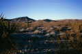
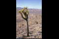
 | 37°N 117°W 14.7 miles (23.7 km) WNW of Beatty, Nye, NV, USA [20-Nov-06] |
 | 38°N 117°W 13.4 miles (21.6 km) ESE of Tonopah, Nye, NV, USA [20-Nov-06] |
 | 38°N 118°W 6.7 miles (10.8 km) WSW of Coaldale, Esmeralda, NV, USA [19-Nov-06] |
 | 33°N 117°W 3.3 miles (5.3 km) NE of Poway, San Diego, CA, USA [09-Nov-06] |
 | 43°N 122°W 10.4 miles (16.7 km) SW of Diamond Lake Junction, Klamath, OR, USA [31-Aug-06] |
 | 44°N 124°W 5.1 miles (8.2 km) ENE of Florence, Lane, OR, USA [28-Aug-06] |
 | 43°N 124°W 7.4 miles (11.9 km) E of Broadbent, Coos, OR, USA [28-Aug-06] |
 | 39°N 121°W 0.4 miles (0.6 km) E of Applegate, Placer, CA, USA [06-Jul-06] |
 | 39°N 119°W 8.8 miles (14.2 km) E of Yerington, Lyon, NV, USA [05-Jul-06] |
 | 39°N 118°W 10.0 miles (16.1 km) NW of Gabbs, Nye, NV, USA [05-Jul-06] |
 | 39°N 114°W 5.0 miles (8.1 km) NNE of Garrison, Millard, UT, USA [04-Jul-06] |
 | 40°N 112°W 2.9 miles (4.8 km) NW of Elberta, Utah, UT, USA [04-Jul-06] |
 | 41°N 113°W 15.1 miles (24.3 km) NNW of Low (Tooele), Box Elder, UT, USA [30-Jun-06] |
 | 41°N 114°W 18.2 miles (29.3 km) N of Wendover (Tooele), Box Elder, UT, USA [30-Jun-06] |
 | 41°N 115°W 7.9 miles (12.7 km) SSW of Wells, Elko, NV, USA [30-Jun-06] |
 | 41°N 118°W 14.0 miles (22.5 km) W of Winnemucca, Humboldt, NV, USA [29-Jun-06] |
 | 40°N 119°W 22.2 miles (35.8 km) NE of Nixon (Washoe), Pershing, NV, USA [29-Jun-06] |
 | 32°N 98°W 2.3 miles (3.7 km) NE of Hico, Hamilton, TX, USA [incomplete] [23-Mar-06] |
 | 33°N 97°W 3.2 miles (5.1 km) S of Lewisville, Denton, TX, USA [21-Mar-06] |
 | 17°S 146°E 7.5 km (4.7 miles) S of Fitzroy Island (Island), QLD, Australia [incomplete] [18-Aug-05] |
 | 35°N 119°W 2.9 miles (4.7 km) W of Wheeler Ridge, Kern, CA, USA [28-Dec-02] |
 | 34°N 118°W 2.4 miles (3.9 km) NE of Whittier, Los Angeles, CA, USA [26-Dec-02] |
 | 38°N 122°W 2.3 miles (3.7 km) NE of Concord, Contra Costa, CA, USA [04-Aug-01] |
 | 23°N 110°W 2.5 km (1.6 miles) NW of Ciruelo, Baja Calif. Sur, Mexico [incomplete] [03-Jan-01] |
 | 24°N 110°W 11.3 km (7.0 miles) NE of Los Planes, Baja Calif. Sur, Mexico [02-Jan-01] |
 | 38°N 80°W 3.2 miles (5.2 km) SE of Trainer, Greenbrier, WV, USA [06-Aug-00] |
 | 38°N 81°W 2.2 miles (3.5 km) E of Cunard, Fayette, WV, USA [incomplete] [05-Aug-00] |
 | 40°N 80°W 0.2 miles (0.3 km) SW of Fredericktown, Washington, PA, USA [04-Aug-00] |
 | 39°N 80°W 3.9 miles (6.2 km) WSW of Belington, Barbour, WV, USA [incomplete] [04-Aug-00] |
 | 36°N 121°W 5.6 miles (9.0 km) W of San Ardo, Monterey, CA, USA [13-May-00] |
 | 20°S 148°E 18.4 km (11.4 miles) ESE of Guthalungra, QLD, Australia [incomplete] [10-Apr-00] |
 | 21°S 149°E 4.0 km (2.5 miles) SE of Mount Jukes, QLD, Australia [incomplete] [10-Apr-00] |
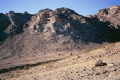
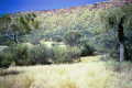 | 23°S 134°E 78.5 km (48.7 miles) N of Alice Springs, NT, Australia [07-Apr-00] |
 | 36°S 137°E 2.6 km (1.6 miles) W of Stun'sail Boom, Kangaroo Island, SA, Australia [02-Apr-00] |
 | 35°S 139°E 5.3 km (3.3 miles) E of Brukunga, SA, Australia [01-Apr-00] |
 | 34°S 138°E 3.1 km (1.9 miles) SSW of Ninnes, SA, Australia [incomplete] [31-Mar-00] |
 | 35°S 137°E 11.2 km (7.0 miles) SW of Corny Point, SA, Australia [31-Mar-00] |
 | 26°S 153°E 2.9 km (1.8 miles) NW of Cooloola, QLD, Australia [24-Mar-00] |
 | 27°S 153°E 5.5 km (3.4 miles) ENE of Elimbah, QLD, Australia [24-Mar-00] |
 | 28°S 153°E 1.5 km (0.9 miles) SSE of Beaudesert, QLD, Australia [incomplete] [23-Mar-00] |
 | 35°N 118°W 10.5 miles (16.9 km) ESE of Mojave, Kern, CA, USA [02-Jan-00] |
 | 35°N 117°W 7.3 miles (11.8 km) N of Barstow, San Bernardino, CA, USA [02-Jan-00] |
 | 36°N 120°W 2.4 miles (3.9 km) W of Kettleman City, Kings, CA, USA [02-Jan-00] |
 | 36°N 119°W 4.6 miles (7.5 km) SSE of Porterville, Tulare, CA, USA [02-Jan-00] |
 | 36°N 116°W 15.4 miles (24.8 km) E of Shoshone, Inyo, CA, USA [01-Jan-00] |
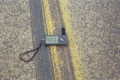
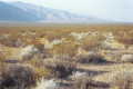
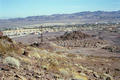
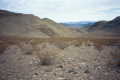 | 36°N 117°W 32.8 miles (52.8 km) SW of Death Valley, Inyo, CA, USA [31-Dec-99] |
 | 36°N 115°W 2.3 miles (3.7 km) S of Henderson, Clark, NV, USA [30-Dec-99] |
 | 35°N 115°W 23.0 miles (37.0 km) NNE of Essex, San Bernardino, CA, USA [29-Dec-99] |
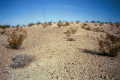 | 34°N 114°W 4.7 miles (7.5 km) N of Bouse, La Paz, AZ, USA [29-Dec-99] |
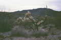 | 32°N 113°W 27.0 miles (43.5 km) SSW of Ajo, Pima, AZ, USA [28-Dec-99] |
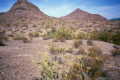 | 33°N 113°W 26.3 miles (42.4 km) SW of Arlington, Maricopa, AZ, USA [28-Dec-99] |
 | 34°N 116°W 10.0 miles (16.1 km) SSE of Twentynine Palms (San Bernardino), Riverside, CA, USA [27-Dec-99] |
 | 34°N 115°W 30.6 miles (49.2 km) NE of Desert Center, Riverside, CA, USA [incomplete] [27-Dec-99] |
 | 34°N 117°W 3.7 miles (5.9 km) E of Calimesa, Riverside, CA, USA [26-Dec-99] |
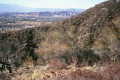
 | 37°N 122°W 2.3 miles (3.7 km) NE of Santa Cruz, Santa Cruz, CA, USA [20-Nov-99] |
 | 39°N 77°W 1.3 miles (2.0 km) NW of Langley Park (Prince George's), Montgomery, MD, USA [03-Nov-99] |
 | 38°N 121°W 4.9 miles (7.9 km) ESE of Linden, San Joaquin, CA, USA [29-Oct-99] |
 | 37°N 121°W 9.2 miles (14.8 km) WSW of Los Banos, Merced, CA, USA [22-Oct-99] |
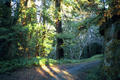
 | 37°N 119°W 10.5 miles (16.9 km) SE of Dinkey Creek, Fresno, CA, USA [22-Oct-99] |