
| { Main | Search | Countries | Information | Member Page } | |
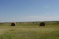
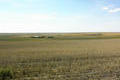
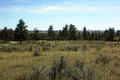
Confluence Visit List (#1 - #25) |
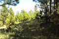
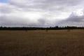
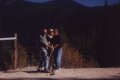 | 47°N 114°W 5.8 miles (9.3 km) SSE of Evaro, Missoula, MT, USA [incomplete] [28-Sep-99] |
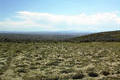
 | 47°N 112°W 5.4 miles (8.7 km) SSW of Craig, Lewis and Clark, MT, USA [22-Jun-00] |
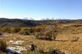
 | 46°N 113°W 9.1 miles (14.6 km) SSW of Anaconda, Deer Lodge, MT, USA [20-Jan-01] |
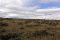
 | 46°N 111°W 10.9 miles (17.5 km) SE of Maudlow, Gallatin, MT, USA [20-May-01] |
 | 46°N 112°W 9.9 miles (15.9 km) NNW of Cardwell, Jefferson, MT, USA [28-May-01] |
 | 48°N 114°W 2.3 miles (3.8 km) E of Woods Bay, Lake, MT, USA [28-Jun-01] |
 | 48°N 110°W 23.7 miles (38.2 km) ENE of Loma, Chouteau, MT, USA [08-Jul-01] |
 | 48°N 115°W 17.2 miles (27.7 km) WSW of Marion (Flathead), Sanders, MT, USA [07-Aug-01] |
 | 48°N 112°W 7.7 miles (12.4 km) WSW of Brady (Pondera), Teton, MT, USA [09-Aug-01] |
 | 46°N 109°W 9.0 miles (14.4 km) SW of Broadview (Yellowstone), Stillwater, MT, USA [03-Sep-01] |
 | 47°N 115°W 13.1 miles (21.1 km) SW of Riverbend, Mineral, MT, USA [incomplete] [07-Sep-01] |
 | 46°N 108°W 2.4 miles (3.8 km) WNW of Pompeys Pillar, Yellowstone, MT, USA [09-Sep-01] |
 | 46°N 107°W 19.3 miles (31.1 km) NW of Colstrip (Rosebud), Treasure, MT, USA [09-Sep-01] |
 | 45°N 109°W 9.8 miles (15.8 km) S of Belfry, Carbon, MT, USA [16-Sep-01] |
 | 45°N 113°W 3.4 miles (5.5 km) ESE of Grant, Beaverhead, MT, USA [incomplete] [13-Oct-01] |
 | 46°N 110°W 7.4 miles (11.9 km) SSW of Melville, Sweet Grass, MT, USA [15-Oct-01] |
 | 47°N 108°W 4.5 miles (7.2 km) S of Cat Creek, Petroleum, MT, USA [20-Oct-01] |
 | 47°N 109°W 4.7 miles (7.6 km) E of Forestgrove, Fergus, MT, USA [20-Oct-01] |
 | 47°N 110°W 5.5 miles (8.9 km) SW of Moccasin, Judith Basin, MT, USA [20-Oct-01] |
 | 45°N 107°W 6.8 miles (10.9 km) W of Decker, Big Horn, MT, USA [21-Oct-01] |
 | 47°N 113°W 6.4 miles (10.4 km) E of Ovando, Powell, MT, USA [27-Oct-01] |
 | 46°N 106°W 18.8 miles (30.3 km) NW of Volborg, Custer, MT, USA [27-Apr-02] |
 | 47°N 105°W 12.7 miles (20.5 km) NNE of Fallon (Prairie), Dawson, MT, USA [28-Apr-02] |
 | 45°N 112°W 20.4 miles (32.8 km) S of Virginia City, Madison, MT, USA [19-May-02] |
 | 45°N 106°W 17.4 miles (28.0 km) SE of Otter, Powder River, MT, USA [incomplete] [22-May-02] |