
| { Main | Search | Countries | Information | Member Page } | |
Confluence Visit List (#1 - #15) |
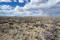
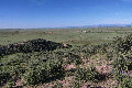
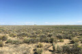
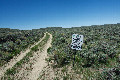 | 42°N 109°W 16.4 miles (26.4 km) N of Superior, Sweetwater, WY, USA [incomplete] [22-Jun-22] |
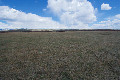
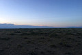
 | 41°N 110°W 5.8 miles (9.4 km) WSW of McKinnon, Sweetwater, WY, USA [21-Jun-22] |
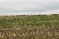
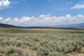
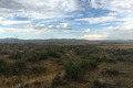
 | 42°N 105°W 4.5 miles (7.2 km) SSW of Wheatland, Platte, WY, USA [01-Aug-21] |
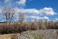
 | 42°N 106°W 12.8 miles (20.5 km) NE of Medicine Bow (Carbon), Albany, WY, USA [01-Aug-21] |
 | 42°N 110°W 3.2 miles (5.2 km) ENE of Fontenelle (Lincoln), Sweetwater, WY, USA [18-May-21] |
 | 43°N 110°W 4.3 miles (6.9 km) NNW of Cora, Sublette, WY, USA [18-May-21] |
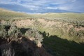
 | 44°N 109°W 12.6 miles (20.2 km) SSW of Meeteetse, Park, WY, USA [incomplete] [13-May-21] |
 | 42°N 105°W 4.5 miles (7.2 km) SSW of Wheatland, Platte, WY, USA [02-Mar-21] |
 | 41°N 105°W 7.2 miles (11.5 km) SSE of Granite, Laramie, WY, USA [23-Feb-21] |
 | 45°N 110°W 0.7 miles (1.1 km) SW of Silver Gate (MT), Park, WY, USA [02-Nov-20] |
 | 41°N 106°W 4.0 miles (6.5 km) S of Jelm, Albany, WY, USA [13-Jul-19] |
 | 42°N 111°W 4.3 miles (6.9 km) S of Taylor, Lincoln, WY, USA [08-Aug-18] |
 | 42°N 110°W 3.2 miles (5.2 km) ENE of Fontenelle (Lincoln), Sweetwater, WY, USA [08-Aug-18] |
 | 42°N 108°W 22.6 miles (36.3 km) N of Wamsutter, Sweetwater, WY, USA [08-Aug-18] |
 | 42°N 107°W 15.5 miles (25.0 km) N of Fort Steele, Carbon, WY, USA [08-Aug-18] |