|

South Africa : Limpopo
1.8 km (1.1 miles) S of Edwinsdale, Limpopo, South Africa
Approx. altitude: 906 m
(2972 ft)
([?] maps: Google MapQuest OpenStreetMap ConfluenceNavigator)
Antipode: 23°N 151°W
Accuracy: 4 m (13 ft)
Quality: good
Click on any of the images for the full-sized picture.


| 23°S 29°E (visit #1) |
![Visit #2: [25-Jan-05]](/za/all/s23e029v2/preview.jpg "Visit #2: [25-Jan-05]")

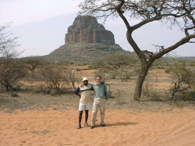
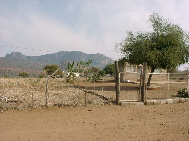
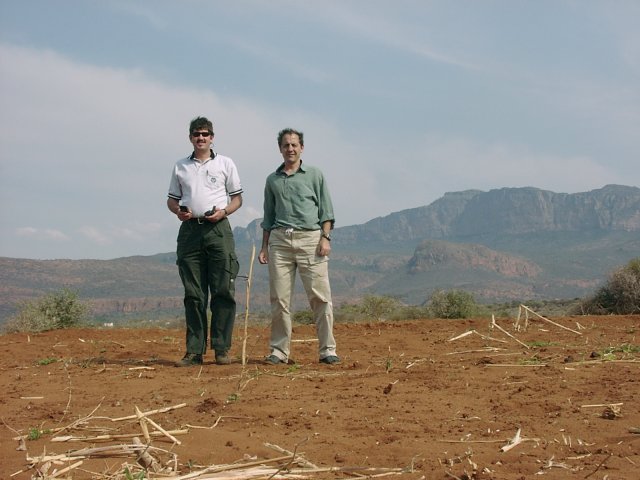
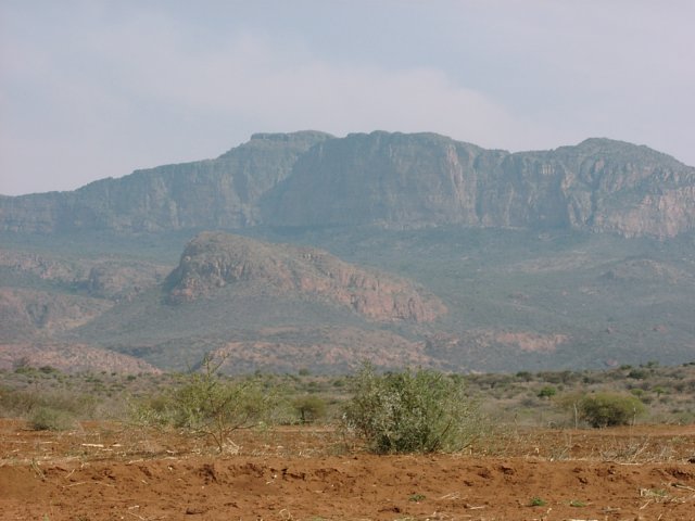
(visited by Hendrik van Eeden and Ferdi Schenck) 28-Aug-2002 -- My friend Ferdi Schenk's wife Rinie had to visit a few social workers in the Limpopo Province (previously Northern Province) as part of a research project. She needed to go to Bochum and Blouberg. This gave Ferdi and me the perfect excuse to go and try and reach the Confluence at 23S 29E near the Scottish sounding village of Glenferness north of the Blouberg ("Blue Mountain"). In addition this would give me another chance at finding an access route to Thabananthlana, a hidden rock tower on a plateau that is only clearly visible to the south from the top of Blouberg. I had been trying to find an access route to this tower for about twenty years, since I first saw it while climbing and hiking on Blouberg. I have never been able to find anybody who had been there or who knew how to get there. A previous serious effort to reach it from the South a few months ago had also ended in a dead end. We left Pretoria at five in the morning and drove the nearly 400 km to Bochum, where we dropped Rienie off for her first interviews. Here we left the tar and started searching for a way to Thabananthlana. At a shop in the village of Millbank we asked around, but had difficulty explaining to the local North Sotho people exactly what we were looking for. Then Charles Mashilo turned up. He spoke good English and offered to show us around. We were told that there are paths up the mountain, but it seemed that it would be a day's hike to get to Thabananthlana and that we would need the permission of the local Induna. While driving to see a beautiful stream running out of the mountain, we caught a glimpse of Thabananthlana. When Charles realised that it was that what we were really after, he said that you could actually reach it by car, and offered to show us the way. A sandy track around the western side of the plateau eventually led to the fulfilment of a 20 year quest. Now all that remains is to go back and climb it. In the meantime Rienie had finished her first interviews, so we had to drive back to Bochum to take her to Blouberg hospital. At one o'clock Ferdi and I could leave on the second part of our adventure - the Confluence at 23S 29E on the other side of the mountain about 90 kilometres away. This we eventually reached at half past two, after asking directions a few times. The Confluence lies just north of the Blouberg in a fallow mealie field just north of Glenferness. We could drive to within 350 metres, and then had an easy walk along a footpath to the Confluence itself. From the Confluence one has a beautiful view of the famous Blouberg North Face, the highest quartzite cliff in South Africa (nearly 500 m) and a popular climbing place for serious climbers. The mountain itself is avoided by the local people, as they consider it a "place of great miracles" inhabited by evil spirits, amongst others a big snake or a spirit of a puffadder. By now we were late, as we had promised to pick Rienie up at three o'clock. When we asked a man at the local shop for the shortest route back to Blouberg Hospital, we were told that we were terribly lost. Our explanation that we actually knew exactly where we were (to the nearest three metres) was just met by a wry smile. However, we got very good instructions and got to Blouberg by four o'clock. We picked Rienie up and headed home, which we reached after covering 1000 km and driving virtually non-stop for fifteen hours. |
| All pictures |
| #1: General view of the area #2: View North #3: View East #4: View South #5: View West #6: GPS screens #7: Charles and me at Thabananthlana #8: The village of Glenferness #9: Ferdi and me at Confluence #10: Blouberg North Face ALL: All pictures on one page |