|

China : Húběi Shěng
4.5 km (2.8 miles) SSW of Baiguo, Húběi, China
Approx. altitude: 64 m
(209 ft)
([?] maps: Google MapQuest OpenStreetMap ConfluenceNavigator)
Antipode: 31°S 65°W
Accuracy: 5 m (16 ft)
Quality: good
Click on any of the images for the full-sized picture.


| 31°N 115°E (visit #1) |
![Visit #2: [11-Aug-05]](/cn/all/n31e115v2/preview.jpg "Visit #2: [11-Aug-05]")
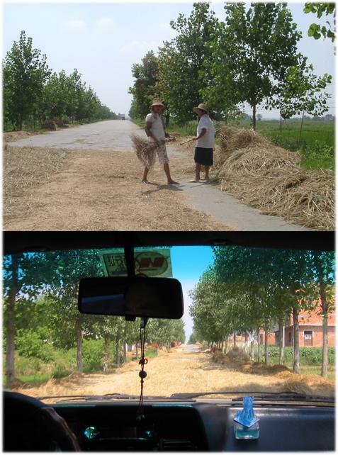
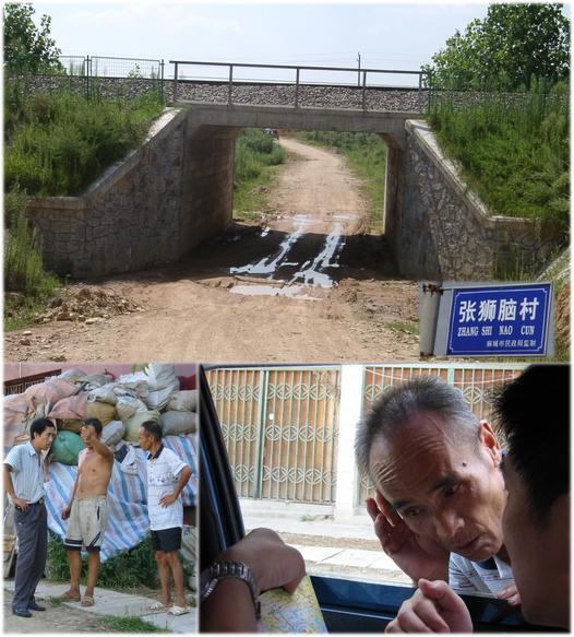
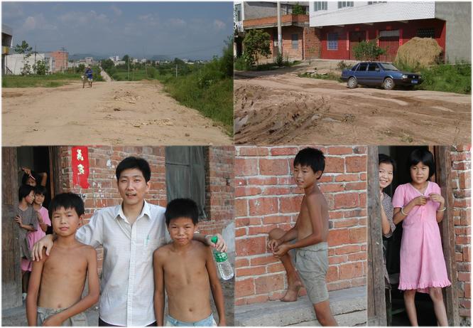
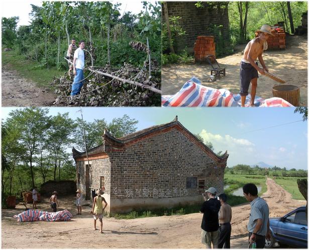
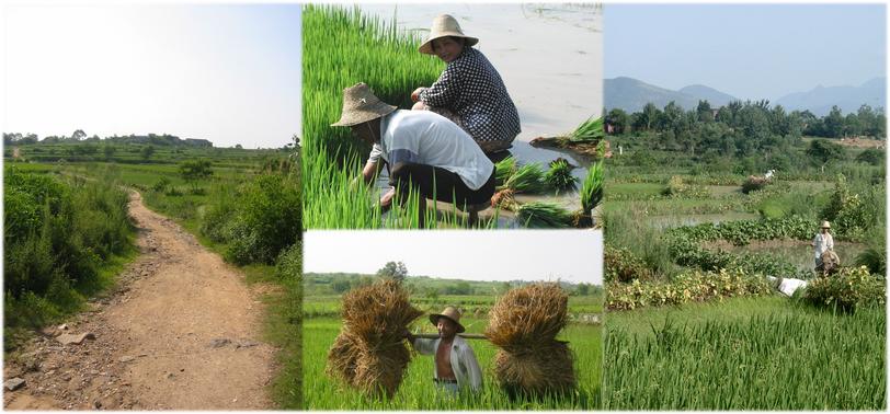
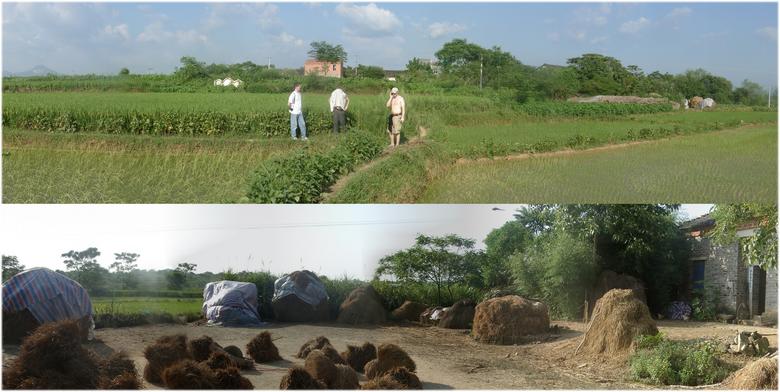
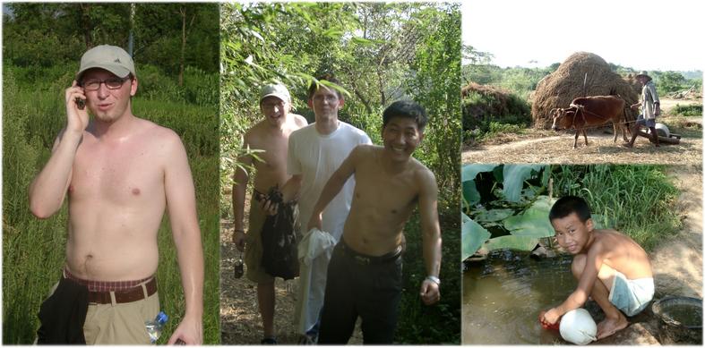
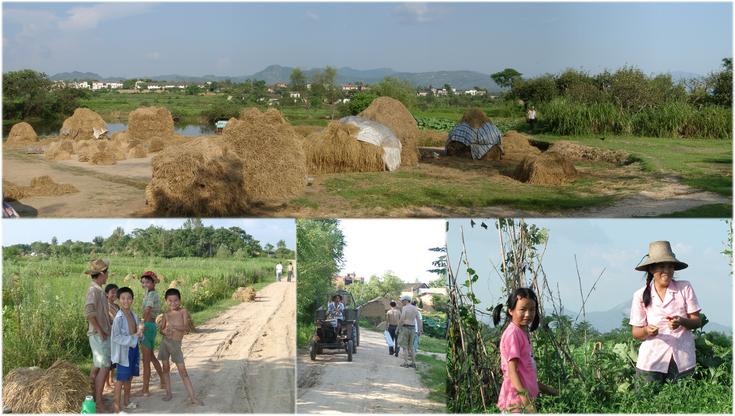
 (visited by Hans Augdoppler, Helmut Wahl, Jürgen Meisel and Bi Wei Fan) 04-Aug-2002 -- From our visit to Finally we had to use an untarred secondary road. Despite questioning some passers-by we were not able to find a direct access to the CP. So we had to go via BAI GUO ZHEN, a city about 5 km to the north. Local inhabitants directed us towards the east, to a vacation resort at a dam. The natives probably assumed that it can be the only aim for tourists. Back to BAI GUO ZHEN we found a promising road towards the south. Because of the miserable conditions of the town streets we had to relief the car from our weight and had the chance to get contact to children. We crossed the 31st degree in a distance of almost 2 km. Then we tried to approach the CP via a dirt track. This way seems not to see many cars so far. We had to clear a tree off the way and our effort ended in a small village for the time being. According to our inquiries there should be an access route north of the 31st degree. Shortly before we returned to the main road we found this road. Considering the condition of this track we decided to park the car and to walk further on. We passed a vast amount of paddy-fields. Seeding and harvesting were in progress, even on this Sunday. Completely drenched in sweat we reached the confluence point behind the second village, GANG LIN CUN, with freshly sedate plants in a little paddy-field. We took our pictures and Jürgen’s new digital camera stopped working, probably due to the high humidity. The farmers were so busy with their rice harvest that they didn’t pay attention to our unusual activity. On our way back through this very densely populated area we could admire peasants who carry out their work in this heat and humidity. Even children worked on the field. On our hike to and from the CP we met many villagers who surprisingly did not point at us as ‘Lau Wai’ as much as they do in WUHAN. Apart from the harsh climatic conditions it was a very pleasant and interesting visit. |
| All pictures |
| #1: Confluence in rice field with lotus leaf indication, north view #2: Rice threshing along the country roads #3: Dirt roads & asking local people for the way #4: Access roads to BAI GUO ZHEN & Children in this town #5: Searching for access; clearing roads; life in village nearby #6: Walking to west; farming impressions along this way #7: Hunters at the CP, marking & GPS reading #8: Village GANG LIN CUN from west, rice straw piles #9: Report; jungle like path; impression from the village GANG LIN CUN #10: From a nearby the village to EAST, local residents ALL: All pictures on one page |