|

United States : Washington
6.0 miles (9.7 km) SSE of Carbonado, Pierce, WA, USA
Approx. altitude: 480 m
(1574 ft)
([?] maps: Google MapQuest OpenStreetMap topo aerial ConfluenceNavigator)
Antipode: 47°S 58°E
Accuracy: 12 m (39 ft)
Quality: good
Click on any of the images for the full-sized picture.


| 47°N 122°W (visit #2) |
![Visit #7: [27-May-16]](/us/wa/n47w122v7/preview.jpg "Visit #7: [27-May-16]")
![Visit #6: [18-Aug-13]](/us/wa/n47w122v6/preview.jpg "Visit #6: [18-Aug-13]")
![Visit #4: [14-Mar-10]](/us/wa/n47w122v4/preview.jpg "Visit #4: [14-Mar-10]")
![Visit #5: [13-Mar-10]](/us/wa/n47w122v5/preview.jpg "Visit #5: [13-Mar-10]")
![Visit #3: [16-Apr-07]](/us/wa/n47w122v3/preview.jpg "Visit #3: [16-Apr-07]")
![Visit #1: [10-Oct-99]](/us/wa/n47w122/preview.jpg "Visit #1: [10-Oct-99]")

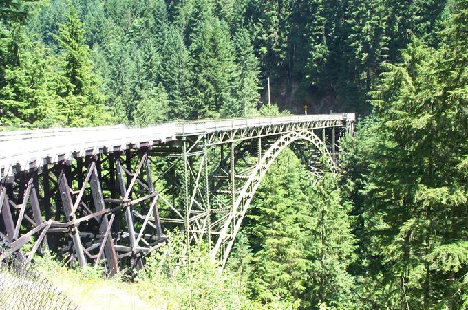
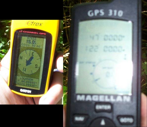
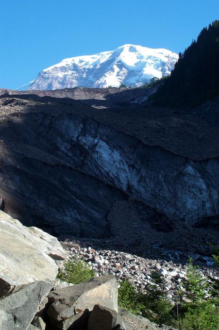
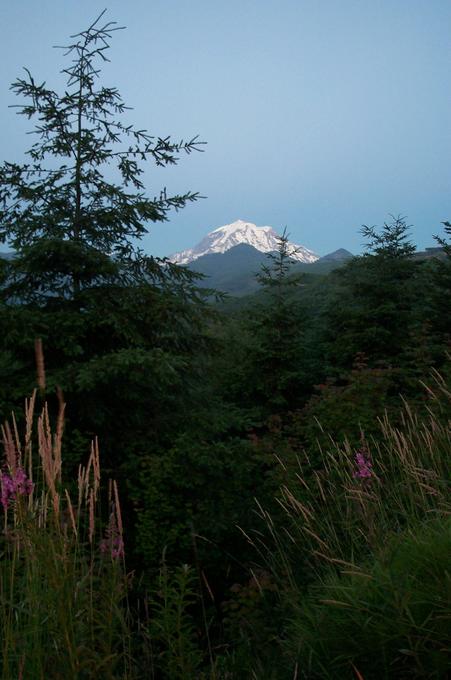
(visited by Eric C. Lincoln, Randall Splinter, Michelle Lincoln, Elaine Splinter and Raymond O. Splinter) 15-Jul-2002 -- After reading the narrative for the previous visit, we realized that we couldn't be sure he had actually gotten within 100 meters, and that it hadn't been visited since Selective Availability was turned off in the GPS system. Therefore, we decided to visit this confluence on a daytrip to Mount Rainier. We followed Route 165 (which leads to the Lake Mowich entrace to the park), crossing the beautiful Fairfax Bridge, and bearing left at the fork with the road variously known as Carbon River Road, Carbon Glacier Road, and Fairfax Forest Reserve Road. Our maps made it clear that the confluence was closer to the main road than to the partly-private Manley Moore Road, so we stayed on the main road and found a parking spot about 0.4 miles past the closest approach. We walked back to the closest approach (less than 400 feet South of the confluence), and then lunged into the forest. We did a bit of wandering, finally finding a spot where we could get a reading from our Garmin GPS -- it indicated that we had wandered about 163 feet too far north. Fortunately, we had a compass -- reception was far too spotty to use the GPS to navigate. Just past where we paced off the distance, we found a small clearing. Climbing up on the trunk of a fallen aspen over the brambles allowed us to finally get a reading with the Garmin -- after it settled down, we got a distance of 15 feet, with an accuracy of 24 feet! After clambering back down from the aspen, we thought to check our Magellan -- to our amazement, it was tracking even under the forest canopy. A bit of wandering delivered the desired zeroes. The Magellan doesn't photograph as well -- the screen has too much glare. However, we were able to get a shot that was roughly legible. After we got back to the car, we continued down the Carbon River Road to the park entrance. At the end of the road, we took the Carbon Glacier trail (about 3.5 miles each way) up to the lowest glacier in the 48 contiguous states. Beautiful hike the whole way, with a fascinating view of the mountain peak over the glacier at the end. On the way back out, we found a good view of the mountain only 2.5 miles from the confluence. |
| All pictures |
| #1: The confluence -- in the woods #2: Fairfax Bridge on the way #3: Finally got a close GPS reading.... We then got all zeroes with the other GPS! #4: Elaine at the confluence #5: The rest of us at the confluence -- note the DCP tee-shirt! #6: You can almost see the sky from the confluence #7: The mountain rises above the top of Carbon Glacier #8: Mount Rainier, viewed from 2.5 miles W of the confluence ALL: All pictures on one page |