|

United Kingdom : Scotland
4.2 km (2.6 miles) NNW of Amhuinnsuidhe, Lewis (Island), Western Isles, Scotland, United Kingdom
Approx. altitude: 365 m
(1197 ft)
([?] maps: Google MapQuest OpenStreetMap ConfluenceNavigator)
Antipode: 58°S 173°E
Accuracy: 5 m (16 ft)
Quality: good
Click on any of the images for the full-sized picture.


| 58°N 7°W (visit #1) |
![Visit #5: [04-Aug-17]](/uk/sc/n58w007v5/preview.jpg "Visit #5: [04-Aug-17]")
![Visit #4: [19-Mar-13]](/uk/sc/n58w007v4/preview.jpg "Visit #4: [19-Mar-13]")
![Visit #3: [02-May-08]](/uk/sc/n58w007v3/preview.jpg "Visit #3: [02-May-08]")
![Visit #2: [05-Jul-02]](/uk/sc/n58w007v2/preview.jpg "Visit #2: [05-Jul-02]")

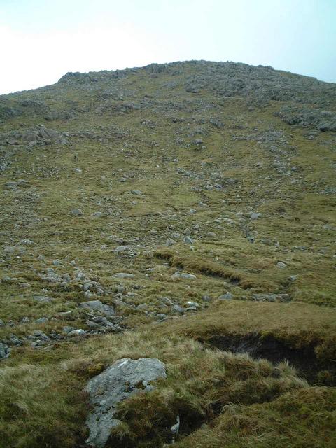
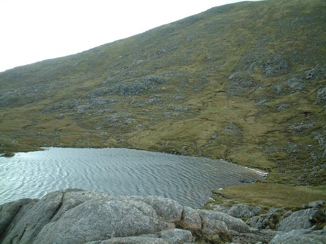
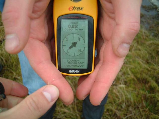
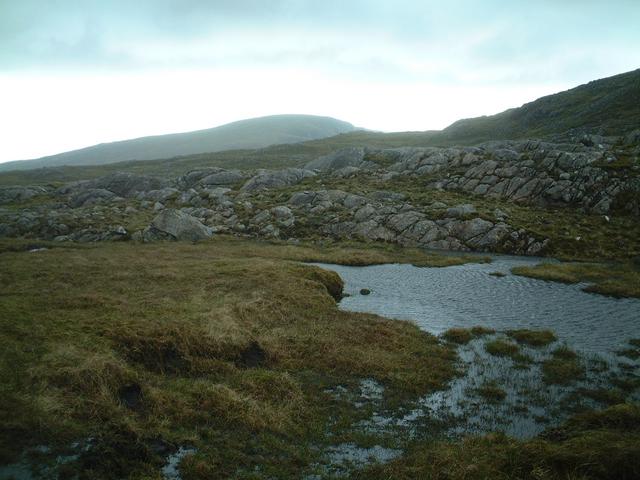
(visited by kevin watt and John Hall) 20-May-2002 -- This confluence is located on the Outer Hebrides of Scotland. One of the hidden beauty spots of Scotland that most tourists (and some natives) sadly never visit. Harris and Lewis are actually two islands connected by a narrow strip of land. Harris is the name given to the Southern Island and also the southern part of the North Island. Still with me? The rest of the Northern Island is called Lewis. I think that’s correct. The location was given a higher profile in 2000 with the BBC documentary Castaway, when a group of volunteers were marooned on the uninhabited island of Taransay, which lies off Harris, to form a community, and become minor celebs, over a period of a year. We left at 8:00am to catch a ferry from Uig, a small ferry port in the North of the Isle of Skye. The 90 min ferry crossing took us to Tarbert in Harris. After 5 hours and a few hundred miles travelling on motorways and behind tourists in mobile homes, the final approach from Tarbert was mostly on single track roads behind sheep, lots of sheep. I’m convinced there are more sheep on the roads of Harris than there are cars. We left the car 3 miles from the confluence and set off for the spot. Despite the fact that this was to be my eighth confluence I was still naïve to believe that I could have faith in everything I saw on the Ordnance Survey map. I’d programmed the GPS to allow us to follow the paths on the OS map for the first 2 miles of the final approach. Unfortunately the first path through the peat bogs was just that, peat bogs, and no path. We followed a more direct route for a mile and eventually discovered some of the route marked on the map. Once we were on the final 1-mile climb to the confluence, the terrain altered to a more stable surface of metamorphic rock known as Lewissian Gneiss, typical of some of the Western Isles of Scotland. We arrived at the confluence, at a height of 370 metres beside Loch Braigh Bheagarais. The point looks up at Tiorga Mor, at 679m the highest spot on Harris. As with most other confluences I’ve reached, there’s usually impending rain or wind (or both). So we did the necessary stuff a reading and a view and set off downhill again. The round trip of about 6 miles walking took more or less 3 hours and at this time of year waterproof gear is thoroughly recommended. If you have the time, which we didn’t, I’m sure the extra climb of 300m up Tiogra Mor would be worthwhile for better views. I’ve included a couple of other photographs, which, although not from the immediate surroundings of the confluence, do typify Harris itself. I can’t put into words how stunning some of the sights are, so just look at the photos. Wonderful beaches and a clear blue sea. Add a sunlamp and shelter from the 100mph winds and you could be in the Caribbean, well almost. |
| All pictures |
| #1: a view from the confluence #2: halfway up the hill #3: rocks typical of the area #4: Loch Braigh Bheagarais #5: the GPS reading #6: a beach view with Taransay in the background #7: just another beach.....and sheep ALL: All pictures on one page |