|

New Zealand : South Island
14.9 km (9.3 miles) S of Kowhitirangi, West Coast, S. Island, NZ
Approx. altitude: 109 m
(357 ft)
([?] maps: Google MapQuest OpenStreetMap ConfluenceNavigator)
Antipode: 43°N 9°W
Accuracy: 10 m (32 ft)
Quality: good
Click on any of the images for the full-sized picture.


| 43°S 171°E (visit #1) |
![Visit #3: [01-Mar-20]](/nz/all/s43e171v3/preview.jpg "Visit #3: [01-Mar-20]")
![Visit #4: [11-Feb-20]](/nz/all/s43e171v4/preview.jpg "Visit #4: [11-Feb-20]")
![Visit #2: [20-Feb-15]](/nz/all/s43e171v2/preview.jpg "Visit #2: [20-Feb-15]")

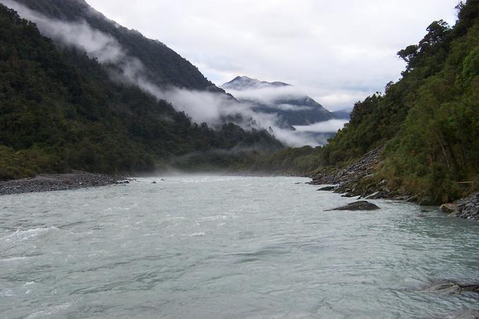
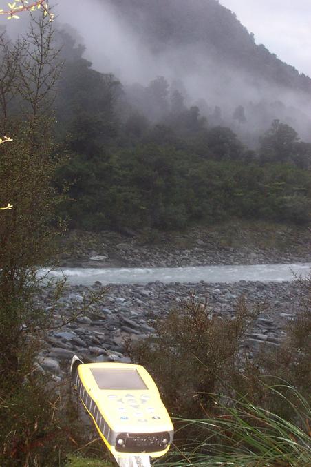
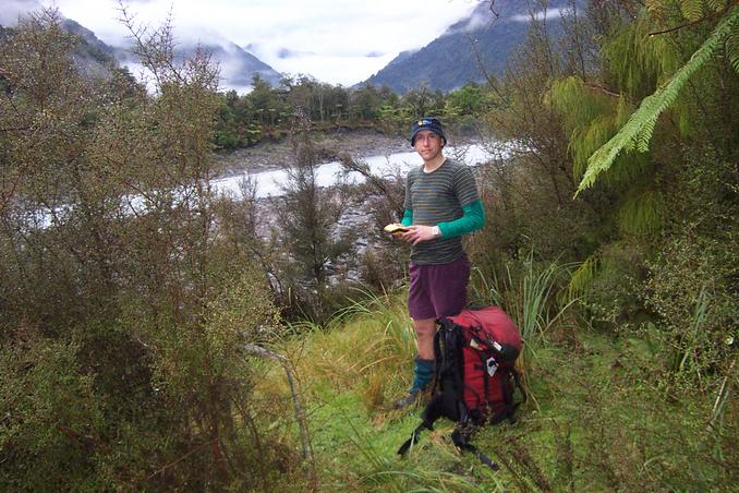
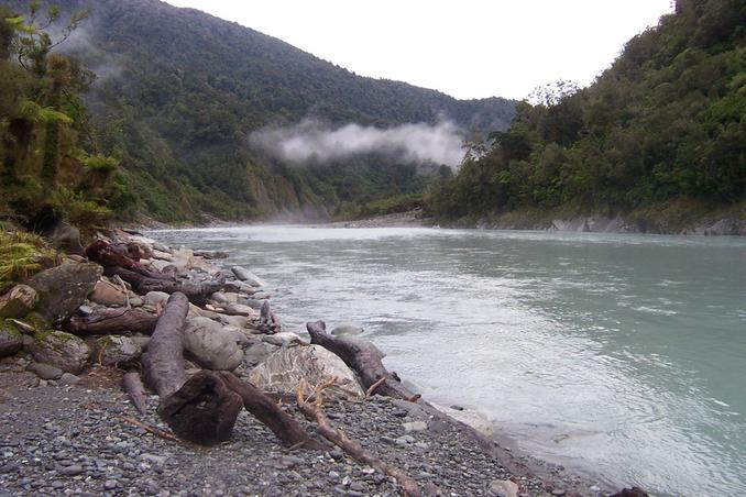
(visited by Bruce James) 26-Apr-2002 -- Visiting this confluence appealed to me as it was very close to a tramping trip I had planned to do in the area. It is located on the West Coast of New Zealand’s South Island, in the mighty Hokitika River. A road takes you to the Hokitika Gorge, from where a 6km walk, up-river, is required to get you to the confluence. The main track is on the true-right of the river and anyone who chooses to go this way will in fact come within 150 m of the confluence. However, the confluence is actually on the other side of the river, which makes getting there a little more challenging. I chose the cross the river using the footbridge at the gorge and proceeded down the true-left. (Another, perhaps easier, option would have been to go via the main track to a crossing near Rapid Creek hut and then backtrack from there about 2 km.) A rough track leads, as far as Minnow Creek. Then for the next kilometre, you do your best to follow rough bits of track and avoid the supple-jacks, which can really make it tough going. A broken down gate near the river-bank indicates the start of a easy grassy track which takes you the next kilometre to the locked cable-way and the river/weather monitoring station where there are excellent camping sites. After that, it is possible to avoid the bush and travel the final couple of kilometres in the river-bed. On the afternoon I started out it had been raining steadily for much of the day and so the river was flowing fairly high, which slowed travel a little. As I was running out of daylight and it was still raining, I decided to camp about a kilometer from the confluence, expecting better light and weather the next day. Photo #2 shows the view from about a kilometre away, approaching from the north. The river sweeps to the left around a small point on which the confluence is located. Conveniently, it was about here that I found a bent, aluminium pole in the riverbed, which I picked up and decided to use as a “flag-pole” to mark the confluence. On arriving I set about determining the precise location and discovered it was up on the grassy bank. The Trimble GeoExplorer3, that I’d borrowed from work, was used to pin-point the location. The “flag-pole” was erected and several photos taken. Photo #1, is facing east and shows the view from the bank, towards the river. Photo #3, is facing south and shows the view looking further up the river. The river continues up to the confluence with the Whitcombe River, another major West Coast river, which continues on up to the main divide at Whitcombe Pass, about 25 km directly South from where I was. Immediately to the west is nothing but thick, West Coast bush. Photo #4 is facing north-west and shows the direction I came from and is taken several metres away from the confluence to get a better view. For those who might want to stay, the confluence offers a couple of reasonable campsites. Also, if you want to approach from the Rapid Creek hut end, from what I could see, it would not be too difficult to travel around the river that way. My return trip was the same way back to Minnow Creek, from where I continued my tramping trip for the next two days, in fabulous weather, over Murray Saddle, and returning to the Hokitika Gorge, via Doctor Creek. |
| All pictures |
| #1: Facing East #2: Approaching from the North #3: Facing South #4: Facing North-west #5: GPS ALL: All pictures on one page |