|

United Kingdom : Scotland
3.8 km (2.4 miles) SSE of Knockan, Highland, Scotland, United Kingdom
Approx. altitude: 434 m
(1423 ft)
([?] maps: Google MapQuest OpenStreetMap ConfluenceNavigator)
Antipode: 58°S 175°E
Accuracy: 5 m (16 ft)
Quality: good
Click on any of the images for the full-sized picture.


| 58°N 5°W (visit #1) | (secondary) |
![Visit #5: [31-Dec-19]](/uk/sc/n58w005v5/preview.jpg "Visit #5: [31-Dec-19]")
![Visit #4: [10-Jun-08]](/uk/sc/n58w005v4/preview.jpg "Visit #4: [10-Jun-08]")
![Visit #3: [29-Aug-06]](/uk/sc/n58w005v3/preview.jpg "Visit #3: [29-Aug-06]")
![Visit #2: [02-Sep-03]](/uk/sc/n58w005v2/preview.jpg "Visit #2: [02-Sep-03]")
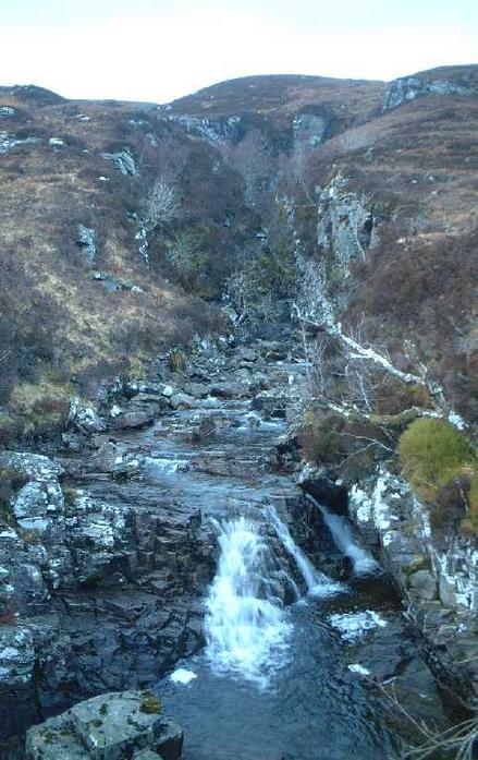
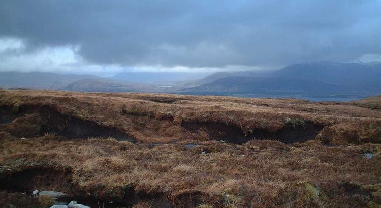
 (visited by kevin watt and John Hall) 25-Mar-2002 -- As a person with non-driving abilities, (i.e. I can’t drive) my previous confluence visits have been in areas accessible by train or bike, or a combination of both. I had planned this confluence for a while but it involved trains, buses, cycling and walking. A three-day trip at the best. So when you discover someone who has the same bizarre desire to visit confluence points……………and who has a big car!! Well you go for it, don’t you? We set off for Ullapool on a diet of the Beach Boys and spinach, cheese and tomato sandwiches (thanks for the sandwiches Bea!). We had planned to stay overnight and try the confluence the next morning, but thanks to some excellent driving by John, (isn’t G-force an amazing sensation?) we reached Ullapool earlier than expected and decided to visit the area around the confluence to get a better idea of what was ahead. A few miles from the point we asked if it was OK to park the car on a nearby farm. “No problem” said the farmer. “Where are you going?” I showed him the map. When he asked why, I just told him we were going to bury a dead body. He seemed OK about that. It’s easier than trying to explain why you would want to visit a confluence isn’t it? We took the bikes as far as we could up the track; it’s about a 200m climb over 3km. It led us to the waterfall where we planned to leave them and start the walk. We were doing well, time was on our side and there were still a few hours of daylight left, so we thought we might as well have a crack at the confluence sooner rather than later. We changed into walking gear and set off up into the boggy hills. The final part was roughly another 250m climb over about 3km of wet ground. I think it took about an hour to reach the point, it’s a wee bit of a steep climb to begin with and then a walk over the peak to the confluence. It wasn’t the clearest of days, but the views were still amazing. The north view looks over to Loch Urigill. No sooner had we taken the readings, photos etc. than the heavens opened up and we were pelted by hailstones. I would recommend this as a confluence with a bit of challenge and with great views. It can be walked all the way from the main road, about 7km at the most. The overall climb is over 400m and waterproof boots would be advisable. |
| All pictures |
| #1: Looking North to Loch Urigill #2: up the hill #3: the waterfall #4: the reading #5: facing east #6: south view #7: west view #8: strange people ALL: All pictures on one page |