|

Saudi Arabia : al-Riyād
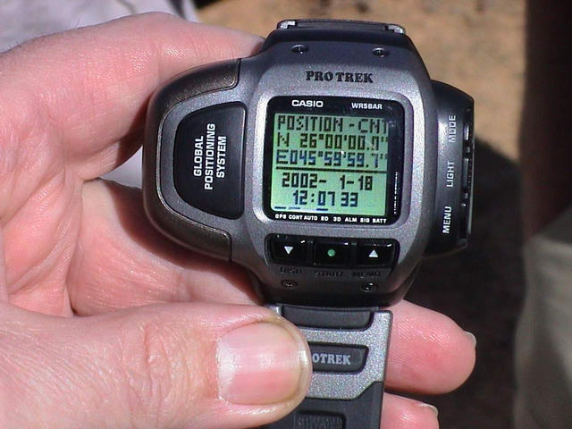
13.3 km (8.3 miles) NE of Ash Shi`b, al-Riyād, Saudi Arabia
Approx. altitude: 665 m
(2181 ft)
([?] maps: Google MapQuest OpenStreetMap ConfluenceNavigator)
Antipode: 26°S 134°W
Accuracy: 10 m (32 ft)
Quality: good
Click on any of the images for the full-sized picture.


| 26°N 46°E (visit #1) |
![Visit #2: [07-Feb-02]](/sa/all/n26e046v2/preview.jpg "Visit #2: [07-Feb-02]")

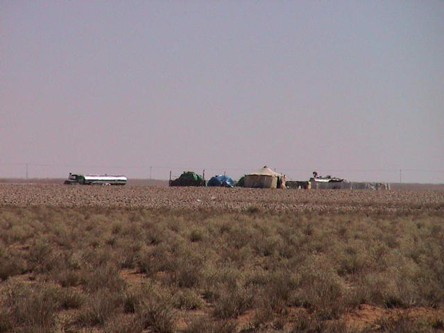
(visited by Gerhard Henrich, Ugur Tayli, Murat Tayli, Petra Angermeir, Andreas Angermeir, Elfi Loew, Helmut Loew, Trudi Fritz, Joerg Fritz, Elisabeth Henrich, Edith Gosewinkel, Udo Gosewinkel and Stèfan Spissu) 18-Jan-2002 -- New year, new challenges. We resumed our excursions and after gathering at the King Sa`ūd University we went out of Riyāḍ in direction of Northwest. The Confluence we were looking for is 26N 46E. Like most of the year, it was a bright and sunny day and the temperature was very convenient, about 20° C. One should know that winter in Saudi Arabia is equivalent to summer in Europe and summer here is next to hell. The Confluence is about 200 kilometres north-northwest and we followed the highway to Burayda. Half the way up we headed to the north and passed the towns of Tumayr and al-Mubayad. It is a nice road heading there and especially Tumayr is a town with lots of rest areas along the main road, well done and inviting for a picnic. There is an ancient centre remaining of old mud buildings surrounded by palm trees. After Tumayr the area becomes very flat until al-Mubayad where the road leads into a beautiful wādī flanked by sandstone escarpments, an ideal place to search for fossils and mineral rocks. We took the opportunity on the way back and found some interesting species such as rock gypsum, molluscs and bivalves. Because of the escarpment we had some doubt to reach the Confluence but after we passed that valley and after a steep way up, we entered another plain and luckily the Confluence was after all easy to reach. Right between a Bedouin camp and their flock of sheep we arrived and took our mandatory documentation. After that we looked for a convenient picnic area and after that we searched for the fossils as mentioned above. It is to be mentioned that we took a guest with us on our trip, Stéfan Spissu from Zürich, Switzerland. He was very impressed about the action and our weekend activities. Anyhow, I guess confluence points in Switzerland are quite more difficult to visit and there are much less points to go. |
| All pictures |
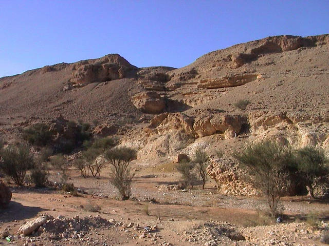
| #1: View to the west #2: Confluence reading #3: Our group in front of a herd of sheep #4: Typical Bedouin camp #5: Wādī 10 km west of the confluence point #6: Old check-point at the entrance of the valley ALL: All pictures on one page |