|

Saudi Arabia : al-Riyād
50.4 km (31.3 miles) NNW of Rumāh, al-Riyād, Saudi Arabia
Approx. altitude: 537 m
(1761 ft)
([?] maps: Google MapQuest OpenStreetMap ConfluenceNavigator)
Antipode: 26°S 133°W
Accuracy: 35 m (114 ft)
Quality: good
Click on any of the images for the full-sized picture.


| 26°N 47°E (visit #1) |
![Visit #2: [21-Feb-08]](/sa/all/n26e047v2/preview.jpg "Visit #2: [21-Feb-08]")
![Visit #3: [29-Aug-08]](/sa/all/n26e047v3/preview.jpg "Visit #3: [29-Aug-08]")

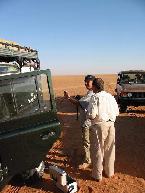
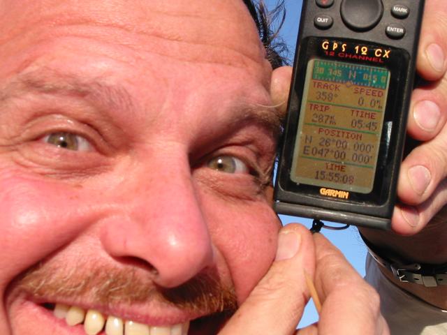
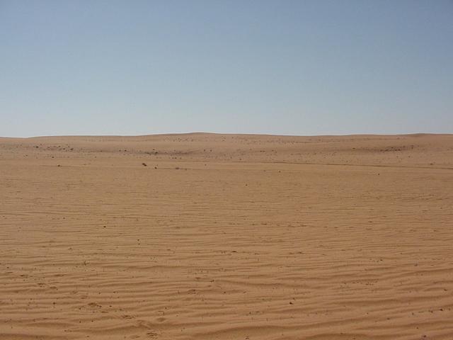
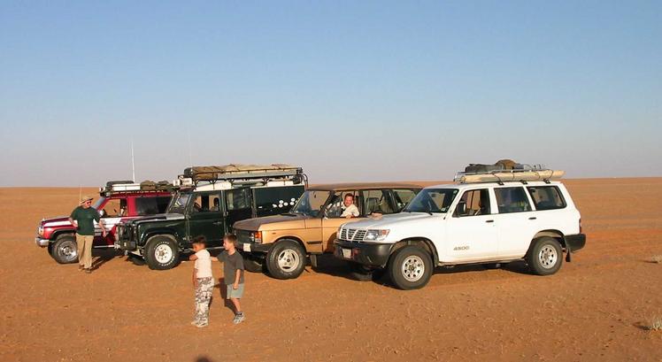
(visited by Alistair Rausch, Zander Rausch, Olaf Carl, Stevie Carl, Bruno Schorr and Andy Neal) 16-Nov-2001 -- We were going to be a party of ten vehicles heading out to the Star Dunes (a cluster of exceptional dune formations to the North of Riyāḍ). I was looking forward to the trip as my first attempt to get to the Star Dunes last year was thwarted by a vehicle break down. Alas, it was not to be. Due to various reasons, the over subscribed trip had dwindled to a mere three vehicles. So Olaf, our well-prepared leader resorted to plan "B". This was to head for the Northern Banban dunes (less dangerous and only 60 km from Riyāḍ) for a spot of sand driving, meet up with Andy (a late comer) and then camp with another party who would be spending the night in the dunes. The "spot of sand driving" was good fun, Bruno nearly rolled his new toy, Andy found us at the pre-arranged meeting point, we found an acceptable campsite, and the other party finally located us. One of the newcomers, Cindy the German Shepherd dog, was vying with the boys, Stevie and Zander, for the "most exhausted" award by charging around in the sand. The group settled down for an evening of BBQ and chit-chat, sheltered from the chilly night breeze. A casual morning culminated with a few attempts to change a wheel on a vehicle that was parked on a slight sideward incline. This proved fruitless as the vehicle kept sliding off the jack. Lesson - Beware; even the slightest of inclines can cause the jack to slew in the sand. The party split up during the mid-morning. The overnighters headed off back to Riyāḍ, while us explorers mulled over what to do with the rest of the day. Olaf suggested that we visit a degree confluence point. "What's that," we asked. Olaf educated us on the Degree Confluence Project and we readily agreed to visit the nearest point - the 26N 47E degree confluence. We headed for hard ground and inflated our tyres. We then headed NE along the tar road towards al-Ṣummān for about 100 km, and then drove East into the sand towards the Confluence. The driving was pretty easy in the sand between the dune lines. But, crossing the dune lines proved a little more challenging because some of us decided not to deflate our tyres. In any event, no one got stuck and we managed to reach the Confluence by mid afternoon. Arriving at the Confluence, we struggled to get a photograph of the GPS reading exactly 26 00.0000N 47 00.0000E as the reading would waver slightly, even when we were stationary. We finally managed it, though. This degree confluence is positioned in the middle of a belt of sand dunes called the Dahnā’ Dunes, which runs for hundreds of kilometres SE from the Great Nafūd desert in the North of Saudia Arabia, to the Rub` al-Khāliy desert (Empty Quarter) in the South-East. At this particular point in the Dahnā’ Dunes, the dune lines are not very high and they are separated by sandy valleys which are a few kilometres wide. The actual degree confluence was in the middle of one of these valleys, so it was very easy to find. We took a few photographs of the area, then headed south along the sand plains and finally met the tar road 15 km north of Rumāḥ. We re-inflated our tyres at dusk and we completed the remaining 150 km back to Riyāḍ by 7:30 pm. After the initial disappointment of not being able to go to the Star Dunes, this trip turned into a very pleasant jaunt. It combined a fair deal of sand driving with the satisfaction of being led into a previously unknown area. |
| All pictures |
| #1: The confluence was situated in a wide sandy valley between lines of low sand dunes. #2: One of the lines of low dunes that we encountered on route. #3: The winners of the "most exhausted" award #4: Our "Adventure Guide". #5: A reluctant photographic subject with the flat sandy plain in the background #6: A car line up at the site. ALL: All pictures on one page |