|

United States : Connecticut
1.6 miles (2.6 km) WSW of West Hartland, Hartford, CT, USA
Approx. altitude: 326 m
(1069 ft)
([?] maps: Google MapQuest OpenStreetMap topo aerial ConfluenceNavigator)
Antipode: 42°S 107°E
Accuracy: 35 m (114 ft)
Quality: good
Click on any of the images for the full-sized picture.


| 42°N 73°W (visit #2) |
![Visit #8: [17-Feb-10]](/us/ct/n42w073v8/preview.jpg "Visit #8: [17-Feb-10]")
![Visit #7: [27-May-07]](/us/ct/n42w073v7/preview.jpg "Visit #7: [27-May-07]")
![Visit #6: [10-Mar-07]](/us/ct/n42w073v6/preview.jpg "Visit #6: [10-Mar-07]")
![Visit #5: [04-Nov-06]](/us/ct/n42w073v5/preview.jpg "Visit #5: [04-Nov-06]")
![Visit #4: [30-Sep-06]](/us/ct/n42w073v4/preview.jpg "Visit #4: [30-Sep-06]")
![Visit #1: [14-Jun-98]](/us/ct/n42w073/preview.jpg "Visit #1: [14-Jun-98]")
![Visit #3: [16-Apr-06]](/us/ct/n42w073v3/preview.jpg "Visit #3: [16-Apr-06]")

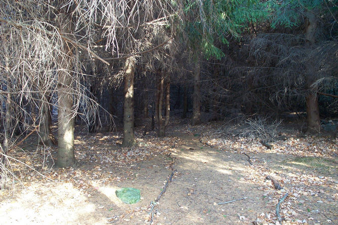
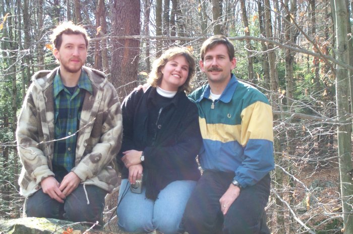
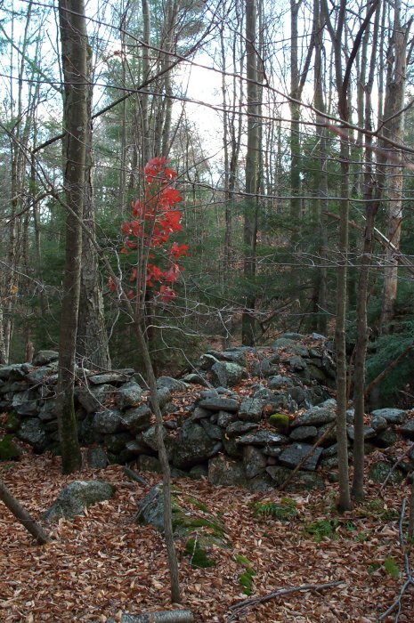
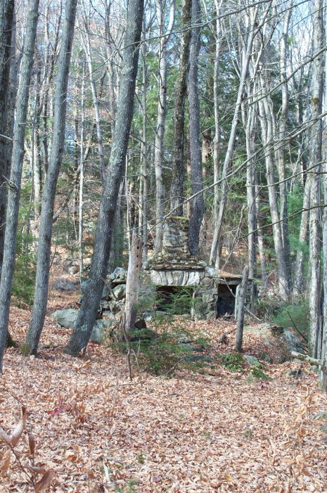
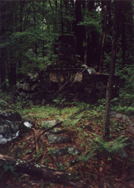
(visited by Alex Jarrett, Eric C. Lincoln and Michelle Lincoln) 12-Nov-2001 -- When Eric (European coordinator) had to go to Connecticut for a business trip, he figured he ought to look up Alex (originator of the confluence project) for a tour of the facilities of Confluence Headquarters. And if you're going to the Headquarters, surely you need to visit a confluence. Michelle (official trip photographer) came along. After due deliberation, 42°N 73°W was chosen. Alex had visited it several years ago when Selective Availability was still turned on, and it was due for a revisit. We drove 45.9 miles through interstate, small towns and around a mountainous reservoir. Ears were popping. When we reached the corner of Hogback Rd and Mill St, the GPS indicated that we should drive no further. We entered the dark forest (photo #6) and wound our way along a path lined with sticks. "Maybe this trail leads right to the confluence," Alex suggested. "Maybe it's a trap!" We stumbled through a low scrub of Rhododendrons, crested a hill and came to a rocky dale (photos #1-4). Nearby was a large granite boulder, where we all posed (photo #8). The previous visit to this confluence found the point slightly to the south. A confluence of stone walls was just to the south - could it be that the stone wall builders knew of the significance of their location? (Photo #9) Photo #10 shows the old fireplace, which corresponds to photo #2 of the first visit. We left the forest by heading west from the confluence, a much easier trip than our journey from the north. |
| All pictures |
| #1: North #2: East #3: South #4: West #5: GPS #6: The path into the dark forest #7: Alex on the granite boulder #8: Alex, Michelle and Eric at the top of the boulder #9: The stone wall confluence #10: The old stone fireplace ALL: All pictures on one page |