|

United States : California
9.2 miles (14.8 km) WSW of Los Banos, Merced, CA, USA
Approx. altitude: 182 m
(597 ft)
([?] maps: Google MapQuest OpenStreetMap topo aerial ConfluenceNavigator)
Antipode: 37°S 59°E
Accuracy: 5 m (16 ft)
Quality: good
Click on any of the images for the full-sized picture.


| 37°N 121°W (visit #2) |
![Visit #10: [29-Oct-17]](/us/ca/n37w121v10/preview.jpg "Visit #10: [29-Oct-17]")
![Visit #9: [03-Jun-09]](/us/ca/n37w121v9/preview.jpg "Visit #9: [03-Jun-09]")
![Visit #8: [07-May-06]](/us/ca/n37w121v8/preview.jpg "Visit #8: [07-May-06]")
![Visit #7: [06-Jul-05]](/us/ca/n37w121v7/preview.jpg "Visit #7: [06-Jul-05]")
![Visit #6: [30-May-04]](/us/ca/n37w121v6/preview.jpg "Visit #6: [30-May-04]")
![Visit #5: [27-Apr-04]](/us/ca/n37w121v5/preview.jpg "Visit #5: [27-Apr-04]")
![Visit #4: [17-Jan-03]](/us/ca/n37w121v4/preview.jpg "Visit #4: [17-Jan-03]")
![Visit #3: [14-Mar-02]](/us/ca/n37w121v3/preview.jpg "Visit #3: [14-Mar-02]")
![Visit #1: [22-Oct-99]](/us/ca/n37w121/preview.jpg "Visit #1: [22-Oct-99]")

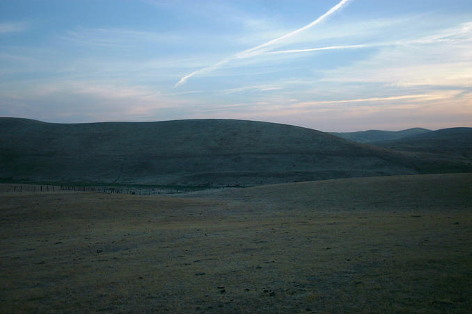
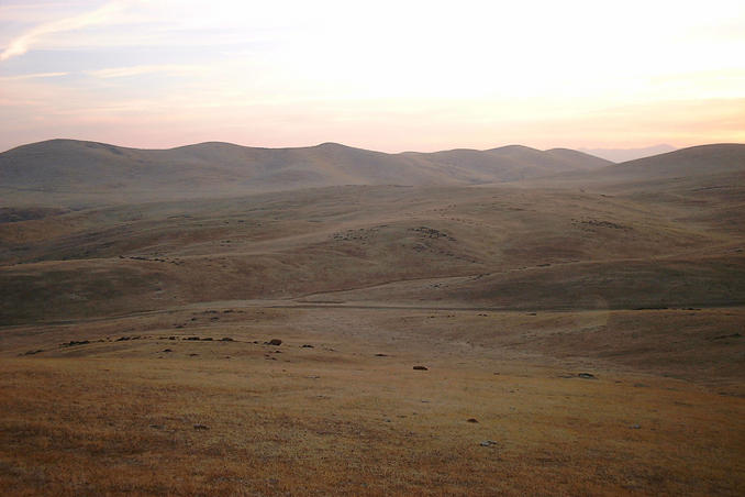
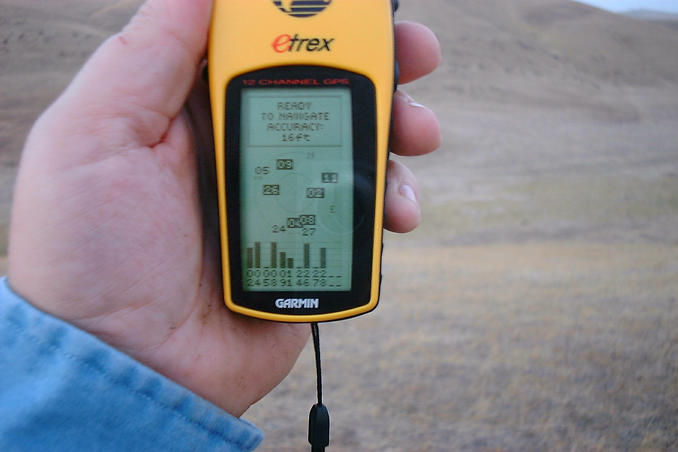
(visited by Gordon Spence) 08-Nov-2001 -- I am on a very short trip to California from the UK (3 days) and left at very short notice - notified Monday 9pm, flew Tuesday 1pm; things are not normally this hectic, honest. I managed to get the job finished by Thursday lunchtime and thoughts turned again to the Confluence project.... Off to the web and straight to the confluence.org web site. I have already done a visit to about 100 miles from home (53N 2W) and about 4300 miles from home (28N 82W) so why not 5500 miles from home. I brought up the map of California and checked the closest point to Sunnyvale where I am staying. Unfortunately the closest point had been revisited within the last couple of months, oh well, cast the net a bit wider. I soon found one that had last been visisted two years ago when SA was still in force. That was the one! 37N 121W. Off down 101S fighting through the traffic, I don't know how you guys put up with it, at 2pm in the afternoon? Anyhow down to Gilroy and turn onto 152E, up through the hills and then on to the glorious run down towards Los Banos, it is a fantastic piece of driving road and not a CHP in sight! I stopped off at Denny's in Los Banos for a late lunch with a colleague and asked the waitress if she knew where Pioneer Road was, "sure, my friend lives down that way". My colleague had to go on down to Fresno, so off I set by myself. Twenty minutes later and I am in the middle of nowhere when my path is blocked by a locked gate. Hmmmm. I got out and checked around very carefully, no indication of anything to suggest that it was "No Entry" or "No Trespassing"; I hadn't come this far to give up with less than a mile to go. Over the fence and off we go on foot. It became obvious that I was going to have to climb a few small hills. Well from the bottom it looked small, it felt like Everest when I got to the top, but in fact was only 587 feet. It was about a 45 degree slope though. Over the top, down the other side and two more smaller hills later. Got it! Not a lot to see though, this really is isolated. Took the N facing shot and then one of the GPS showing absolutely locked on and one of the accuracy - 5m After trekking back to the car, I see someone examining it. Turns out he is the land owner! I explained what I was doing and that it was a volunteer global project, and apologised for any inconvenience I may have caused. He said that it was OK and no harm was done, then wandered off slowly shaking his head - I could almost hear him thinking "crazy foreigners!" Another success, three down and counting.... |
| All pictures |
| #1: Not a lot to see here #2: Allaleno helped with directions #3: No further by car #4: It looks like a small hill #5: GPS locked on exactly #6: Accurate enough ALL: All pictures on one page |