W
NW
N
N
NE
W
the Degree Confluence Project
E
SW
S
S
SE
E

Iceland

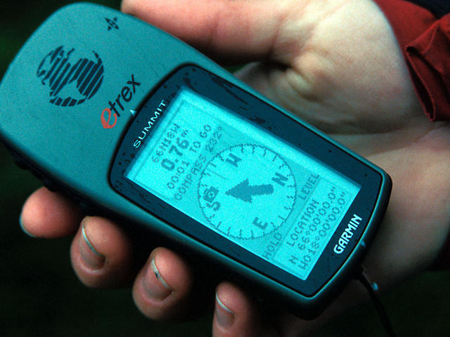
9.1 km (5.7 miles) NE of Höfðahverfi, Suður-Þingeyjarsýsla, Iceland
Approx. altitude: 558 m (1830 ft)
([?] maps: Google MapQuest OpenStreetMap ConfluenceNavigator)
Antipode: 66°S 162°E

Quality: good

Click on any of the images for the full-sized picture.

#2: GPS reading: We got to the exact location #3: Celebrating the confluence #4: Getting there... #5: home sweet home #6: Uuups. Don't camp there #7: neon-green mosses around the confluence

  { Main | Search | Countries | Information | Member Page | Random }

  66°N 18°W (visit #1)  

#1: A panoramic view centered northwards

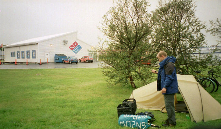
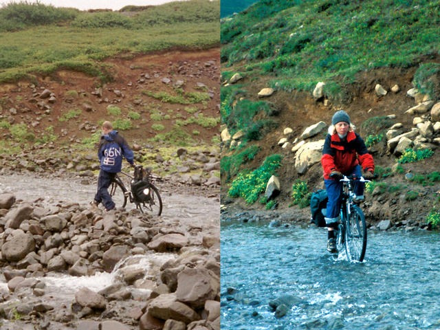
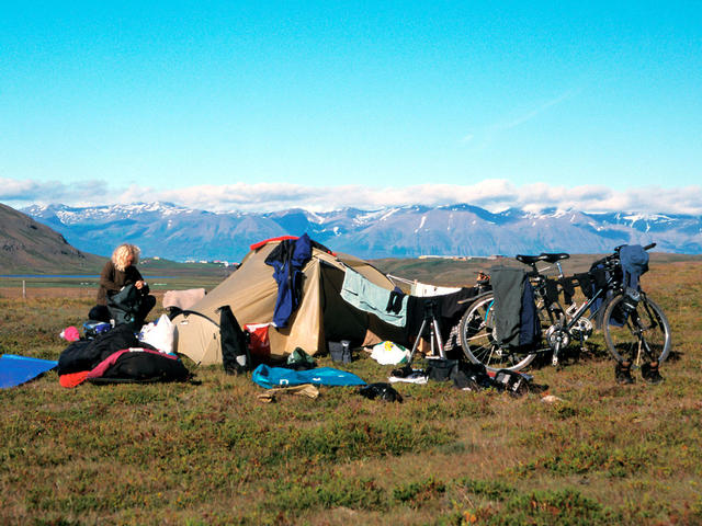
(visited by Eva Buehlmann and Reto Stöckli)

24-Aug-2001 -- After taking some pictures on confluence 66N 20W we couldn't wait to get this confluence. This plan involved crossing 2 degrees longitude along the 120 km long pass road from Saudarkrokur to Akureyri (despite heavy winds and rain in our faces). We arrived in Akureyri at 11 p.m. and stopped - tired like a sheep - at the first Pizza Take Away. Many thanks to Domino's Pizza, their too small fish pizzas do not really satisfy the stomaches of two hungry bikers, but still saved our lives. Sorry for putting up our tent right at the shop's backyard).

From Akureyri the confluence can be reached by following route 1 and 83 direction Grenivik, making a right turn around 4km before Grenivik (65°56'17.7"N / 18°07'11.1"W). If you follow the mud track (F839) and go on for around 10km you reach a bridge crossing the river (65°59'33.7"N / 18°03'50.3"W). This is in fact the only bridge in this valley and there are many more rivers to cross. We used our TEVA sandals to push our bikes through the glacier drainage water by feet or just took the risk of biking through the shallow water with enough speed (and getting out with wet hiking boots, but that's another story...).
The 3km long hike to the confluence from the bridge was very scenic, leading through snowfields, bright green colored mosses, lichens and cotton grass contrasting the black volcanic rock formations. We got to the exact location on 24th August 2001 after around 2 hours of biking and 1 hour of walking, the weather being quite windy and drizzling. The photographs were taken with freezing fingers. The panoramic picture shows snow covered mountains around the confluence. In this area snowfall can happen anytime during the year. The soil is in a permanent state of freezing and thawing so hiking is a pretty wet experience for your feet.

After taking another quick glance at the wonderful panorama of Icelandic nature scenery we headed back to our "base camp" near Grenivik and enjoyed a bunch of carbohydrates as a tasty confluence-dinner with smashed potatoes, eggs, cheese and with a sweet chocolate cream before sinking in sweet dreams. This was a very rewarding and nice as well as adventurous confluence trip! We enjoyed it so much and recommend it to anyone visiting Iceland.

(Note: The waterproof confluence signs (66N / 18W) on our backs confused the few passing jeep drivers quite a lot!)


 All pictures
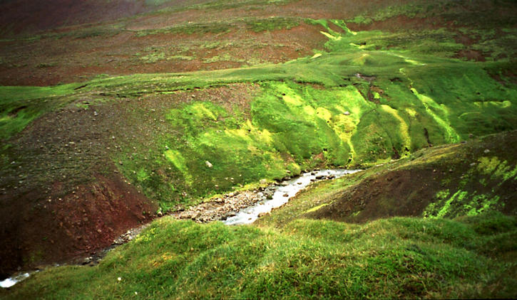
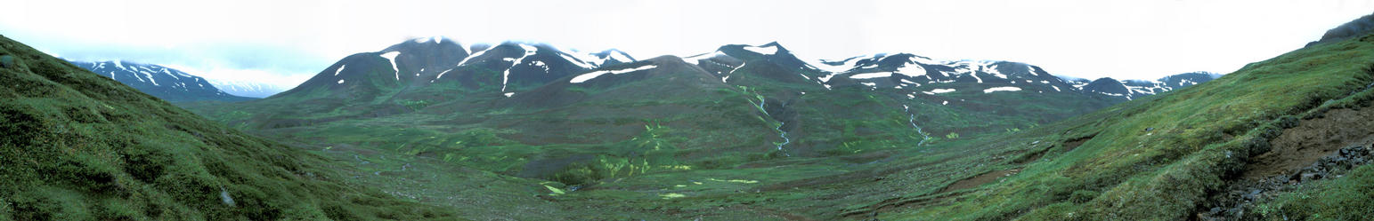
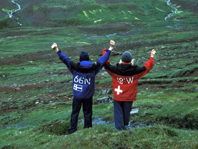
#1: A panoramic view centered northwards
#2: GPS reading: We got to the exact location
#3: Celebrating the confluence
#4: Getting there...
#5: home sweet home
#6: Uuups. Don't camp there
#7: neon-green mosses around the confluence
ALL: All pictures on one page