|

Romania
near Troianul, Teleorman, Romania
Approx. altitude: 95 m
(311 ft)
([?] maps: Google MapQuest OpenStreetMap ConfluenceNavigator)
Antipode: 44°S 155°W
Accuracy: 90 m (295 ft)
Quality: good
Click on any of the images for the full-sized picture.


| 44°N 25°E (visit #1) |
![Visit #2: [24-Dec-23]](/ro/all/n44e025v2/preview.jpg "Visit #2: [24-Dec-23]")

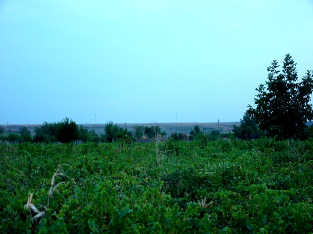
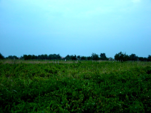
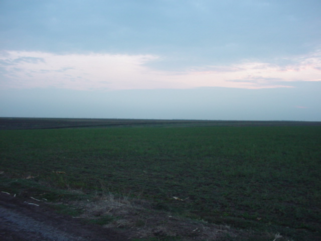
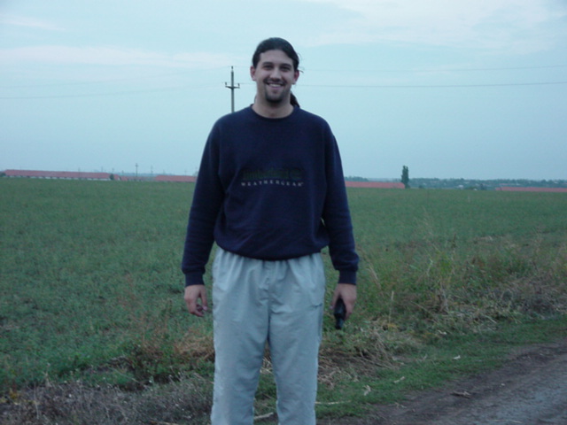
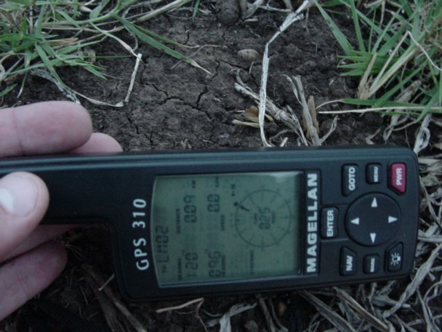
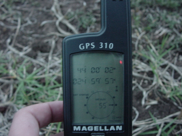
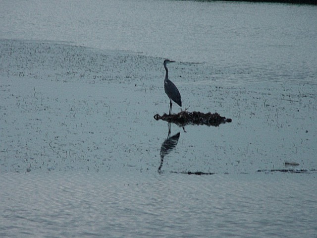
(visited by Mihai Pitigoi, Andra Costin, Mihnea Costin and Carmen Stroe) 21-Sep-2001 -- English -- Again the same crew left confluence-hunting, this time on a Friday afternoon, after work, the weekend being busy with a trip elsewhere. We left Bucharest at 5 p.m. and drove west to Alexandria (yes, there is one also in Romania, named after the ruler of the country that founded it, some 200 years ago), the county seat of Teleorman. Teleorman county lies in the Danube plain, being a land with lots of slow-running rivers, that formed lots of valleys and small lakes all across the county. Forests are few in these parts, the land being used for crops and cattle raising. The main occupation is agriculture, cities and urban towns being scarce (50 miles, from Bucharest to Alexandria, there are only villages and rural towns). In fact in the county there are only 4 industrial cities, way under the county average in Romania (a Romanian county is roughly the size of 65 by 65 miles). To better understand, Romania is slightly smaller than Oregon in size (as I see on the CIA World Factbook website), has a population of 22 million (about 9% of the US population), and is divided into 40 counties, almost equal in size. From Alexandria we still had some 20 miles more to go north, to Rosiori de Vede, and from here another 6 miles south, to the village of Troianu. The confluence appeared to be near the village. At 6:50 p.m. we entered the dirt road network of Troianu. It seems that we have a populated country! This confluence is my third one, and the second one that lies in a village! As we followed the GPS, we turned left and right so many times, that we no longer remembered the way back to the main road. At some point we went down a little slope to find ourselves in a river valley, then climbed the slope on the other bank of the river. Driving on a road that had houses on one side and vineyards on the other, we noticed that the confluence was on the other side of the vineyards. We found a road on the other side and stopped at the nearest point. The confluence laid in the middle of the vineyards that were newly planted, as can be seen in the pictures. We had a problem: it was getting dark so we didn't have time to look for the landlord and even if we found him he wouldn't give us permission to step on his newly planted vines. A grown vineyard is different, you can walk between the rows, but a newly planted one is still "crawling" on the ground, so it's just not the terrain to wander aimlessly on in search of all zeros. But we luckily found a spot 90 meters from the confluence, and took the pictures there. The elevation was 105 meters. Picture #1 shows the south view. I balanced it with a photo editor, to be brighter, as it was already dark enough for the camera. You can see the vineyard. The trees further are on the road with the houses (there can be seen some roofs also). In the distance there is the hill on the other side of the valley. Picture #2 is also balanced, but of bad quality. Still you can see a roof, eastwards. Picture #3 is taken westwards, on the other side of the road, and shows an agriculture field. Picture #4 shows me and some farm buildings, and is taken north. Pictures #5 and #6 are the proof of the location. Picture #7 shows a crane (or some kind of long-legged bird, I don’t know exactly what bird was it), on a small nice lake just 500 meters from the confluence, that we passed by on the way back. We asked around for the way back to the paved road, and got back home at 9 p.m., after an hour and a half of night driving. Romanian Version 21-Sep-2001 -- Romana -- Din nou am plecat in aceeasi formula spre o confluenta, de data asta vineri dupa serviciu. Am pornit din Bucuresti spre Alexandria pe la 5. De aici am luat-o spre Rosiori de Vede, si de acolo spre Troianu. Am intrat in sat si am inceput sa cautam locul exact. Troianu se afla pe malurile inalte ale unui riu, si nu are drumuri asfaltate. Am mers prin labirintul de drumuri de tara pina am uitat cum sa ajungem inapoi. Dupa ce am mai urcat o panta, am ajuns pe o ulita cu case pe o parte si vii pe cealalta. GPS-ul ne arata confluenta in directia viilor. Am gasit o alta ulita de partea cealalta a viilor, de data asta afara din sat, avand pe o parte viile si pe cealalta un teren agricol. Confluenta era la 90 metri in mijlocul viei. Nu mai aveam timp sa cautam proprietarul sa ii cerem permisiunea de a intra in vie pentru ca se intuneca deja (era trecut de 7) si nu mai aveam lumina pentru poze. Via era si tinara, inca la pamint, si nu prea aveam cum sa mergem prin ea fara sa o calcam in picioare, asa ca am facut pozele acolo. Altitudinea era de 105 metri. Poza 1, modificata usor pentru a fii mai luminoasa, este spre sud. Se vede via, si mai departe copacii de pe ulita cu case (se vad si acoperisuri). In zare este malul celalalt al riului. Poza 2 e si ea modificata, dar cam neclara. Se vede insa un acoperis spre est. Poza 3 este spre vest, de cealalta parte a drumului. In poza 4 sunt eu spre nord, si cladirile unei ferme. Pozele 5 si 6 – GPS. In poza 7 este o barza (cred), pe un lac la vreo 500 metri de confluenta, pe linga care am trecut la intoarcere. Am intrebat cum sa ajungam la asfalt si eram inapoi la Bucuresti la 9 seara. |
| All pictures |
| #1: South view towards the confluence/Vedere spre sud, spre confluenta #2: Eastwards/Spre est #3: Fields westwards/Cimpuri spre vest #4: Farm buildings northwards/Ferma spre nord #5: 90 meters/90 metri #6: Location/Pozitia exacta #7: Bird on a lake/Barza ALL: All pictures on one page |