|


Russia : Moskovskaya oblast'
0.1 km (0.1 miles) SW of Solnyshko, Moskovskaya oblast', Russia
Approx. altitude: 184 m
(603 ft)
([?] maps: Google MapQuest OpenStreetMap ConfluenceNavigator)
Antipode: 55°S 142°W
Accuracy: 35 m (114 ft)
Quality: good
Click on any of the images for the full-sized picture.
| 55°N 38°E (visit #7) | (secondary) |
![Visit #6: [17-Jul-21]](/ru/all/n55e038v6/preview.jpg "Visit #6: [17-Jul-21]")
![Visit #5: [20-Apr-17]](/ru/all/n55e038v5/preview.jpg "Visit #5: [20-Apr-17]")
![Visit #4: [31-Jan-10]](/ru/all/n55e038v4/preview.jpg "Visit #4: [31-Jan-10]")
![Visit #3: [15-Oct-05]](/ru/all/n55e038v3/preview.jpg "Visit #3: [15-Oct-05]")
![Visit #2: [04-Aug-03]](/ru/all/n55e038v2/preview.jpg "Visit #2: [04-Aug-03]")
![Visit #1: [15-Jun-03]](/ru/all/n55e038/preview.jpg "Visit #1: [15-Jun-03]")
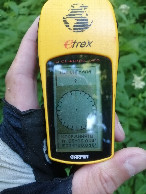
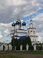
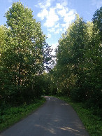
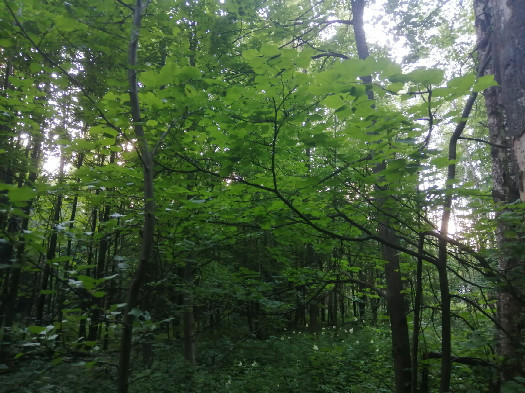 (visited by Alexander Koptilkin) 5-Июля-2026 – Продолжение этого дня после 55°N 39°E. После обеда в Коломне, возвращаюсь на свою дорогу. На этот раз двигаюсь на запад по отличному Малинскому шоссе. Подсыхающий асфальт, отсутствие машин и немного холмистый рельеф, не свойственный Подмосковью, сделали поездку приятной. После Субботово, где я пополнил запасы воды с роднике, небольшой грунтовый участок до железнодорожного переезда, а затем снова асфальт. Тут я ловил себя на мысли, что нахожусь уже где-то в провинции: неспешная и тихая жизнь небольших посёлков, поля, засеянные рапсом. Однако, когда добрался до Малино, чтоб сделать остановку и съесть мороженого, навигация сломалась и меня перебросило в Смоленскую область. Возможно, из-за аэродрома, что находится поблизости. До заветной цели оставалось немного и пришлось ехать, внимательно следя за дорогами и указателями. Но не уследил: свернул около Зотовского пруда не туда и выехал на Московское большое кольцо (дорогу А-108)... Поток машин, шум, сразу накатила усталость... Когда доехал до пересечения с Каширским шоссе, навигация восстановилась, но на этот крюк я уже потерял много времени и сил. По Каширскому шоссе доехал-таки до посёлка Киясово, где обнаружил красивую церковь Казанской иконы Божией Матери. Дальше, через деревушку Березня, доезжаю, наконец, до СНТ Солнышко. Проезжаю этот ухоженный дачный поселок насквозь и на самом краю включаю GPS-навигатор. На 80 метров прохожу в лес по тропинке и оказываюсь на месте. Однако, связь всё время теряется, и о «нулях» не приходится говорить. Фиксирую то, что получилось. Так не хотелось уже никуда уезжать из этого тихого и спокойного летнего вечера среди дач... Особенно после этой напряженной гонки со временем. Однако, время близилось к семи и нужно было возвращаться в Королёв. Доезжаю до платформы Жилёво, где сажусь на старую электричку до Москвы. В итоге, в своей квартире в Королёве я оказался уже в половине одинадцатого вечера. Данные посещения:
5-Jul-2026 – Continuation of this day after 55°N 39°E. After lunch in Kolomna, I return to my previous road. This time I'm heading west along the excellent Malinskoye Highway. The drying asphalt, the lack of cars, and the slightly hilly terrain, unusual for the Moscow region, made the trip pleasant. After the village of Subbotovo, where I replenished my water supply from a spring, a short dirt road began before reaching the railway crossing, and then the road continued onto asphalt again. Here I caught myself thinking that I was already somewhere in the provinces: the leisurely and quiet life of small villages, fields sown with rapeseed. However, when I reached the town of Malino to stop and eat ice cream, navigation failed and I was transferred to the Smolensk region. Perhaps this happened because of the airfield that is nearby. There was little time left until my intended destination and I had to drive, carefully watching the roads and road signs. But I didn't keep an eye on the roads: I turned in the wrong direction near Zotovsky Pond and ended up on the Moscow Big Ring Road (road A-108)... There is a stream of cars here, noise, and I immediately felt tired... By the time I reached the intersection with Kashirskoye Highway, navigation had been restored, but I had already lost a lot of time and energy on this mistake. I finally reached the village of Kiyasovo along the Kashirskoye Highway, where I discovered the beautiful Church of the Kazan Icon of the Mother of God. Further on, through the village of Bereznya, I finally reach the cottage village "Solnyshko". I drive through this well-kept village and turn on the GPS navigator. I walk 80 meters into the forest along a path and find myself at the place. However, the connection keeps getting lost, and there's no point in talking about "zeros". I'm recording what I get. I really didn’t want to leave this quiet and calm summer evening among these cottages... Especially after this tense race against time. However, it was approaching seven in the evening and it was time to return to Korolev. I reach Zhilevo station, where I board an old electric train to Moscow. As a result, I found myself in my apartment in Korolev at half past ten in the evening. Visit details:
|
| All pictures |
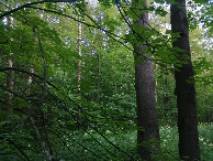
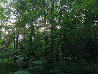
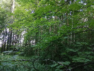
| #1: View to the north #2: View to the south #3: View to the west #4: View to the east #5: GPS reading #6: Church of the Kazan Icon of the Mother of God #7: Road to Bereznya ALL: All pictures on one page |