|

Togo
7.8 km (4.8 miles) NE of Nalématé, Kara, Togo
Approx. altitude: 213 m
(698 ft)
([?] maps: Google MapQuest OpenStreetMap ConfluenceNavigator)
Antipode: 10°S 179°W
Quality: good
Click on any of the images for the full-sized picture.


| 10°N 1°E (visit #1) |
![Visit #2: [30-Oct-10]](/tg/all/n10e001v2/preview.jpg "Visit #2: [30-Oct-10]")

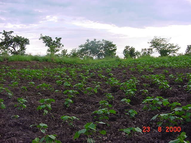
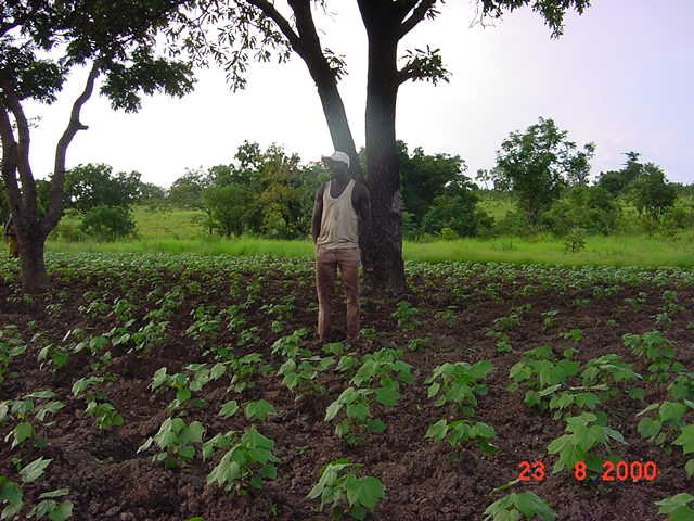
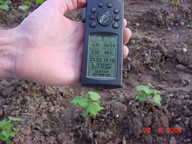
(visited by J. Baker Hill and David Wood) 23-Aug-2000 -- David Wood and I were on a trip to Togo to pick up some solar equipment from an abandoned project when we noticed there was a confluence point just off the road, about 6 kilometers northwest of Kanté, Togo. This was 10N 1E. It was at the end of a particularly bad stretch of pavement and we had almost decided to skip it and go on as it was just an hour and a half till sunset and we were about that far from our overnight destination. But then we noticed that the basemap was slightly inaccurate and that instead of 500 meters off the road the point was about 40 meters. We lined up with the point and stopped. It was on a stretch of road that had been cut into a rise, so we had to ford a ditch with water in it, climb a small cliff, and we ended up in a cotton field. A young man named Ali was working in it and we struck up a conversation in French with him. He was quite amused as we went round and round his field looking to make the right numbers come up in the GPS window. We thanked him, climbed back down the cliff and back into the trusty 4Runner, and drove on past the Togolese president's mansion a few km's further down the road, getting to our overnight by just after dark. |
| All pictures |
| #1: The cotton field in Togo at 10N 1E #2: David trying to get the right numbers #3: Almost! #4: Ali in his strategically located field ALL: All pictures on one page |