|

Sweden
16.3 km (10.1 miles) WSW of Burgsvik, Gotland (Island), Gotland, Sweden
Approx. altitude: 0 m
(0 ft)
([?] maps: Google MapQuest OpenStreetMap ConfluenceNavigator)
Antipode: 57°S 162°W
Accuracy: 7 m (22 ft)
Quality: good
Click on any of the images for the full-sized picture.


| 57°N 18°E |

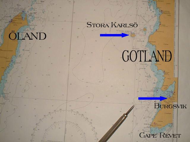
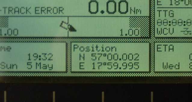
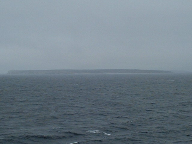
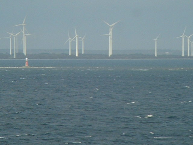
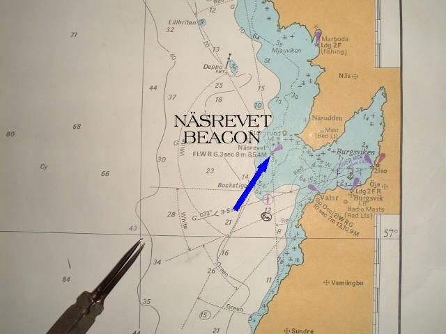
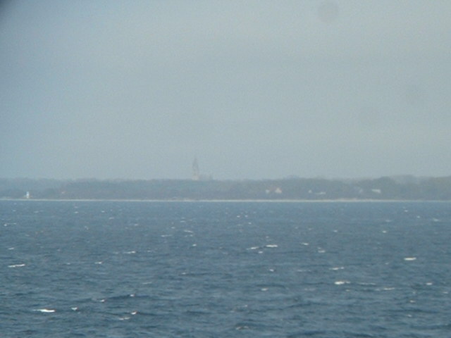
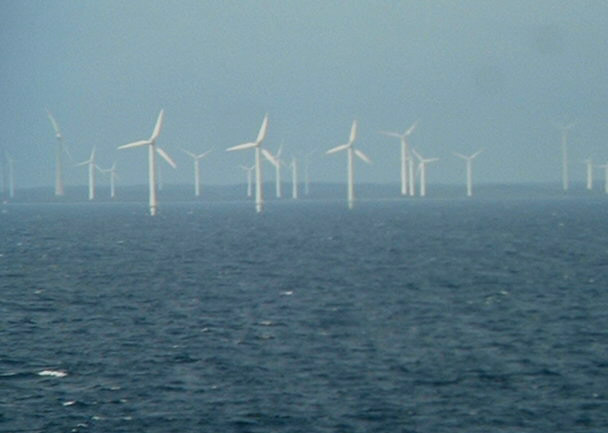
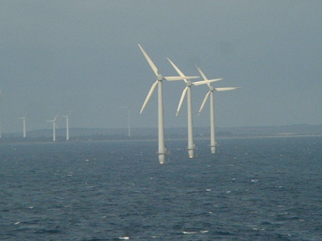
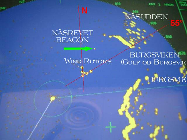
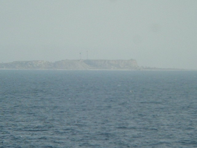
(visited by Captain Peter, Valentyn Smirnov and Volodymyr Kokorev) 05-May-2002 -- On our way from Saint Petersburg back to the Skagerrak (Skaw) today we were off Gotland again. When we passed it on Apr 30th, we visited 58°N/19°E, but for 57°N/18°E it had been still too dark then. This time there was chance for this point, which we were approaching from the North. When we were abeam of the small Island Stora Karlsö, we went on a course of 177° towards the confluence. The coast is full of wind rotors, in front we see the small lighthouse of Näsrevet. Then we proceeded to the confluence, from where we could see the church of Burgsvik. Burgsvik is the closest settlement to the confluence and is a small harbor, where limestone is loaded. It has a population of about 300. In the area off the Burgsviken (Gulf of Burgsvik) there are many wind rotors some of them even built into the sea. Please have a closer look to these wind rotors on the Radar screen. The rotors in the sea are orientated as a triangle according to the directions from where the wind predominantly is blowing in this area, i.e. from North and from 55° (roughly NE), in order to gain a maximum output. The Southern end of Gotland Islands is called Revet. This was quite an interesting confluence, and provided with new knowledge about Gotland's electric power generating system we are proceeding further. |
| All pictures |
| #1: Burgsvik #2: Map #3: GPS #4: Stora Karlsö #5: Wind Rotors on the coast #6: Näsrevet #7: Wind Rotors in the Gulf of Burgsvik #8: Wind Rotors in the sea! #9: Radar #10: Revet ALL: All pictures on one page |
| Notes |
|
In the Baltic Sea, but with a view of land. |