|

Italy : Marche
2.3 km (1.4 miles) NE of Piè del Sasso, Macerata, Marche, Italy
Approx. altitude: 1015 m
(3330 ft)
([?] maps: Google MapQuest OpenStreetMap ConfluenceNavigator)
Antipode: 43°S 167°W
Accuracy: 3 m (9 ft)
Quality: good
Click on any of the images for the full-sized picture.
")


| 43°N 13°E (visit #1) |
![Visit #3: [24-Dec-22]](/it/all/n43e013v3/preview.jpg "Visit #3: [24-Dec-22]")
![Visit #2: [13-Sep-18]](/it/all/n43e013v2/preview.jpg "Visit #2: [13-Sep-18]")

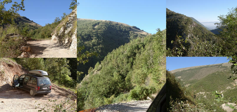
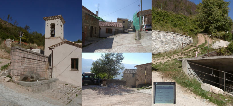
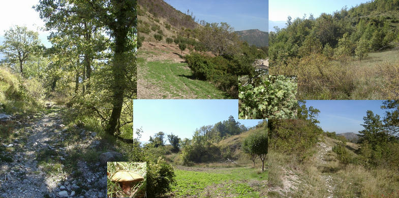
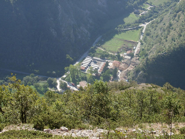
(visited by Hans Augdoppler) 13-Oct-2001 -- On my way to Austria I decided to do a bypass in the direction of 43°N 13°E. I left the A14 at Porto Civitanova and used the SS77 towards Muccia. Just before this town I turned left in the direction of Terni (SS209). Finally I used the SP20 to Monte Cavallo, which is also a village at a valley. The mountains are flat at the top with grazing sheep and sometimes very steep in the lower parts. At the entrance of Monte Cavallo was the junction to Colle Bianco, Cesure and Valdcadara. I went up the gravel road and the CP supposed to be somewhere to the left (NW), within the thorn bushes in an extreme steep terrain. Since the distance was still a few hundred meters it made no sense to start an exploration in this difficult landscape. So I decided to try it somehow from the upper parts of the mountain having in mind, that the indicated altitude in the CP-project isn’t accurate. Since the road ended in the village of Cesure I made a trial go around the massif. I ended up in a very steep part and there was no real chance to get around. Therefore I resigned and went back to Cesure, prepared to park the car and to hike the last 900 m. Cesure is a strange village, partly reconstructed, but the only inhabitants were an old couple. They watched me, but didn’t like to talk to or even get in touch with me. Moreover I was prepared to do some exploration than to expect to get to the CP by this method. After I was dressed properly in order to withstand thorns and other ugly things as well as a steep terrain. From the end of the village a former drivable gravel road could be found, thorny but able to walk with great care. Fortunately the direction led me directly towards the integer. As close as 400 m the path suddenly disappeared whether it was so well hidden by thorn bushes or actually ended. Now the hard life of the fight with the enemy began, thorn bushes and other unfriendly plants. In order to bypass the tight parts I had to climb up, scratched by thorns and burnt by the sun. Then a clearing appeared in the lower parts and the CP seemed to be in or just behind this area. So I stepped down in mind that I’d have to go up later on again. Suddenly I could see my old road again; about 20m below the suspected place of the CP. Fighting with the steep terrain I could get a ZERO reading. A tree was present to mount the wooden plate. Even the confluence beer was present and I think I didn’t forget the empty bottle – please check it J. What a wonderful view to the south, the village of Piandellanoce, the valley of the river Chienti and to the west, towards Monte Tolagna. The village Monte Cavallo seems to be just below you – just make one step too much… To return to Cesure it was a Saturday noon walk along a historical path with a tremendous view. Time to think about the hardship of the people who lived and worked here decades ago. Nowadays all these former cultivated lands are regained by the wilderness leaving stonewalls and paved path as witnesses. Just some crazy CP hunters may fight against the thorns following vestiges of former generations. Half the way I returned to the original part, which I’ve found on my way to the CP. A tip for further visitors: As you think the track ends, just turn to left, towards downhill and you may find the path again. It will be a nice walk - beware of thorns but no dogs are around. For more information see: [http://linz.orf.at/gast/augdoppl/Confluence/Italy.htm#ItalyCentral] |
| All pictures |
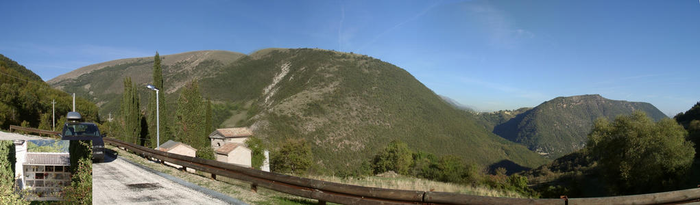
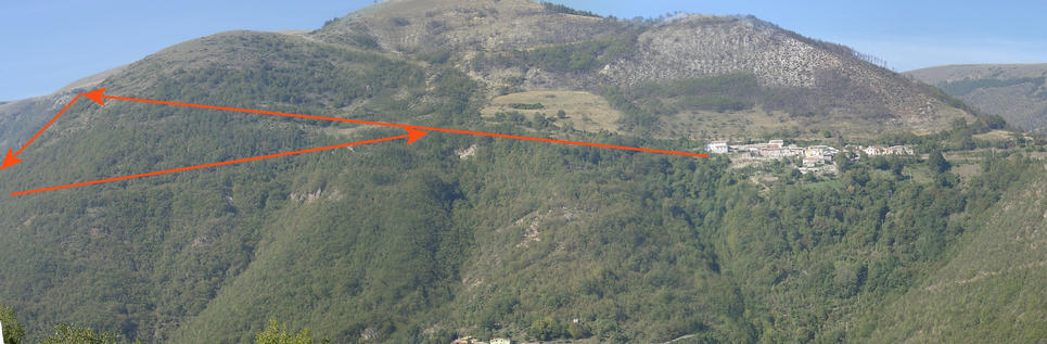
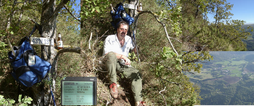
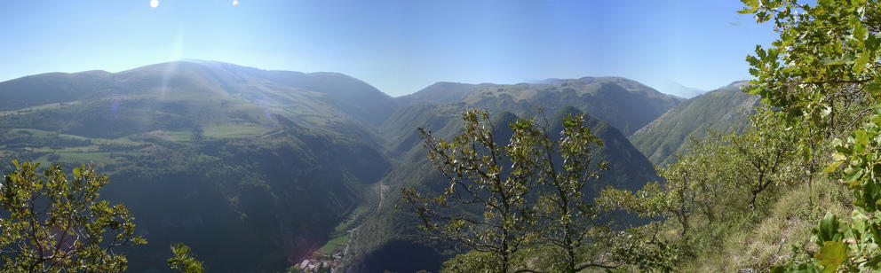
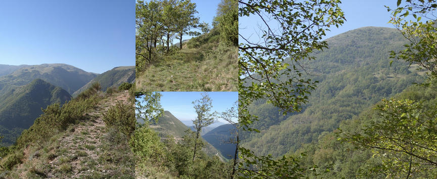
| #1: From the CP downwards to the village of Monte Cavallo #2: Cemetery of Cesure and panoramic view in direction north (Valcadara) #3: Way trough the valley to Valcadara #4: Village of Cesure with exit towards CP at right #5: Way out of Cesure with typical vegetation #6: Panorama seen from opposite mountain with the route indicated #7: At the CP with plate looks at Piandellanoce #8: Panorama from confluence point into the valley of river Chienti #9: Way back to Cesure, easier and joyful #10: Two houses with lighting in a remote valley on the way to Valdcadara ALL: All pictures on one page |