|

Brazil : Alagoas
20.9 km (13.0 miles) SE of Ponta Gravatá (Cape, Pernambuco), Alagoas, Brazil
Approx. altitude: 0 m
(0 ft)
([?] maps: Google MapQuest OpenStreetMap ConfluenceNavigator)
Antipode: 9°N 145°E
Accuracy: 10 m (32 ft)
Quality: good
Click on any of the images for the full-sized picture.


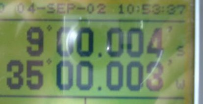
| 9°S 35°W |

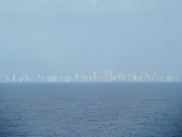
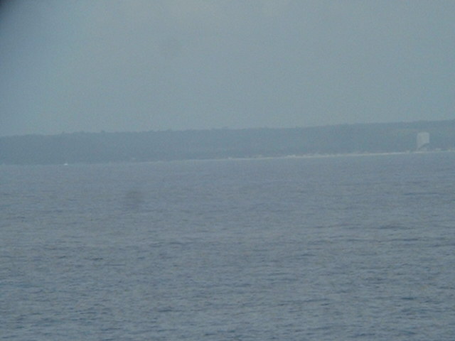
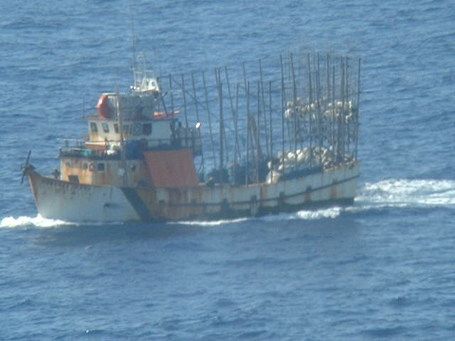
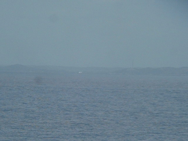
(visited by Captain Peter and Dimitriy Peysakhov) 04-Sep-2002 -- After having loaded bananas and melons yesterday at Natal (Rio Grande do Norte), we continued our voyage to the Rio de La Plata (Argentina). Four hours prior the arrival at the confluence we had passed Recife, the most important town in Northeastern Brazil. The Brazilian coastline of the section around 9°S varies. In the North part, from Tamandaré to the mouth of Rio Una the coast is high and backed by hills. South of the river it is very low. From Rio Una to the mouth of Rio Manguaba the coast becomes again higher, again backed by hills, some of them brightly colored cliffs. Most of this coast is backed by coconut groves. A barrier fringes the coast at distances of 5 cables (abt 2,000 metres) to 3 nautical miles (abt 6 km). It dries in places and there are numerous passages through it. There are numerous fish in the area. Here we see a typical Brazilian fisherman. Pôrto de Pedras is situated on the mouth of Rio Manguaba and provides anchorage for small craft only. |
| All pictures |
| #1: The coast as seen from the confluence #2: GPS #3: Recife #4: Brazilian fisherman #5: Pôrto de Pedras seen from the Confluence ALL: All pictures on one page |
| Notes |
|
In the ocean, but with a good view of land. |