| 1°S 53°W
33.9 km (21.1 miles) N of Ramos, Pará, Brazil
| | 1°N 127°E
37.6 km (23.3 miles) WNW of Pulau Hiri (Island), Maluku, Indonesia
|
|
| 0° 53°W
34.2 km (21.2 miles) SSE of Acampamento Grande (Amapá), Pará, Brazil
| | 0° 127°E
20.5 km (12.7 miles) W of Pulau Tolimao (Island), Maluku, Indonesia
|
|
| 1°N 53°W
30.0 km (18.6 miles) NNE of Terceiro Acampamento, Amapá, Brazil
| | 1°S 127°E
30.2 km (18.8 miles) SW of Tanjung Gegori (Cape), Pulau Mandioli (Island), Maluku, Indonesia
|
|
| 2°N 53°W
119.0 km (73.9 miles) ENE of Maloca dos Urucuianas, Amapá, Brazil
| | 2°S 127°E
59.4 km (36.9 miles) SW of Tanjung Akelamo (Cape), Pulau Obi (Island), Maluku, Indonesia
|
|
| 3°N 53°W
15.9 km (9.9 miles) NE of Dégrad Claude, Cayenne, French Guyana
| | 3°S 127°E
17.5 km (10.9 miles) NNE of Waeplau, Pulau Buru (Island), Maluku, Indonesia
|
|
| 4°N 53°W
5.8 km (3.6 miles) NNW of Badek, Cayenne, French Guyana
| | 4°S 127°E
27.8 km (17.3 miles) SW of Pulau Ambelau (Island), Maluku, Indonesia
|
|
| 2°S 52°W
20.7 km (12.9 miles) ENE of Veiros, Pará, Brazil
| | 2°N 128°E
5.9 km (3.7 miles) ENE of Tanjung Salimuli (Cape), Pulau Halmahera (Island), Maluku, Indonesia
|
|
| 1°S 52°W
17.1 km (10.6 miles) NNW of Vida Nova (Pará), Amapá, Brazil
| | 1°N 128°E
5.2 km (3.2 miles) SE of Akeselaka, Pulau Halmahera (Island), Maluku, Indonesia
|
|
| 0° 52°W
7.6 km (4.7 miles) WSW of Camaipi, Amapá, Brazil
| | 0° 128°E
11.7 km (7.3 miles) ENE of Tanjung Bare (Cape), Pulau Halmahera (Island), Maluku, Indonesia
|
|
| 1°N 52°W
5.2 km (3.2 miles) NE of Teresinha, Amapá, Brazil
| | 1°S 128°E
18.9 km (11.7 miles) WNW of Pulau-pulau Loleojaha (Islands), Maluku, Indonesia
|
|
| 2°N 52°W
66.9 km (41.5 miles) SSW of Lourenço, Amapá, Brazil
| | 2°S 128°E
33.4 km (20.7 miles) S of Wai, Pulau Obi (Island), Maluku, Indonesia
|
|
| 3°N 52°W
54.1 km (33.6 miles) NNW of Regina, Amapá, Brazil
| | 3°S 128°E
5.6 km (3.5 miles) S of Tanjung Pamali (Cape), Pulau Boano (Island), Maluku, Indonesia
|
|
 | 67°N 52°W
25.2 km (15.6 miles) NE of Saqqarliit, Vestgrønland, Greenland
[incomplete] | | 67°S 128°E
80.8 km (50.2 miles) SE of Al'bov Rocks (Hill), Longitude 90 East to 179 East, Antarctica
|
|
| 68°N 52°W
39.2 km (24.3 miles) ESE of Aalatsivik, Vestgrønland, Greenland
| | 68°S 128°E
534.2 km (331.7 miles) WSW of Dumont D'urville, Longitude 90 East to 179 East, Antarctica
|
|
 | 70°N 52°W
2.7 km (1.7 miles) SW of Saqqaq, Vestgrønland, Greenland
[incomplete] | | 70°S 128°E
564.8 km (350.7 miles) N of Dome Charlie (Peak), Longitude 90 East to 179 East, Antarctica
|
|
| 71°N 52°W
7.0 km (4.3 miles) SW of Ukkusissat, Vestgrønland, Greenland
| | 71°S 128°E
350.7 km (217.8 miles) WNW of Cameron Nunataks (Hill), Longitude 90 East to 179 East, Antarctica
|
|
| 72°N 52°W
65.5 km (40.7 miles) NE of Nuugaatsiaq, Vestgrønland, Greenland
| | 72°S 128°E
301.9 km (187.5 miles) WNW of Cameron Nunataks (Hill), Longitude 90 East to 179 East, Antarctica
|
|
| 79°N 52°W
268.5 km (166.7 miles) ESE of Center of Putdlerssuaq (Island), Nordgrønland, Greenland
| | 79°S 128°E
450.9 km (280.0 miles) S of Dome Charlie (Peak), Longitude 90 East to 179 East, Antarctica
|
|
| 80°N 52°W
195.9 km (121.7 miles) S of Jul Peterson Bjerg (Mountain), Nordgrønland, Greenland
| | 80°S 128°E
468.9 km (291.2 miles) ESE of Vostok, Longitude 90 East to 179 East, Antarctica
|
|
| 81°N 52°W
91.0 km (56.5 miles) SSW of Center of Permin Land (Island), Nordgrønland, Greenland
| | 81°S 128°E
422.4 km (262.3 miles) W of Lonewolf Nunataks (Hill), Longitude 90 East to 179 East, Antarctica
|
|
| 82°N 52°W
13.1 km (8.1 miles) ESE of Center of Hendrik Ø (Island), Nordgrønland, Greenland
| | 82°S 128°E
403.7 km (250.7 miles) W of Lonewolf Nunataks (Hill), Longitude 90 East to 179 East, Antarctica
|
|
| 3°S 51°W
26.0 km (16.1 miles) S of João, Pará, Brazil
| | 3°N 129°E
62.0 km (38.5 miles) NE of Tanjung Sopi (Cape), Pulau Morotai (Island), Maluku, Indonesia
|
|
| 2°S 51°W
21.1 km (13.1 miles) WSW of Portel, Pará, Brazil
| | 2°N 129°E
49.9 km (31.0 miles) ESE of Tanjung Posiposi (Cape), Pulau Morotai (Island), Maluku, Indonesia
|
|
| 1°S 51°W
5.9 km (3.7 miles) ENE of Curumu, Pará, Brazil
| | 1°N 129°E
34.2 km (21.2 miles) ESE of Tanjung Wayamli (Cape), Pulau Halmahera (Island), Maluku, Indonesia
|
|
 | 0° 51°W
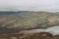
6.7 km (4.2 miles) ESE of Macapá (Amapá), Pará, Brazil
[incomplete] | | 0° 129°E
18.8 km (11.7 miles) S of Pulau Weilon (Island), Maluku, Indonesia
|
|
