
| { Main | Search | Countries | Information | Member Page } | |
United Kingdom : England (all confluences) (visit information) |
Primary: 17 visited, 17 total.
| |
| Plans for this Region | |
|
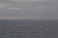
50°N 5°W 7.4 km (4.6 miles) ESE of Black Head (Cape), Cornwall, England, United Kingdom [secondary] |

|
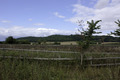
51°N 2°W 2.3 km (1.4 miles) W of Bower Chalke, Wiltshire, England, United Kingdom [secondary] |
|
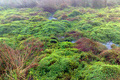
52°N 2°W 1.9 km (1.2 miles) N of Alderton, Gloucestershire, England, United Kingdom [secondary] |

|
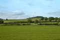
53°N 2°W 2.2 km (1.4 miles) NNW of Cheadle, Staffordshire, England, United Kingdom [secondary] |
|
54°N 2°W 3.8 km (2.4 miles) ESE of Rylstone, North Yorkshire, England, United Kingdom [secondary] |

|
55°N 1°W 23.3 km (14.5 miles) ENE of Souter Point (Cape), South Tyneside, England, United Kingdom [incomplete] [secondary] |
|
55°N 2°W 2.1 km (1.3 miles) NNW of Aydon, Northumberland, England, United Kingdom [secondary] |