
| { Main | Search | Countries | Information | Member Page } | |
Australia : New South Wales (visit information) |
84 visited, 84 total. | |
| Plans for this Region | |

|
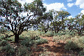
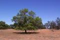
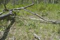
37°S 150°E 7.4 km (4.6 miles) SE of Haycock Point (Cape), NSW, Australia |
|
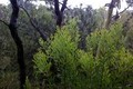
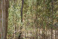
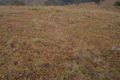
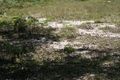
37°S 149°E 6.9 km (4.3 miles) SSW of Quidong, NSW, Australia |
|
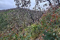
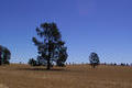
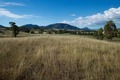
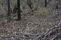
36°S 150°E 3.6 km (2.2 miles) SSE of Wamban, NSW, Australia |
|
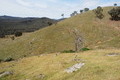
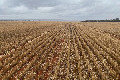
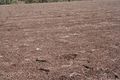
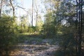
36°S 149°E 8.8 km (5.5 miles) SSE of Shannons Flat, NSW, Australia |
|
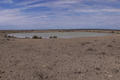
36°S 148°E 5.7 km (3.5 miles) SW of Tooma, NSW, Australia |
|
36°S 147°E 2.1 km (1.3 miles) NE of Ettamogah, NSW, Australia |
|
36°S 146°E 1.5 km (0.9 miles) SSW of Mulwala, NSW, Australia |

|
35°S 151°E 15.9 km (9.9 miles) E of Currarong, NSW, Australia |
|
35°S 150°E 10.6 km (6.6 miles) WNW of Coolumburra, NSW, Australia |
|
35°S 149°E 4.3 km (2.7 miles) SW of Murrumbateman, NSW, Australia |
|
35°S 148°E 10.1 km (6.3 miles) NE of Nangus, NSW, Australia |
|
35°S 147°E 5.4 km (3.4 miles) ENE of Bulgary, NSW, Australia |
|
35°S 146°E 16.8 km (10.4 miles) N of Bundure, NSW, Australia |
|
35°S 145°E 12.7 km (7.9 miles) W of Willurah, NSW, Australia |
|
35°S 144°E 10.7 km (6.6 miles) NNW of Moulamein, NSW, Australia |
|
34°S 151°E 2.1 km (1.3 miles) NNW of Menai, NSW, Australia |
|
34°S 150°E 9.9 km (6.1 miles) SW of Kanangra, NSW, Australia |
|
34°S 149°E 6.0 km (3.7 miles) SE of Wyangala, NSW, Australia |
|
34°S 148°E 7.7 km (4.8 miles) NE of Bimbi, NSW, Australia |
|
34°S 147°E 10.4 km (6.5 miles) E of Tallimba, NSW, Australia |
|
34°S 146°E 18.3 km (11.4 miles) NE of Tabbita, NSW, Australia |
|
34°S 145°E 18.0 km (11.2 miles) SE of Booligal, NSW, Australia |
|
34°S 144°E 23.6 km (14.7 miles) NNW of Oxley, NSW, Australia |
|
34°S 143°E 17.7 km (11.0 miles) SE of Arumpo, NSW, Australia |
|
34°S 142°E 10.5 km (6.5 miles) ENE of Pomona, NSW, Australia |
|
33°S 151°E 6.4 km (4.0 miles) SSE of Big Yengo, NSW, Australia |
|
33°S 150°E 3.3 km (2.0 miles) ESE of Brogans Creek, NSW, Australia |
|
33°S 149°E 1.3 km (0.8 miles) S of Boomey, NSW, Australia |
|
33°S 148°E 3.7 km (2.3 miles) N of Cooks Myalls, NSW, Australia |
|
33°S 147°E 17.2 km (10.7 miles) NW of Condobolin, NSW, Australia |
|
33°S 146°E 21.2 km (13.2 miles) SSE of Mount Hope, NSW, Australia |
|
33°S 145°E 43.8 km (27.2 miles) W of Roto, NSW, Australia |
|
33°S 144°E 30.2 km (18.8 miles) WSW of Ivanhoe, NSW, Australia |
|
33°S 143°E 33.5 km (20.8 miles) WNW of Pan Ban, NSW, Australia |
|
33°S 142°E 47.3 km (29.4 miles) NE of Scotia, NSW, Australia |
|
32°S 152°E 4.0 km (2.5 miles) ENE of Gloucester, NSW, Australia |
|
32°S 151°E 1.5 km (0.9 miles) N of Gundy, NSW, Australia |
|
32°S 150°E 2.1 km (1.3 miles) ENE of Cassilis, NSW, Australia |
|
32°S 149°E 12.9 km (8.0 miles) NNW of Elong Elong, NSW, Australia |
|
32°S 148°E 3.8 km (2.4 miles) NNE of Trangie, NSW, Australia |
|
32°S 147°E 16.6 km (10.3 miles) WSW of Buddabadah, NSW, Australia |
|
32°S 146°E 30.1 km (18.7 miles) W of Nymagee, NSW, Australia |
|
32°S 145°E 17.2 km (10.7 miles) ESE of Noona, NSW, Australia |
|
32°S 144°E 39.9 km (24.8 miles) W of Bulla, NSW, Australia |
|
32°S 143°E 60.6 km (37.6 miles) SW of Wilcannia, NSW, Australia |
|
32°S 142°E 32.6 km (20.2 miles) SW of Little Topar, NSW, Australia |
|
31°S 153°E 1.4 km (0.9 miles) SE of Kinchela, NSW, Australia |
|
31°S 152°E 30.1 km (18.7 miles) SW of Carrai, NSW, Australia |
|
31°S 151°E 5.3 km (3.3 miles) NNE of Daruka, NSW, Australia |
|
31°S 150°E 9.0 km (5.6 miles) ESE of Ghoolendaadi, NSW, Australia |
|
31°S 149°E 5.8 km (3.6 miles) ENE of Barwon, NSW, Australia |
|
31°S 148°E 13.8 km (8.6 miles) ESE of Quambone, NSW, Australia |
|
31°S 147°E 27.5 km (17.1 miles) E of Coolabah, NSW, Australia |
|
31°S 146°E 38.7 km (24.0 miles) NNE of Tindarey, NSW, Australia |
|
31°S 145°E 29.8 km (18.5 miles) W of Kerrigundi, NSW, Australia |
|
31°S 144°E 40.3 km (25.0 miles) W of Tilpa, NSW, Australia |
|
31°S 143°E 18.3 km (11.4 miles) SSW of White Cliffs, NSW, Australia |
|
31°S 142°E 35.4 km (22.0 miles) NNW of Mootwingee, NSW, Australia |
|
30°S 153°E 2.2 km (1.4 miles) SE of Kremnos, NSW, Australia |
|
30°S 152°E 4.3 km (2.7 miles) NW of Kookabookra, NSW, Australia |
|
30°S 151°E 4.6 km (2.9 miles) WSW of Aberdeen, NSW, Australia |
|
30°S 150°E 4.7 km (2.9 miles) NNE of Couradda, NSW, Australia |
|
30°S 149°E 12.1 km (7.5 miles) NNE of Burren Junction, NSW, Australia |
|
30°S 148°E 11.5 km (7.1 miles) WNW of Walgett, NSW, Australia |
|
30°S 147°E 14.0 km (8.7 miles) ESE of Brewarrina, NSW, Australia |

|
30°S 146°E 11.7 km (7.3 miles) NNE of Bourke, NSW, Australia |
|
30°S 145°E 30.2 km (18.8 miles) WNW of Gumbalie, NSW, Australia |
|
30°S 144°E 36.0 km (22.4 miles) SSW of Wanaaring, NSW, Australia |
|
30°S 143°E 94.8 km (58.9 miles) N of White Cliffs, NSW, Australia |
|
30°S 142°E 31.1 km (19.3 miles) SSE of Milparinka, NSW, Australia |
|
30°S 141°E 90.1 km (56.0 miles) WSW of Milparinka, NSW, Australia |
|
29°S 153°E 3.1 km (1.9 miles) ENE of Coombell, NSW, Australia |
|
29°S 152°E 1.0 km (0.6 miles) SE of Homestead, NSW, Australia |
|
29°S 151°E 5.7 km (3.5 miles) W of Atholwood, NSW, Australia |
|
29°S 150°E 20.9 km (13.0 miles) SSW of Tulloona, NSW, Australia |
|
29°S 149°E 2.8 km (1.7 miles) SSE of Mungindi, NSW, Australia |
|
29°S 148°E 20.2 km (12.5 miles) E of Hebel (QLD), NSW, Australia |
|
29°S 147°E 28.0 km (17.4 miles) NNE of Weilmoringle, NSW, Australia |
|
29°S 146°E 30.5 km (18.9 miles) ESE of Barringun (QLD), NSW, Australia |
|
29°S 145°E 36.4 km (22.6 miles) N of Yantabulla, NSW, Australia |
|
29°S 144°E 39.6 km (24.6 miles) W of Hungerford (QLD), NSW, Australia |
|
29°S 143°E 68.0 km (42.2 miles) S of Bulloo Downs (QLD), NSW, Australia |
|
29°S 142°E 47.6 km (29.6 miles) N of Tibooburra, NSW, Australia |
|
29°S 141°E 0.4 km (0.2 miles) S of Cameron Corner (QLD), NSW, Australia |