
| { Main | Search | Countries | Information | Member Page } | |
Confluence Visit List (#26 - #50) |
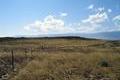
 | 48°N 116°W 4.4 miles (7.0 km) SSW of Heron, Sanders, MT, USA [04-Aug-02] |
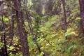
 | 46°N 113°W 9.1 miles (14.6 km) SSW of Anaconda, Deer Lodge, MT, USA [28-Aug-02] |
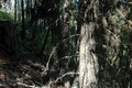
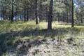 | 46°N 114°W 7.6 miles (12.2 km) NE of Conner, Ravalli, MT, USA [02-Sep-02] |
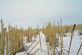
 | 49°N 107°W 28.7 miles (46.2 km) WNW of Opheim, Valley, MT, USA [secondary] [25-May-03] |
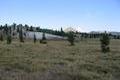
 | 47°N 111°W 10.2 miles (16.4 km) SW of Monarch (Cascade), Meagher, MT, USA [19-Jun-03] |
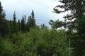
 | 48°N 113°W 26.7 miles (43.0 km) WSW of Dupuyer (Pondera), Flathead, MT, USA [15-Aug-03] |
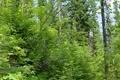
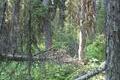
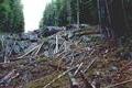
 | 47°N 115°W 13.1 miles (21.1 km) SW of Riverbend, Mineral, MT, USA [16-Aug-03] |
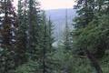
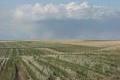
 | 48°N 111°W 19.7 miles (31.8 km) NW of Fort Benton, Chouteau, MT, USA [16-Aug-03] |
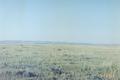
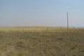
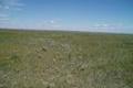
 | 45°N 106°W 17.4 miles (28.0 km) SE of Otter, Powder River, MT, USA [11-Sep-03] |
 | 45°N 113°W 3.4 miles (5.5 km) ESE of Grant, Beaverhead, MT, USA [13-Sep-03] |
 | 45°N 106°W 17.4 miles (28.0 km) SE of Otter, Powder River, MT, USA [14-Sep-03] |
 | 46°N 108°W 2.4 miles (3.8 km) WNW of Pompeys Pillar, Yellowstone, MT, USA [19-Apr-04] |
 | 46°N 109°W 9.0 miles (14.4 km) SW of Broadview (Yellowstone), Stillwater, MT, USA [22-Apr-04] |
 | 49°N 116°W 20.7 miles (33.4 km) NNE of Moyie Springs (ID), Lincoln, MT, USA [secondary] [01-Jun-04] |
 | 49°N 116°W 20.7 miles (33.4 km) NNE of Moyie Springs (ID), Lincoln, MT, USA [secondary] [03-Jun-04] |
 | 49°N 107°W 28.7 miles (46.2 km) WNW of Opheim, Valley, MT, USA [secondary] [05-Aug-04] |
 | 45°N 109°W 9.8 miles (15.8 km) S of Belfry, Carbon, MT, USA [24-Aug-05] |
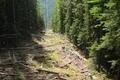
 | 47°N 114°W 5.8 miles (9.3 km) SSE of Evaro, Missoula, MT, USA [17-Sep-05] |
 | 47°N 114°W 5.8 miles (9.3 km) SSE of Evaro, Missoula, MT, USA [13-Aug-06] |
 | 48°N 106°W 4.4 miles (7.1 km) SSE of Frazer (Valley), McCone, MT, USA [18-Feb-07] |
 | 48°N 105°W 11.0 miles (17.7 km) SSW of Brockton (Roosevelt), Richland, MT, USA [18-Feb-07] |
 | 47°N 112°W 5.4 miles (8.7 km) SSW of Craig, Lewis and Clark, MT, USA [31-Jul-08] |
 | 47°N 112°W 5.4 miles (8.7 km) SSW of Craig, Lewis and Clark, MT, USA [27-Jun-09] |
 | 48°N 112°W 7.7 miles (12.4 km) WSW of Brady (Pondera), Teton, MT, USA [27-Jun-09] |
 | 45°N 109°W 9.8 miles (15.8 km) S of Belfry, Carbon, MT, USA [12-Aug-09] |