
| { Main | Search | Countries | Information | Member Page } | |
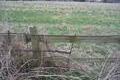
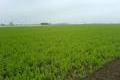
Confluence Visit List (#101 - #125) |
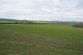
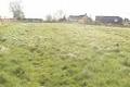
 | 52°N 1°W 1.1 km (0.7 miles) W of Buckingham, Buckinghamshire, England, United Kingdom [13-Feb-05] |
 | 51°N 2°W 2.3 km (1.4 miles) W of Bower Chalke, Wiltshire, England, United Kingdom [secondary] [20-Feb-05] |
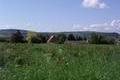
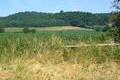
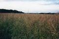
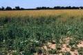
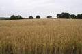
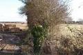 | 52°N 2°W 1.9 km (1.2 miles) N of Alderton, Gloucestershire, England, United Kingdom [secondary] [06-Mar-05] |
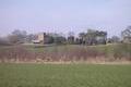 | 55°N 2°W 2.1 km (1.3 miles) NNW of Aydon, Northumberland, England, United Kingdom [secondary] [19-Mar-05] |
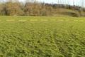 | 52°N 1°W 1.1 km (0.7 miles) W of Buckingham, Buckinghamshire, England, United Kingdom [06-Apr-05] |
 | 52°N 2°W 1.9 km (1.2 miles) N of Alderton, Gloucestershire, England, United Kingdom [secondary] [09-Apr-05] |
 | 52°N 0° 1.1 km (0.7 miles) W of Barkway, Hertfordshire, England, United Kingdom [29-Apr-05] |
 | 53°N 1°E 2.3 km (1.4 miles) N of Blakeney Point (Cape), Norfolk, England, United Kingdom [30-Apr-05] |
 | 53°N 1°E 2.3 km (1.4 miles) N of Blakeney Point (Cape), Norfolk, England, United Kingdom [30-Apr-05] |
 | 52°N 2°W 1.9 km (1.2 miles) N of Alderton, Gloucestershire, England, United Kingdom [secondary] [30-May-05] |
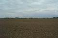 | 53°N 0° 2.9 km (1.8 miles) SE of Frith Bank, Lincolnshire, England, United Kingdom [11-Jun-05] |
 | 53°N 1°W near Lowdham, Nottinghamshire, England, United Kingdom [12-Jun-05] |
 | 52°N 2°W 1.9 km (1.2 miles) N of Alderton, Gloucestershire, England, United Kingdom [secondary] [10-Jul-05] |
 | 52°N 0° 1.1 km (0.7 miles) W of Barkway, Hertfordshire, England, United Kingdom [15-Jul-05] |
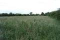
 | 52°N 1°E 2.2 km (1.4 miles) SSE of Raydon, Suffolk, England, United Kingdom [16-Jul-05] |
 | 51°N 0° 3.0 km (1.9 miles) NW of Fletching, East Sussex, England, United Kingdom [26-Jul-05] |
 | 53°N 0° 2.9 km (1.8 miles) SE of Frith Bank, Lincolnshire, England, United Kingdom [06-Aug-05] |
 | 51°N 1°W 1.9 km (1.2 miles) S of Froxfield, Hampshire, England, United Kingdom [25-Sep-05] |
 | 52°N 1°E 2.2 km (1.4 miles) SSE of Raydon, Suffolk, England, United Kingdom [26-Sep-05] |
 | 51°N 0° 3.0 km (1.9 miles) NW of Fletching, East Sussex, England, United Kingdom [26-Dec-05] |
 | 52°N 1°E 2.2 km (1.4 miles) SSE of Raydon, Suffolk, England, United Kingdom [22-Jan-06] |
 | 52°N 0° 1.1 km (0.7 miles) W of Barkway, Hertfordshire, England, United Kingdom [06-Mar-06] |
 | 52°N 2°W 1.9 km (1.2 miles) N of Alderton, Gloucestershire, England, United Kingdom [secondary] [18-Mar-06] |
 | 52°N 3°W near Michaelchurch Escley, Herefordshire, England, United Kingdom [01-Apr-06] |
 | 53°N 0° 2.9 km (1.8 miles) SE of Frith Bank, Lincolnshire, England, United Kingdom [13-May-06] |