|
Mexico : Sonora
2.5 km (1.6 miles) SW of Represo, Sonora, Mexico
Approx. altitude: 40 m
(131 ft)
([?] maps: Google MapQuest OpenStreetMap ConfluenceNavigator)
Antipode: 28°S 69°E
Accuracy: 10 m (32 ft)
Quality: good
Click on any of the images for the full-sized picture.
| 28°N 111°W (visit #2) |

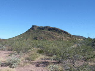
(visited by Andy Martin) 08-Nov-2003 -- This was my second visit to this confluence. The first time, in November 2001, I did not have a camera, but had left a small cairn and register. My Garmin Etrex unit relocated the cairn at exactly the same spot. No one had signed the register. I took photos in 5 directions, and then climbed nearby hills 675 and 941 (feet) that are 1/2 and 1 mile NNE of the confluence. The day was warm, and hike was tiring. Saw a cowboy on the hike in, and some more cows on hike out. Andy Martin, Tucson Arizona |
| All pictures |
| #1: Hill 675 to the NE #2: View to east #3: Mount Bacochibampo to the SE #4: View to south #5: Hill to NW. Confluence is at the foot of this one #6: Cairn at confluence #7: GPS reading on cairn ALL: All pictures on one page |


![Visit #3: [02-Feb-14] Visit #3: [02-Feb-14]](/mx/all/n28w111v3/preview.jpg)
![Visit #1: [11-Nov-01] Visit #1: [11-Nov-01]](/mx/all/n28w111/preview.jpg)