|

China : Guǎngxī Zhuàngzú Zìzhìqū
1.9 km (1.2 miles) ESE of Yongfu, Guǎngxī, China
Approx. altitude: 145 m
(475 ft)
([?] maps: Google MapQuest OpenStreetMap ConfluenceNavigator)
Antipode: 25°S 70°W
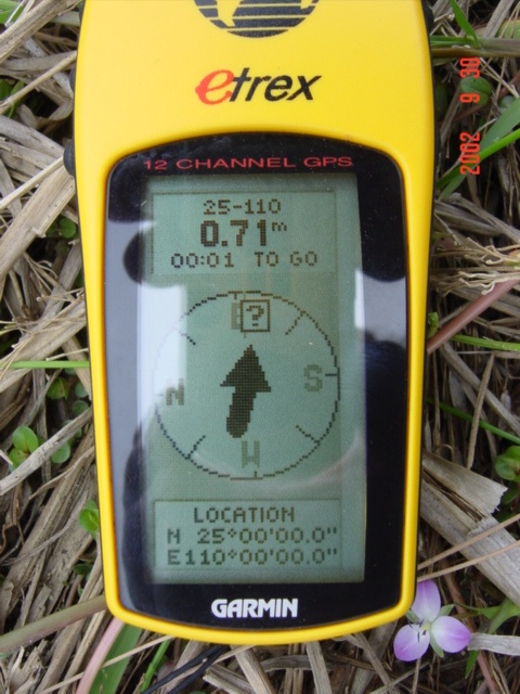
Accuracy: 5 m (16 ft)
Quality: good
Click on any of the images for the full-sized picture.


| 25°N 110°E (visit #2) |
![Visit #1: [05-Sep-00]](/cn/all/n25e110/preview.jpg "Visit #1: [05-Sep-00]")

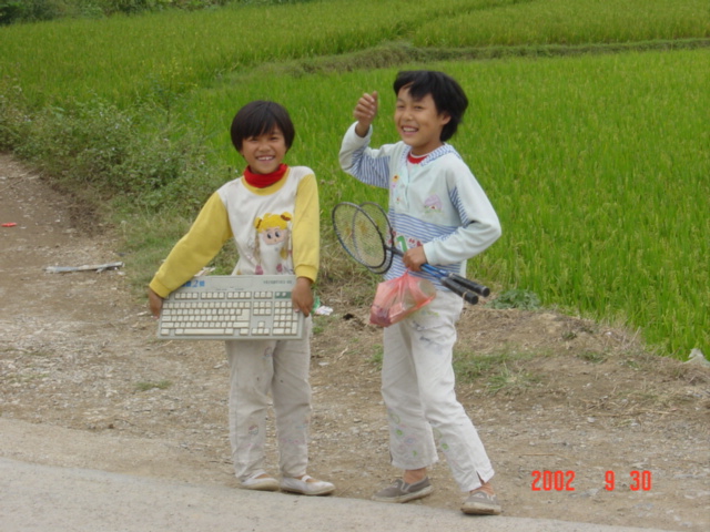
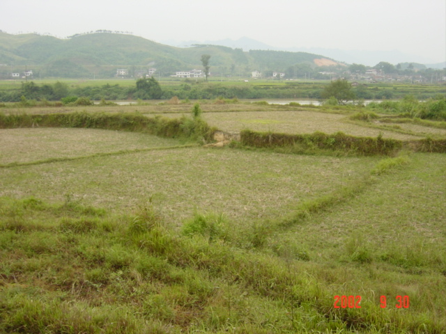
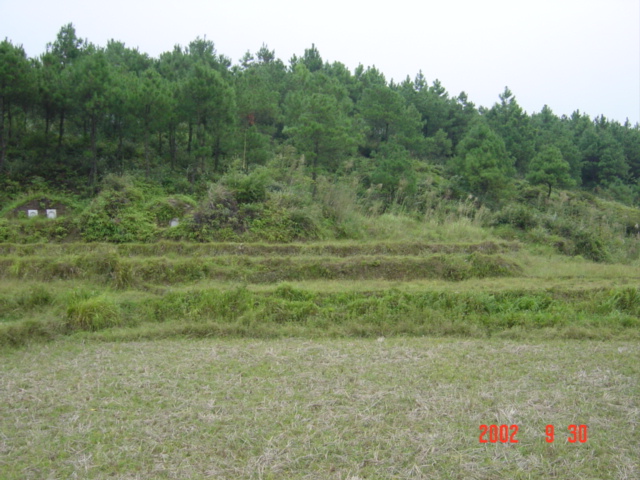
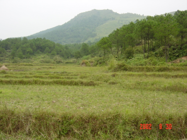
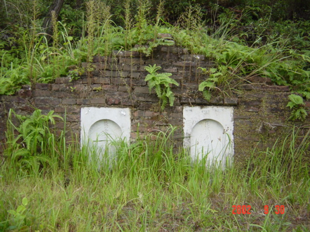
(visited by Targ Parsons) 30-Sep-2002 -- This was the first confluence ever to be visited in China, and I thought it might be interesting to visit it again now, more than two years later, to see what changes may have taken place in the intervening period. I'd just completed a successful visit to the confluence "next door" at 25°N 111°E, so I was already in the area anyway, and I had some spare time on my hands. I needed to wait on the roadside in the town of Cushijiang for no more than five minutes before a crowded bus came by, heading west to Guilin via Yangshuo. I managed to squeeze into a small space at the bottom of the stairwell, and after some adept persuasion by the conductor, the door was finally coaxed shut behind me. I spent the next hour with my body pressed hard up against it, praying that it would not fly open as we bumped our way along the terrible road. By the time we reached Yangshuo, the road had improved considerably, and sufficient passengers has disembarked to afford me the comfort of a seat, from which I was then able to enjoy the passing spectacle of those world-famous "pointy mountains" (technical term: "karst mountains"). The entire journey took a little over three hours, and we arrived at the central bus station in Guilin at 6:30 p.m. I checked into a nearby hotel that offered satellite TV, so I could watch a live telecast of the United States Formula One Grand Prix. (Michael Schumacher accidentally pipped at the post by his team-mate Rubens Barrichello as they attempted a formation finish.) A river was being dredged opposite the hotel, and a huge crowd was milling about down in the riverbed amongst the heavy machinery, sifting through the gravel that was being dug up. When I enquired what was going on, I learned that people used to toss coins into the river to make wishes, and the huge crowd now assembled were hoping to make their own wishes come true by reclaiming some of this booty. The first noticeable (and pleasant) change since the original visit to this confluence came the next morning, when I set off from Guilin to Yongfu. No longer was it necessary to travel "over bad roads in an overcrowded bus" as the first visitors did, because there is now a four-lane divided expressway the whole way. The high-speed bus journey is both swift and comfortable. The expressway passes just 825 metres west of the confluence, but of course I did not have the luxury the first visitors had of being able to simply ask the driver to "let me off here." Nevertheless, when my bus eventually exited the expressway and arrived at the Yongfu bus station at 10:40 a.m., the confluence was still only 1.7 kilometres to the northeast. I made my way on foot across town in the general direction of the confluence, passing along the way several roadside stalls run by members of the minority Yao Nationality, dressed in their traditional costumes. The first major obstacle I encountered was the railway line, although I soon found a way across this. Then I crossed some fields, a road, then some more fields, until finally all that remained between me and the confluence was the same impediment that had confronted the first visitors: the river. As I walked to a bridge 900 metres to the northeast, I passed a pair of ecstatically happy young girls carrying a bizarre assortment of items. Goodness only knows what they were up to! The bridge afforded a very good view of a sand dredging operation in progress below. Incredibly noisy pumps were pumping slurry from the river bottom directly into waiting trucks. The water component then escaped through the cracks on either side of the tailgate, eventually leaving the truck filled with sand. After crossing the bridge, I left the road and headed back towards the confluence, walking through rice paddies that were ripe for harvesting, as well as other fields filled with various different crops. There were many dragonflies and beautiful large iridescent blue and black butterflies to be seen (but which proved elusively difficult to photograph). It would have been a perfectly lovely peaceful walk, were it not for the incessant noise of the dredging pumps. Just as the first visitors had described it, I soon rounded a small hill, and there before me was the confluence, located in a dry paddy field, visible in the middle foreground of the main photo, which was taken looking north-northwest. In this, and other photos taken looking south, east and west from the spot itself (elevation 145 metres), one can detect another, not so pleasant change since the original visit: the air pollution is much worse. Where once there were semi-blue skies, now there are only varying shades of grey. This is unfortunately symptomatic of many areas of China these days. Another small change I noticed was that the graves on the hill to the south of the confluence had been given a fresh coat of paint. It is from the vantage point of these graves that the main photo looking north-northwest was taken. Before leaving, I sat down to eat my lunch next to this lucky couple, whose enviable afterlife assignment is to oversee 25°N 110°E for all perpetuity. |
| All pictures |
| #1: Facing north-northwest; confluence in centre foreground field, river beyond; expressway on distant hillside. #2: Roadside stall run by members of minority Yao Nationality. #3: Bridge 900 metres northeast of confluence. #4: Happy girls! #5: Pumping slurry from river bottom directly into truck. #6: Facing south. #7: Facing east. #8: Facing west. #9: The zeros: N 25°00'00.0", E 110°00'00.0" #10: Graves on the hill to the south. ALL: All pictures on one page |