|

Niger : Tillabéri
2.6 km (1.6 miles) NW of Tafo Kwara, Tillabéri, Niger
Approx. altitude: 223 m
(731 ft)
([?] maps: Google MapQuest OpenStreetMap ConfluenceNavigator)
Antipode: 14°S 178°W
Accuracy: 4 m (13 ft)
Quality: more pictures needed
Click on any of the images for the full-sized picture.


")
| 14°N 2°E (visit #1) |
![Visit #2: [02-Feb-08]](/ne/all/n14e002v2/preview.jpg "Visit #2: [02-Feb-08]")

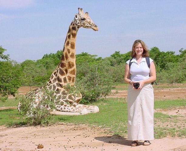
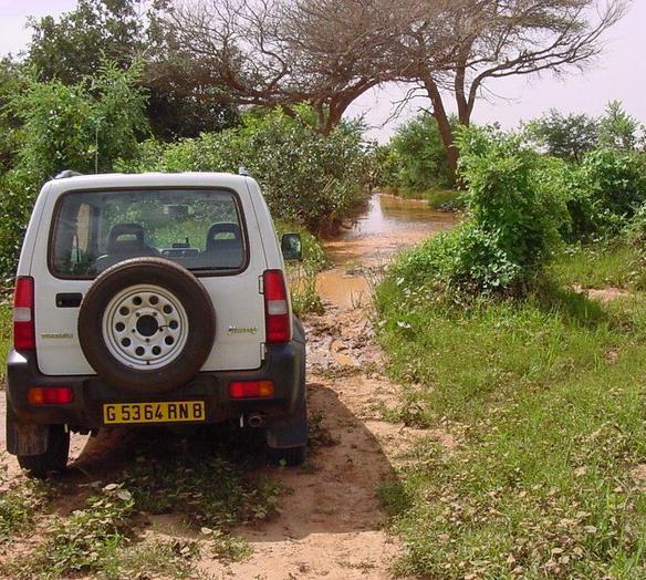
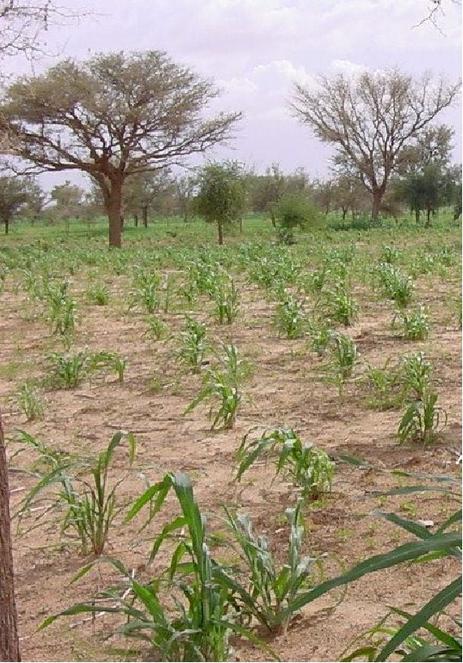
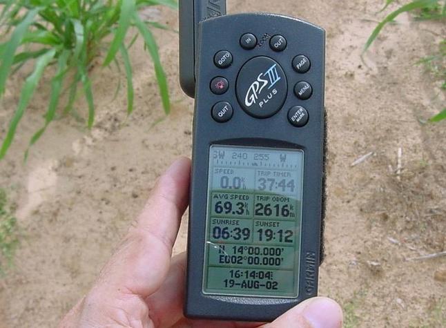
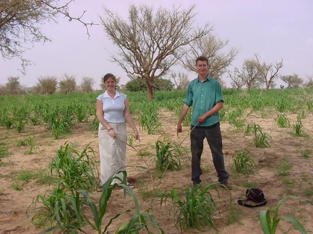
(visited by J. Baker Hill, Rachel Johnston and Andy Bowes Lyon) 19-Aug-2002 -- We recently received a visit from a couple of young British friends, Rachel Johnston (whose father accompanied me to 16N 2E in 2001) and Andy Bowes Lyon. As far as I am concerned two of the best things to do in Niger are seeing the giraffes in the wild, and confluence hunting. So without much persuasion I got Rachel and Andy to try both on the momentous day of 19 August, 2002. First we drove out some 60 km from Niamey to the south-east, hired a guide, and found a herd of giraffes less than 5 km from the main road. We got some great pictures and were able to get really close to them. We got back to Niamey about noon and ate lunch at my house before heading north on the main, recently repaired, laterite road that leads to Ouallam. Our objective, 14N 2E, has been on my agenda for some time. It only required some willing partners and a free day to bag it. The reading on the GPS showed 51.8 km from my house in Niamey, but of course we knew it might be considerably further than that. We headed north on a hot day with cumulus buildup, kicking up a good cloud of dust. Some 45 km up the road and after crossing a couple of washes full of sand we came to Goubé, a small town where the transporters often stop for tea or supplies. I remembered seeing a small sign north of Goubé pointing to Boukanda, which lay on the route I had chosen to reach the Confluence. We soon saw the sign, but there was no road anywhere to be seen. It seems that when the main road was repaired they had neglected to leave an opening in the ditch for the track to Boukanda. So we just shifted into low range, the Suzuki climbed into and out of the ditch, and we found tracks leading west, the GPS showing some 12 km to go. After about 4 km we saw the village of Boukanda and the basemap road showed a choice of tracks. I endeavoured to keep the GPS arrow heading in the right direction and we were soon following what looked like the correct track. From the looks of it it had been a long while since a motorised vehicle had passed that way. Some distance from Boukanda we pulled to a stop before a long stretch of water where the track normally crossed a dry stream bed. However, it was no longer dry, as August is the height of the rainy season. We debated about whether to try and cross the water, but no one seemed anxious to wade in and test out the depth. While trying to sound with a stick, Andy slipped on some clay and almost went into the water. He was fortunate enough to catch himself, though, and the only damage was to his hands, which were really muddy, and maybe his pride! After some scouting I found a way around the stream to the south and again the Suzuki went into low range as we crawled through the clay and tall grass, coming back onto the track after a couple of hundred meters. The track was fairly clear except for a lot of erosion. At one point we came to a very deep hole, at which there was some doubt as to whether the Suzuki could get back out of it. Again into low range, and, growling furiously, the little vehicle climbed out with no trouble at a very steep angle. Eventually we joined with a well-travelled track, with what looked like the ruts of a dump truck or other large vehicle. We passed some picturesque areas of low buttes and mountains but I had not much hope of the Confluence being scenic. Reading 2 km from the point, we spotted a village in the distance. We were all sure that after all our trouble the point would be in someone's courtyard, but fortunately the GPS led us on past and we came abreast of 14N 2E, next to a large millet field, reading 430 meters to go. We climbed out with the temperature gauge reading 38°C (just over 100°F) and began to hike through the field. Fortunately we were just far enough from the village and the millet was high enough that we did not have to try to explain what we were doing! Rachel, wearing sandals, cried out at one point and we found that a large thorn had pierced her sole and entered her heel. There was some slight bleeding but she was not deterred and we continued on to the point, located between two larger trees and still in the big millet field. Using the pointer arrow I went directly to the Confluence and read the zeros on the GPS for the first time in several Confluences. I even managed to get off a shot of the screen before it fluctuated. After we posed for a few pictures we noticed that the cumulus had accumulated into a large, dark storm back to the east, so we decided to try and get out of our situation before we were shanghaied by the rain. On the way back we spotted a bright yellow chameleon crossing the track, so we got out and persuaded him to get on a stick. He changed colours a few times before the storm made us get back in the car and continue on. We got a picture at the deep hole, and with relief crossed the stream once again before it began to sprinkle as we passed Boukanda and got back onto the main road. Then it began to rain in earnest. We thought we were home free, but had reckoned without the sandy washes south of Goubé. The first one was no problem although water was already rushing across it, but at the second we were dismayed to see that a Peugeot 404 pickup was in the water up to its headlights and stalled out. I knew that the Suzuki was slightly higher but we decided to wait until someone waded across so we could see the depth of the water. Sure enough, after pushing the 404 back onto dry land, one of the fellows began to wade across and we saw that the water was not over knee deep, which would be easy for the Suzuki. That is, until he got to the main channel where the water was rushing through quite rapidly... there he sunk to mid-thigh, with the water splashing a good bit higher! The deep part was very narrow, though, and with the man's encouragement and our desire to get home that night we decided to go for it. Once again into low range four-wheel-drive, and the Suzuki launched eagerly forward into the rushing water. Up to the hubs, no problem. We began to push a bow wave with the front bumper and I slowed. Then we hit the deep part! The whole front end went briefly under and brown water washed to the base of the windshield! But the front wheels dug in with a comforting feeling and we came up immediately. The little engine did not miss a lick and we continued on to the cheers of the people on the other side, fists and adrenaline both pumping furiously. The rain stopped soon afterwards and we rode on into Niamey in a cloud of dust, with another successful Confluence and two converts to confluence hunting! |
| All pictures |
| #1: A view of the general area of the Confluence looking southwest #2: Andy and the view to the southwest from the point #3: Rachel and Andy indicating the exact spot of the Confluence, taken from the southwest #4: The GPS indicating the exact spot. #5: Rachel and a friendly old giraffe the morning of the hunt #6: The Suzuki trying to make up its mind whether to try a crossing #7: Approaching a deep hole on the way back in the Suzuki (note the darkening sky) ALL: All pictures on one page |