|

Mozambique : Gaza
1.5 km (0.9 miles) SSW of Zucula, Gaza, Mozambique
Approx. altitude: 49 m
(160 ft)
([?] maps: Google MapQuest OpenStreetMap ConfluenceNavigator)
Antipode: 25°N 147°W
Accuracy: 3 m (9 ft)
Quality: good
Click on any of the images for the full-sized picture.


| 25°S 33°E |

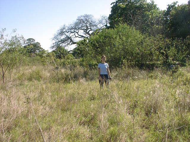
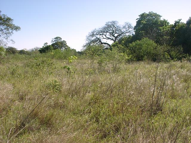
(visited by Hendrik van Eeden and Jana van Eeden) 04-Jul-2002 -- After my friend Ferdi Schenck's successful bagging of 25S 29E, my interest in the Confluence Project was rekindled. Our annual vacation to Mozambique was coming up and I decided to try to bag the first one there. Without any good maps of the country, few good roads and the risk of land mines, the task seemed quite challenging. Looking at the tourist map I had, it seemed that two Confluences might be fairly easily reached from the main road to the North from the capital city Maputo (the only tar road in the country), the first one (25S 33E) being close to the town of Macia and the second (24S 35E) close to the town of Maxixe. As it turned out 24S 35E was quite far off the main road, but 25S 34E proved to be just 3 km off the main road and I ended up bagging it as well. We were going for a two week vacation in the Inhamabane area about 400 km north-east of Maputo (endless beaches, no people, fantastic snorkelling, beer and seafood), and I expected that we would pass close to the Confluences on our way. My wife was not amused by the idea at all, as tourists are routinely warned not to stray from the main roads because of the risk of land mines left over after the civil war. There is an on-going project to clear the mines though, and most have been removed by now. When the main road passed just 6 km from the 25S 33E Confluence, I decided to take the chance. We turned off onto a very small sand track opposite the Confluence and started scraping through the bushes. The track seemed to be getting smaller and we were travelling very slowly, but just as I started despairing (after about 1 km), we came onto a big dirt road going west from Macia. This road took us to within 2 km. Here we started looking again for a track going in the right direction, but twice we had to turn back as the tracks veered off in the wrong direction. Once my daughter Jana and I got out of the bakkie near a few huts and started hiking along a foot path, but this also veered off and we ended on another small dirt road, which in turn seemed to be going in the right direction. We jogged back to the bakkie and followed the new track, but this bent around a vlei (marshy area) with the Confluence seemingly on the opposite side. Eventually we returned to the point where we first started hiking and Jana and I set off cross country. Every now and again we came across one of the local women working small plots of mealies and casava. All were very friendly and greeted us as we went past. Eventually even the small foot paths connecting the plots petered out. Two hours after leaving the main road we reached the Confluence - the first in Mozambique. |
| All pictures |
| #1: General view of area #2: View North #3: View East #4: View South #5: View West #6: GPS screen #7: Jana at Confluence #8: Women in fields #9: Final approach ALL: All pictures on one page |